Geographic information search and navigation system based on visual field of users
A geographic information and navigation system technology, applied in road network navigators, electrical digital data processing, special data processing applications, etc., can solve the problem that information cannot be automatically screened out, and achieve the effect of convenient expansion and high scalability
- Summary
- Abstract
- Description
- Claims
- Application Information
AI Technical Summary
Problems solved by technology
Method used
Image
Examples
Embodiment Construction
[0032] In order to clearly illustrate the solutions in the present invention, preferred embodiments are given below and detailed descriptions are given in conjunction with the accompanying drawings.
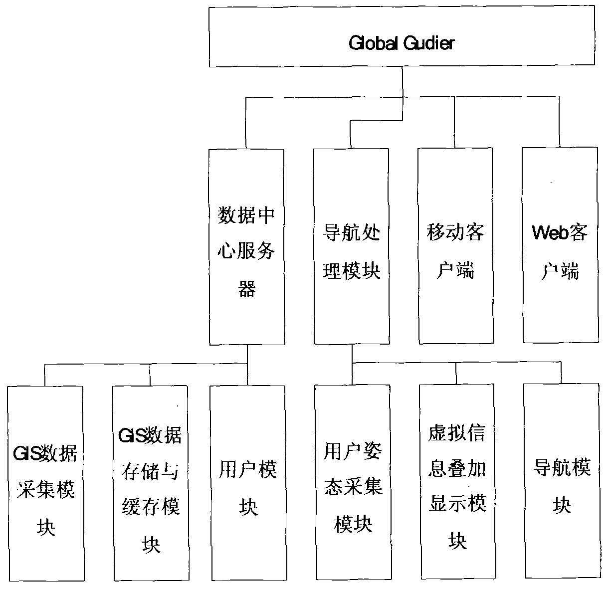
[0033] see figure 1 , The system of the present invention mainly includes a GIS data acquisition module, a GIS data storage and cache module, a user module, a user attitude acquisition module, a virtual information superposition module and a navigation module.
[0034] These modules are respectively integrated in the data center server and the navigation processing module, and may also be partly integrated in the mobile client. For example, the GIS data collection module, GIS data storage and cache module, and user module are integrated in the data center server, and the user posture collection module, virtual information superposition module and navigation module are integrated in the navigation processing module. The functions of each module are described in detail below.
[...
PUM
 Abstract
Description
Claims
Application Information
 - R&D
- Intellectual Property
- Life Sciences
- Materials
- Tech Scout
- Unparalleled Data Quality
- Higher Quality Content
- 60% Fewer Hallucinations
Browse by: Latest US Patents, China's latest patents, Technical Efficacy Thesaurus, Application Domain, Technology Topic, Popular Technical Reports.
© 2025 PatSnap. All rights reserved.Legal|Privacy policy|Modern Slavery Act Transparency Statement|Sitemap|About US| Contact US: help@patsnap.com


