Method for generating data in navigation electronic map
An electronic map and data technology, applied in directions such as road network navigators, can solve the problems of inability to distinguish intersections, roundabouts, imperfections, unreasonable turn-to-voice broadcasts, etc., to achieve the effect of improving clarity
- Summary
- Abstract
- Description
- Claims
- Application Information
AI Technical Summary
Problems solved by technology
Method used
Image
Examples
Embodiment 1
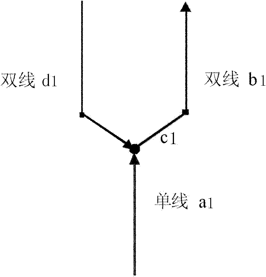
[0042] First explain the nouns we will or have used.
[0043] Leading line: The part where the double lines converge to form an abnormal angle. figure 1 , the single-line a1 (that is, the actual main road a1) to the double-line b1 (that is, the actual auxiliary road b1) constitutes a turn, which is actually a straight turn, but due to drawing reasons, the exit angle of the double-line b is abnormal. We put This kind of part that causes the abnormal exit angle of the double-line b1 (auxiliary road b1), that is, the section of c1, is called the leading line.
[0044] Connection within the intersection: due to the existence of double lines, they often meet at the intersection to form a road line that belongs to the interior of the intersection. Such as figure 2 and image 3 The middle dotted line represents the road lines in the intersection, and the attribute of these road lines is the connection in the intersection.
[0045] Simple intersection point: an intersection point...
PUM
 Abstract
Description
Claims
Application Information
 - R&D
- Intellectual Property
- Life Sciences
- Materials
- Tech Scout
- Unparalleled Data Quality
- Higher Quality Content
- 60% Fewer Hallucinations
Browse by: Latest US Patents, China's latest patents, Technical Efficacy Thesaurus, Application Domain, Technology Topic, Popular Technical Reports.
© 2025 PatSnap. All rights reserved.Legal|Privacy policy|Modern Slavery Act Transparency Statement|Sitemap|About US| Contact US: help@patsnap.com


