A method of map display data preprocessing

A technology for displaying data and preprocessing. It is used in electrical digital data processing, special data processing applications, instruments, etc. It can solve the problems of low compression rate, large difference in display density, and under-compression compression rate, so as to avoid excessive compression. Compression or undercompression, avoid local over-dense or over-sparse, reduce the effect of peak time consumption

Active Publication Date: 2011-12-28
TSINGHUA UNIV
View PDF2 Cites 40 Cited by
  • Summary
  • Abstract
  • Description
  • Claims
  • Application Information

AI Technical Summary

Problems solved by technology

The existing processing methods mainly include: 1. Establish a multi-level grid index or tree structure, combined with a cache mechanism, to realize fast positioning and loading of data. The disadvantage is that the cache mechanism is more suitable for the situation where the map moves randomly. The directional movement display commonly used in navigation has poor adaptability; 2. Use the administrative level of the display object to specify the display level for it, and display objects of a specific level under each scale to select the display content of each scale. The disadvantages are: In different areas of the same scale, the display density m

Method used


Image

  • A method of map display data preprocessing
  • A method of map display data preprocessing
  • A method of map display data preprocessing

Examples


Embodiment Construction

[0058] The present invention will be described in detail below with reference to the drawings and embodiments.

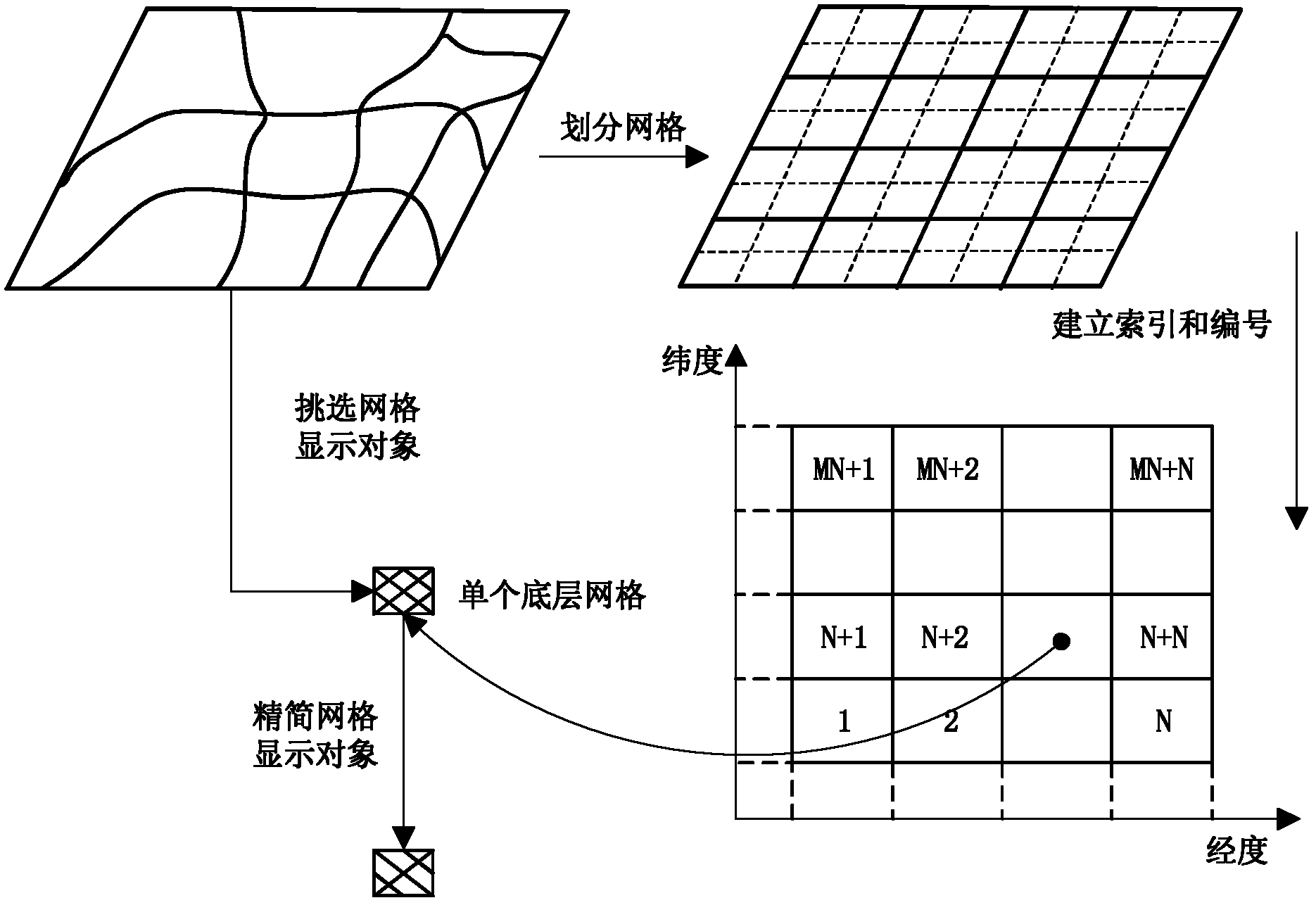
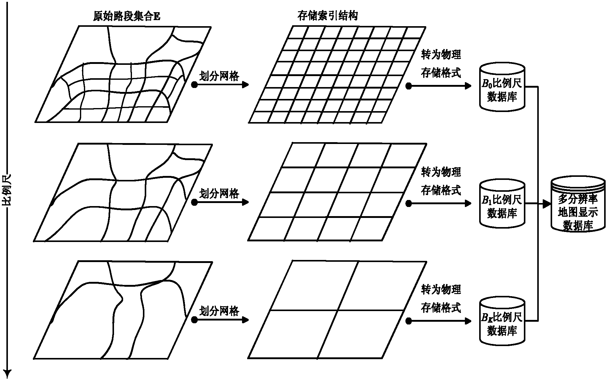
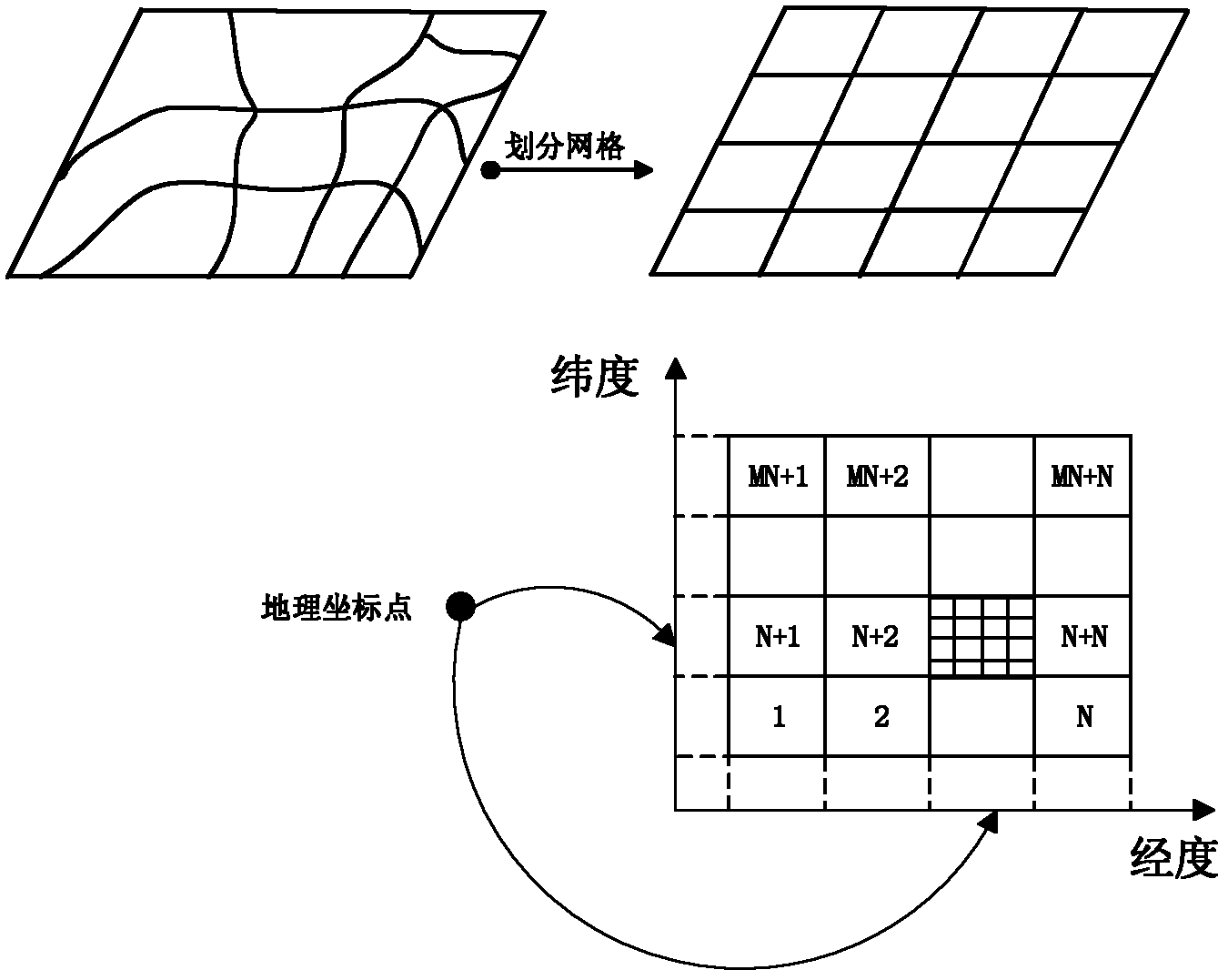
[0059] Such as figure 1 , figure 2 As shown, the preprocessing of each level of scale map data in the present invention includes the following steps:

[0060] 1) Establish a grid index storage structure;

[0061] 2) Select display objects for each grid;

[0062] 3) Streamline display objects for each grid.

[0063] After completing the above three steps, the data of each grid can be stored as a file according to the grid index storage structure established in step 1), and then a multi-resolution map display database can be established.

[0064] The specific implementation method of the above steps is described as follows:

[0065] 1) Establishing a grid index storage structure is to divide the map into a grid, establish a secondary grid index storage structure, and combine with an estimated loading strategy to achieve rapid data positioning and fast loading, which includes the...


PUM


Abstract

The invention relates to a method for preprocessing map display data. The method is characterized by comprising the following steps of: 1) establishing a multi-resolution secondary grid index storage structure, and realizing an estimate read policy on the basis of the index storage structure; 2) controlling the density of a display object of each grid individually to select the reasonable displayobject; and 3) simplifying the display object in each grid by combining the resolution of human eyes. In the method, the high loading efficiency can be obtained in the directional movement display ofa map, the density of display contents in each measuring scale and each area is reasonable, the display objects are simplified on the premise of ensuring the visual effect of the human eyes, and the display data volume is reduced. The method can be widely applied to various vehicle-mounted navigation systems to realize the efficient loading of the map display data.

Description

Technical field [0001] The invention relates to a data preprocessing method, in particular to a map display data preprocessing method in a car navigation system. Background technique [0002] One of the main functions of the on-board autonomous navigation system is to display electronic maps in real time and provide relevant navigation information. At present, with the continuous development of geographic information systems, the amount of data required to display electronic maps is also expanding. In-vehicle autonomous navigation systems are mostly built on hardware platforms based on embedded devices, and the computing power of their processors and the speed of file reading and writing are greatly restricted. If these image data are not organized and processed in advance, it may be When the display content is unreasonable, such as too few, accumulation or overlap, sometimes it is even difficult to realize the real-time display of the electronic map. To solve this problem, the...

Claims


Application Information

Patent Timeline
IPC IPC(8): G06F17/30
Inventor 杨殿阁连小珉王钊张照生李挺李江涛
Owner TSINGHUA UNIV
Why Eureka
Try Eureka