Modeling method based on mass laser radar grid point cloud data
A technology of lidar and point cloud data, applied in electrical digital data processing, special data processing applications, instruments, etc., can solve the problems of inconvenient operation, low security, data sharing and unmanageable massive data, saving space , High rendering efficiency, the effect of ensuring security and concurrency
- Summary
- Abstract
- Description
- Claims
- Application Information
AI Technical Summary
Problems solved by technology
Method used
Image

Examples
Embodiment Construction
[0023] The present invention will be further described in detail below in conjunction with the accompanying drawings, so that those skilled in the art can implement it with reference to the description.
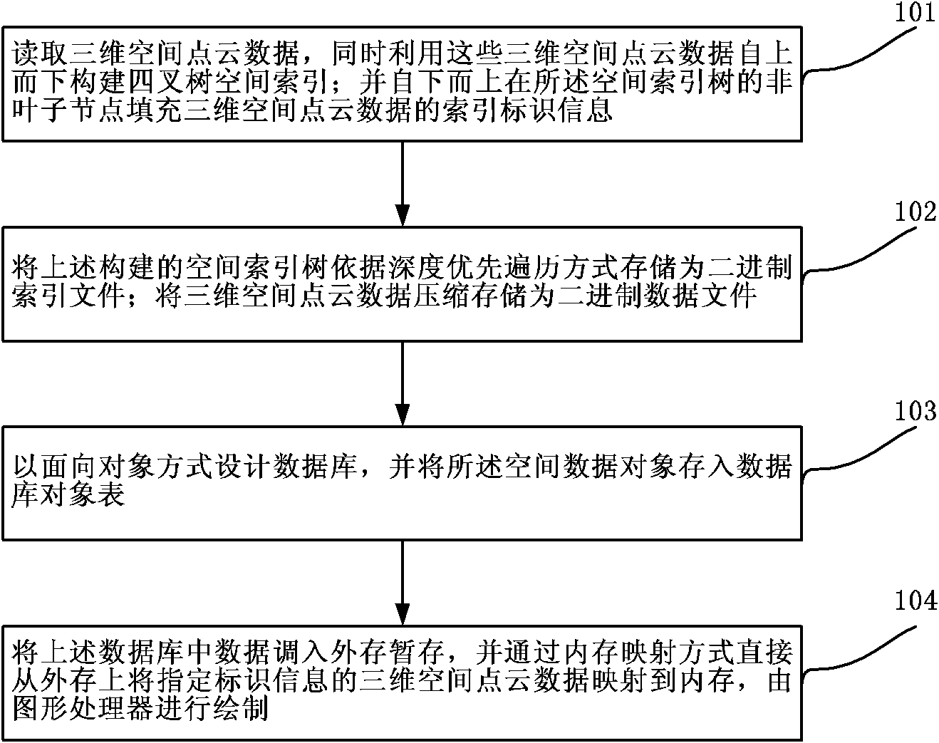
[0024] Such as figure 1 As shown, the modeling method based on massive lidar grid point cloud data of the present invention comprises the following steps:
[0025] Step 101, read the three-dimensional space point cloud data, and use these three-dimensional space point cloud data to construct a quadtree spatial index from top to bottom; and fill the three-dimensional space point cloud in the non-leaf nodes of the spatial index tree from bottom to top The index identification information of the data.
[0026] In this step, according to the rasterity of the original 3D spatial point cloud data, a quadtree spatial index is constructed in a top-down manner according to the number of rows and columns of the scanned point cloud.
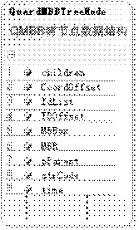
[0027] The data structure of the quadtree spatial ...
PUM
 Abstract
Description
Claims
Application Information
 - Generate Ideas
- Intellectual Property
- Life Sciences
- Materials
- Tech Scout
- Unparalleled Data Quality
- Higher Quality Content
- 60% Fewer Hallucinations
Browse by: Latest US Patents, China's latest patents, Technical Efficacy Thesaurus, Application Domain, Technology Topic, Popular Technical Reports.
© 2025 PatSnap. All rights reserved.Legal|Privacy policy|Modern Slavery Act Transparency Statement|Sitemap|About US| Contact US: help@patsnap.com