

Mobile GIS (Geographic Information System) system based on intelligent mobile phone and application thereof
A smart phone and system technology, applied in special data processing applications, telephone communications, instruments, etc., can solve the problems of low data collection speed, long boot time, and easy loss of collected information, so as to improve the drawing speed and improve the operation. Speed, the effect of solving flickering phenomenon
- Summary
- Abstract
- Description
- Claims
- Application Information
AI Technical Summary
Problems solved by technology
Method used
Image

Examples
Embodiment Construction
[0073] The present invention will be described in further detail below in conjunction with the accompanying drawings and specific embodiments.
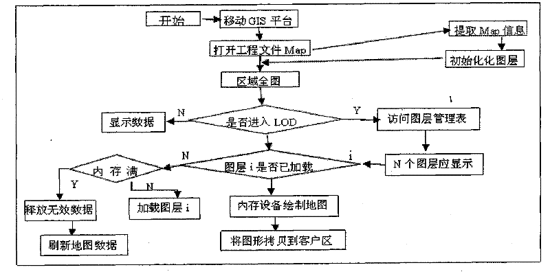
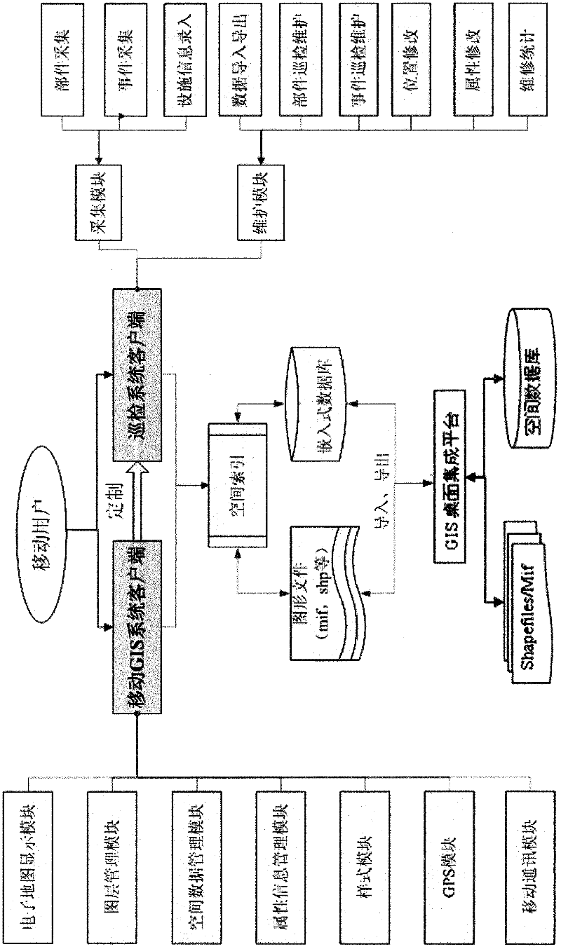
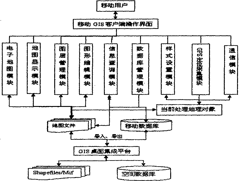
[0074] refer to figure 1 , a mobile GIS system system based on smart phones, including a wireless communication network, a GPS positioning device, and a mobile terminal, as well as the Internet and a geographical application server, the mobile terminal is a smart phone used by a mobile user, and it is characterized in that the The mobile terminal has the following software function modules: electronic map module, map display module, layer management module, graphic editing module, information query module, database management module, style setting module, GPS positioning acquisition module, communication module, and map files module, mobile database module, GIS desktop integration platform module, spatial database module and shapefiles / Mif module, among which:
[0075] The electronic map module is the basic core of the mobile termina...
PUM
 Abstract
Description
Claims
Application Information