Quantified simulation method for forest remote sensing data of synthetic aperture radar

A technology of remote sensing data and simulation methods, applied in the field of synthetic aperture radar forest remote sensing, can solve problems such as the inability to accurately simulate the complex natural environment of the radar system, the analysis and evaluation of the inversion algorithm affecting the forest parameters, and the too ideal forest remote sensing simulation data.

Inactive Publication Date: 2012-04-04
BEIJING INSTITUTE OF TECHNOLOGYGY
View PDF2 Cites 29 Cited by
  • Summary
  • Abstract
  • Description
  • Claims
  • Application Information

AI Technical Summary

Problems solved by technology

However, this simulation method is inconsistent with the whole process of data acquisition in real remote sensing systems. When the remote sensing system has non-ideal factors, it cannot accurately simulate the characteristics of the radar system and the characteristics of the complex natural environment, which makes the simulated forest remote sensing data too ideal and inconsistent with the real remote sensing system. The response results are inconsistent, which affects the analysis and evaluation of the forest parameter inversion algorithm

Method used


Image

  • Quantified simulation method for forest remote sensing data of synthetic aperture radar
  • Quantified simulation method for forest remote sensing data of synthetic aperture radar
  • Quantified simulation method for forest remote sensing data of synthetic aperture radar

Examples


Embodiment

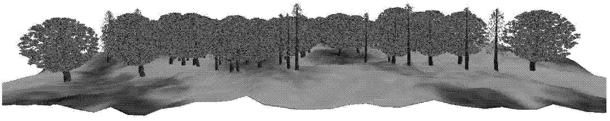
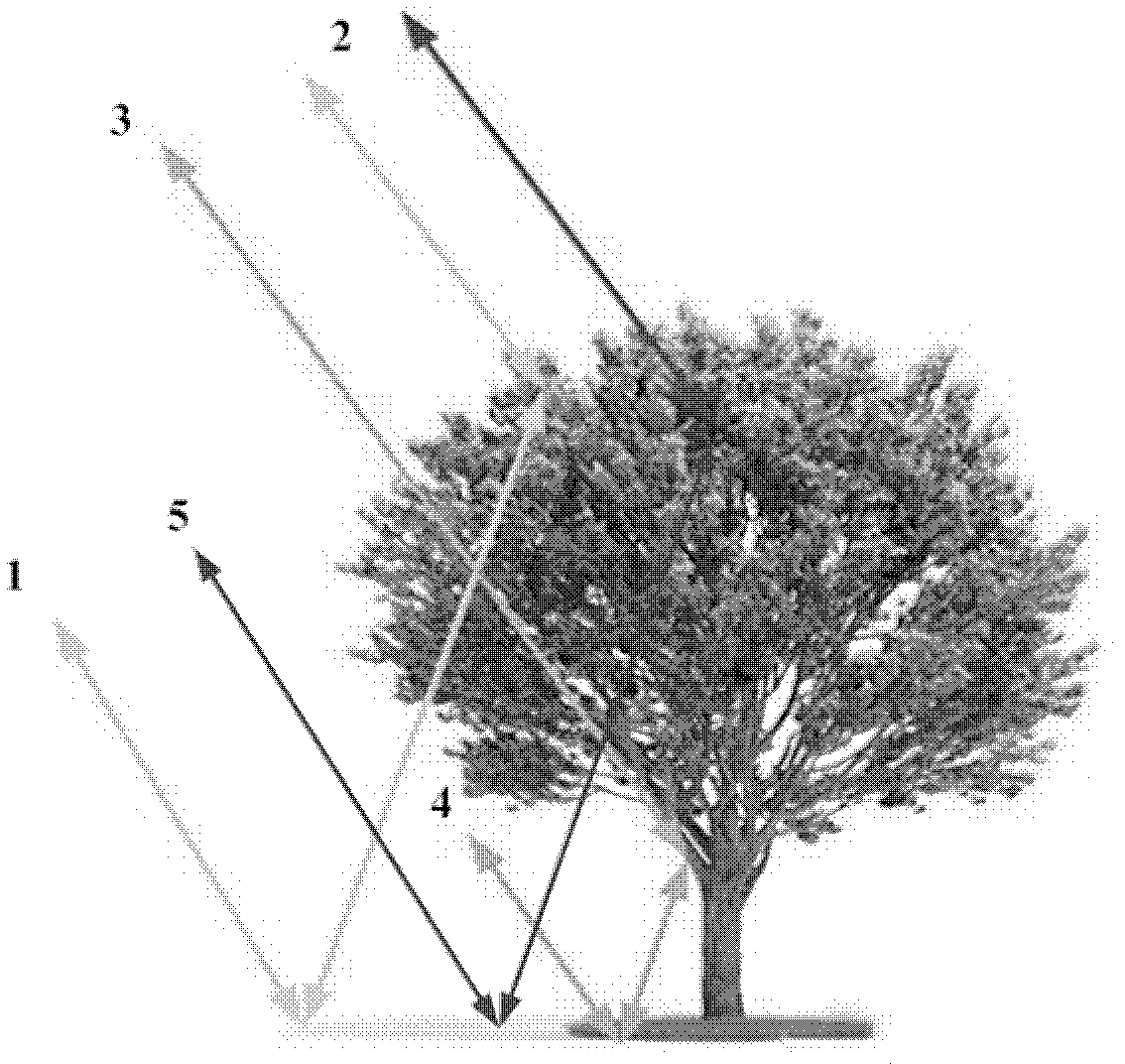
[0025] The SAR system is used to carry out quantitative simulation experiments of remote sensing data of forest scenes, and the simulation results are obtained by imaging processing through the back projection (BP) imaging algorithm. In order to verify the correctness of the simulation results, the typical forest height inversion algorithm is used to simulate the images After processing, the forest height inversion result is obtained. The area of ​​the forest plot is 50hm 2 , the number of trees is 7,000, and the tree species are mixed forests of broad-leaved trees and coniferous pine; the SAR flight altitude is 3,000m, the central viewing angle is 45 degrees, the SAR system resolution is 1m, the radar antenna beamwidth is 0.1rad, and the radar works at a wavelength of 0.24 In the L-band of m, the antenna adopts the full polarization method.

[0026] A quantitative simulation method for SAR forest remote sensing data, the implementation process of the technical scheme is as a...


PUM


Abstract

The invention relates to a simulation method for forest remote sensing data of a synthetic aperture radar, in particular to a quantified simulation method, belonging to the forest remote sensing technical field of the synthetic aperture radar. The simulation method comprises the following steps that: a geometrical model of a three-dimensional forest scene is built, a back scattering model of the radar is built, and SAR (Specific Absorption Rate) echo signal simulation and SAR image treatment are carried out. According to the invention, the echo signal simulation and image treatment processes are introduced in the quantified simulation process of the SAR forest remote sensing data, the overall acting process of a remote sensing system and the natural environment is reflected, and the overall link fidelity simulation from the observed object description and the action mechanism description of microwave scattering process to the acquisition of the original signal of the remote sensing system and ground image treatment can be accomplished.

Description

technical field [0001] The invention relates to a simulation method for synthetic aperture radar (SAR) forest remote sensing data, in particular to a quantitative simulation method, which belongs to the technical field of synthetic aperture radar (SAR) forest remote sensing. Background technique [0002] Forests are the main body of the earth's ecological materials. Estimation of regional and global forest biomass is of great significance for detecting ecosystem carbon cycle and climate change, and is one of the important contents of ecology and global change research. In recent years, the role of synthetic aperture radar remote sensing technology in the detection of forest biological structure has been widely concerned, and it has become a powerful tool for estimating important parameters of forests in a large area on the ground. The quantitative simulation technology of remote sensing data plays an important role in the application of SAR forest remote sensing. On the one ...

Claims


Application Information

Patent Timeline
Patent Type & Authority Applications(China)
IPC IPC(8): G01S13/90
Inventor 曾涛孙晗伟胡程
Owner BEIJING INSTITUTE OF TECHNOLOGYGY
Why Eureka
Try Eureka