Rapid path planning method

A planning and fast technology, applied in the field of navigation, to achieve the effect of saving system resources

Active Publication Date: 2014-05-21
GUANGZHOU HAIGE COMM GRP INC
View PDF4 Cites 4 Cited by
  • Summary
  • Abstract
  • Description
  • Claims
  • Application Information

AI Technical Summary

Problems solved by technology

Therefore, the existing paths planned simply by Dijkstra's shortest path algorithm or A3 algorithm are not necessarily the optimal path planning

Method used


Image

  • Rapid path planning method
  • Rapid path planning method
  • Rapid path planning method

Examples


Embodiment Construction

[0035] This method is a fast path planning method, which is generally divided into two parts: map preprocessing and path planning. The map preprocessing is to prepare for path planning.

[0036] The preprocessing of the map includes three parts: spatial layering, grid partitioning and road data topology.

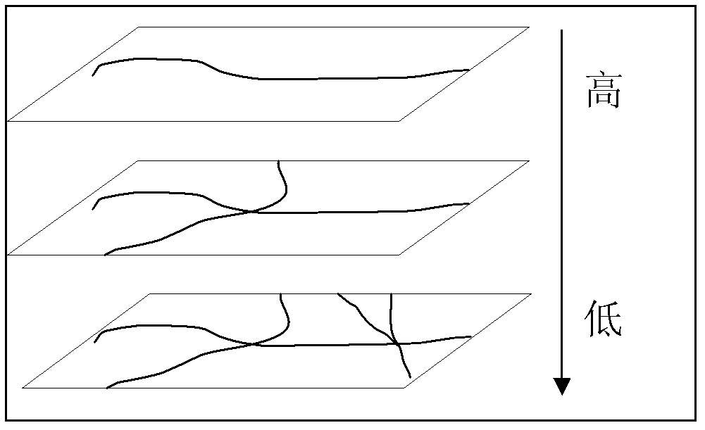
[0037] Spatial stratification is to organize the road network data hierarchically according to the road level, such as figure 1 As shown, the higher-level roads are more advanced (such as expressways, national highways), and the lower-level roads include high-level roads. The lower the level, the more detailed the roads (such as streets and alleys).

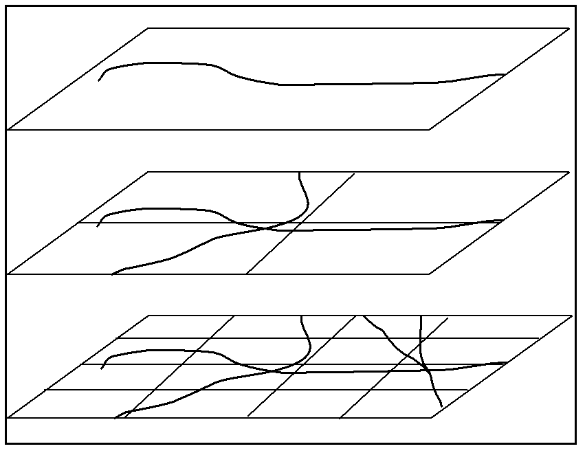
[0038] Grid partitions such as figure 2 As shown, each layer of roads is divided into grids with rectangles, and the data is stored and managed with the grid as the unit. When the system reads, the required data is read with the grid as the unit index, which is targeted and can Greatly reduce the amount of data read, and qui...


PUM


Abstract

The invention discloses a rapid path planning method comprising the following steps: (S1) establishing space sublayers for a road network according to a road grade, dividing mesh regions for each layer of road network, and establishing a topological structure of the road network according to road data; (S2) respectively carrying out lifting exploration on an initial position and a final position of a low-level road network, and searching a hop position entering a high-level road network; and (S3) planning a path between an initial hop and a final hop on the high-level road network according to a shortest path algorithm. In the invention, a navigation path is planned by using methods such as road mergence, two-way lifting exploration and the like, and the requirement of the traditional navigation system for rapidly calculating and planning the optimal path can be met.

Description

technical field [0001] The invention relates to the field of navigation, and more specifically, relates to a method for fast path planning. Background technique [0002] In recent years, the application of GPS (Global Positioning System, Global Positioning System) has become more and more common. Obtaining one's own position from GPS, and then planning a route to a destination, greatly facilitates people's daily life. [0003] The navigation system needs to quickly calculate the best path for navigation, but most of the existing navigation systems rely on some hardware with limited computing and processing capabilities, and the navigation system itself will consume most of the system resources, so the path planning method must be Efficient and fast. [0004] The current method for selecting the navigation path is to abstract the traffic network into a topological network containing multiple nodes, and then plan a path from the start point to the end point through the shorte...

Claims


Application Information

Patent Timeline
Patent Type & Authority Patents(China)
IPC IPC(8): G01C21/34
Inventor 李庆建
Owner GUANGZHOU HAIGE COMM GRP INC
Why Eureka
Try Eureka