System for performing relative navigation on spacecraft based on background astronomical information

A relative navigation and spacecraft technology, applied in the direction of integrated navigator, etc., can solve the problems of installation error, spacecraft navigation accuracy, etc.

Inactive Publication Date: 2012-07-25
BEIHANG UNIV
View PDF3 Cites 8 Cited by
  • Summary
  • Abstract
  • Description
  • Claims
  • Application Information

AI Technical Summary

Problems solved by technology

[0004] In order to solve the influence of the installation error of the existing sensor and the attitude error of the spacecraft on the relative navigation accuracy, the present invention designs a method to measure the information of the target spacecraft 100 and the target astronomical background 300 through the visible light sensor, and then use the reference celestial body 400 in the inertial coor

Method used


Image

  • System for performing relative navigation on spacecraft based on background astronomical information
  • System for performing relative navigation on spacecraft based on background astronomical information
  • System for performing relative navigation on spacecraft based on background astronomical information

Examples


Embodiment Construction

[0024] The present invention will be further described in detail below in conjunction with the accompanying drawings.

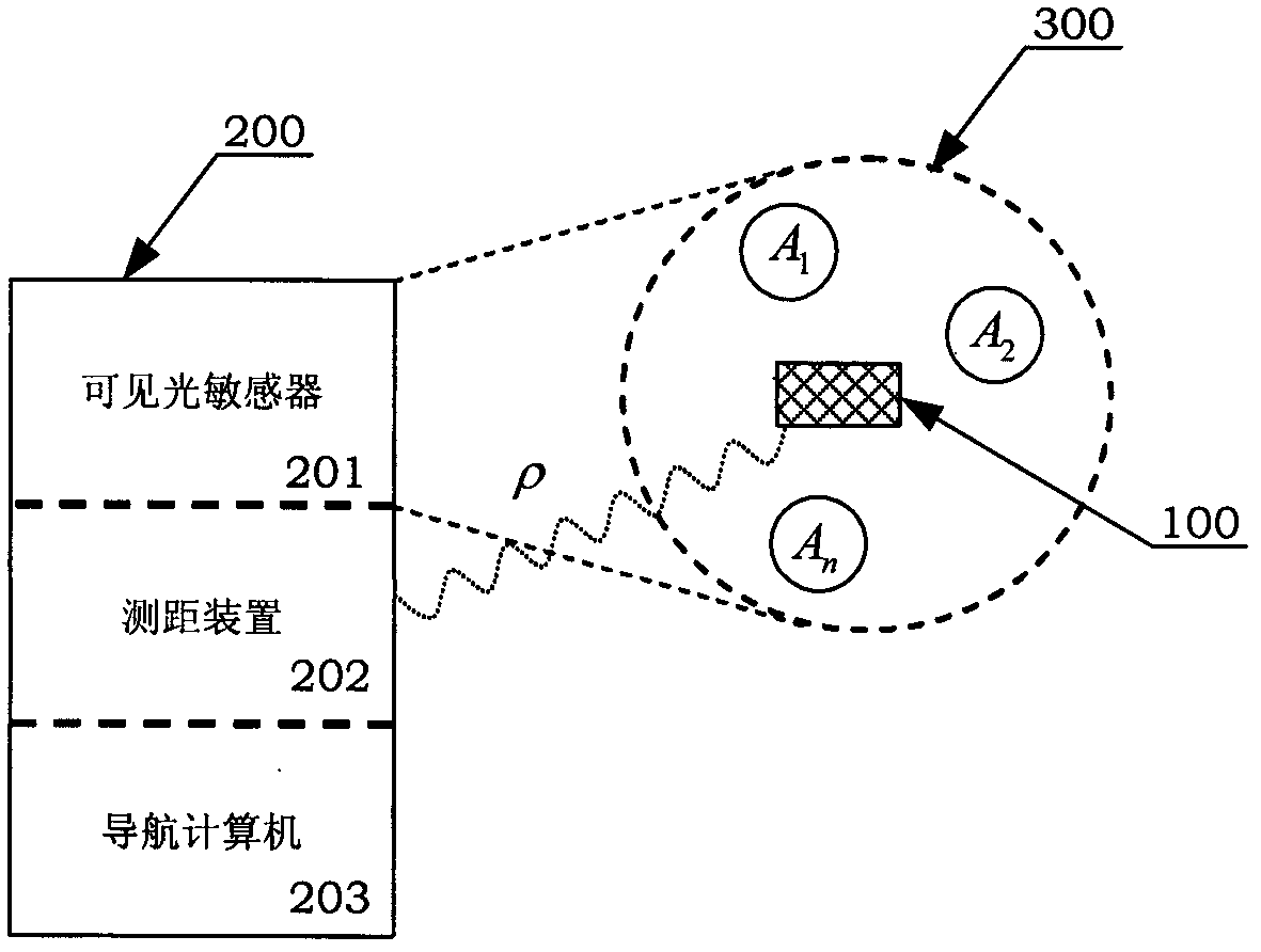
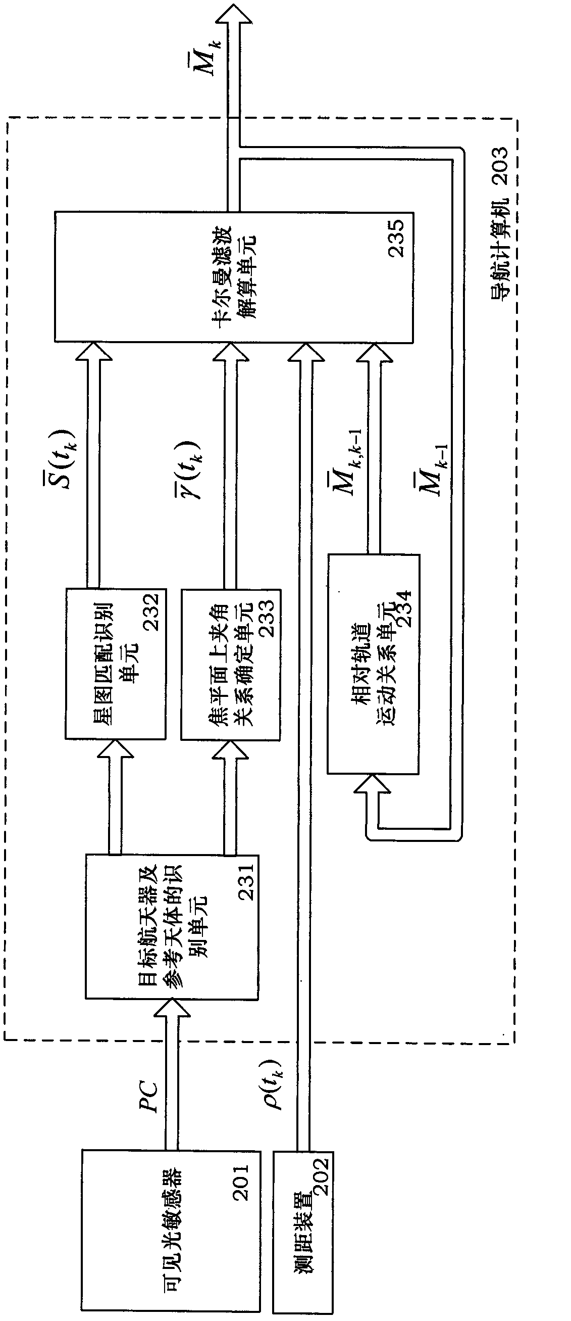
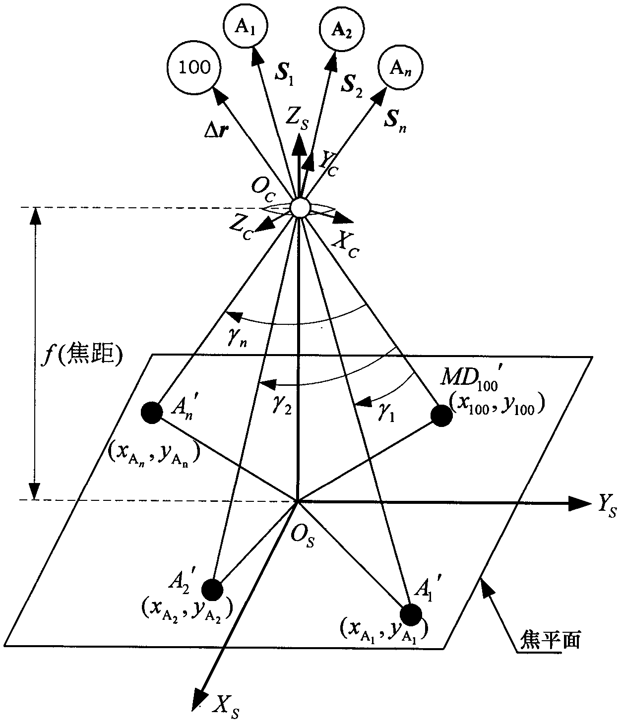
[0025] see figure 1 In the schematic diagram of the relative navigation of the two spacecraft shown, the tracking spacecraft 200 includes a visible light sensor 201 , a distance measuring device 202 and a navigation computer 203 . The visible light sensor 201 is used to acquire the target astronomical background 300 . The target astronomical background 300 refers to the field of view formed by the target spacecraft 100 and multiple celestial bodies relative to the visible light sensor 201 in the tracking spacecraft 200 . A celestial body that can be used as a reference for relative navigation among the plurality of celestial bodies is called a reference celestial body. The first reference celestial body is recorded as A 1 , the second reference celestial body is denoted as A 2 , ..., the nth reference celestial body is denoted as A n . The ranging devic...


PUM


Abstract

The invention discloses a system for performing relative navigation on a spacecraft based on background astronomical information. The system comprises a target spacecraft and reference celestial body recognition unit, a star map matching recognition unit, a determining unit for relationship between a focal plane and an upper included angle, a relative orbital motion relationship unit and a Kalman filtering resolving unit. The system is kept in a processor of a navigational computer. According to the system, by means of a hardware platform of a tracing spacecraft, in reference to the information of the target astronomical background and according to the distance between the target spacecraft and the tracing spacecraft, the relative motion state of the target spacecraft under the inertial frame OCXCYCZC of the tracing spacecraft is calculated by using a filtering method, and the target spacecraft is finally traced and positioned.

Description

technical field [0001] The invention relates to the technical field of spacecraft guidance and navigation, in particular to a relative navigation method for spacecraft using background astronomical reference information. Background technique [0002] The relative navigation and guidance technology of spacecraft has always been a key technology in the aerospace field, especially in the autonomous rendezvous / approach mission of spacecraft. In the 1950s, the United States and the Soviet Union conducted spacecraft rendezvous and docking experiments for lunar exploration missions. At that time, radars and astronauts were mainly used to complete relative navigation and guidance. Since the 1990s, space rendezvous has gradually become autonomous. Japan has carried out the "Engineering Test-7" (ETS-VII) autonomous rendezvous test mission, and the United States has carried out the "autonomous rendezvous technology verification" for spacecraft on-orbit services. (DART) and "Orbital Ex...

Claims


Application Information

Patent Timeline
IPC IPC(8): G01C21/24
Inventor 陈统王楷徐世杰
Owner BEIHANG UNIV
Why Eureka
Try Eureka