Remote intelligent three-dimensional digital early warning method and system for subgrade surface settlement
A subgrade surface, three-dimensional digital technology, applied in the field of basic engineering
- Summary
- Abstract
- Description
- Claims
- Application Information
AI Technical Summary
Problems solved by technology
Method used
Image
Examples
Embodiment Construction
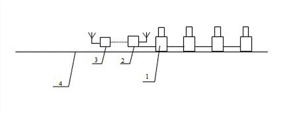
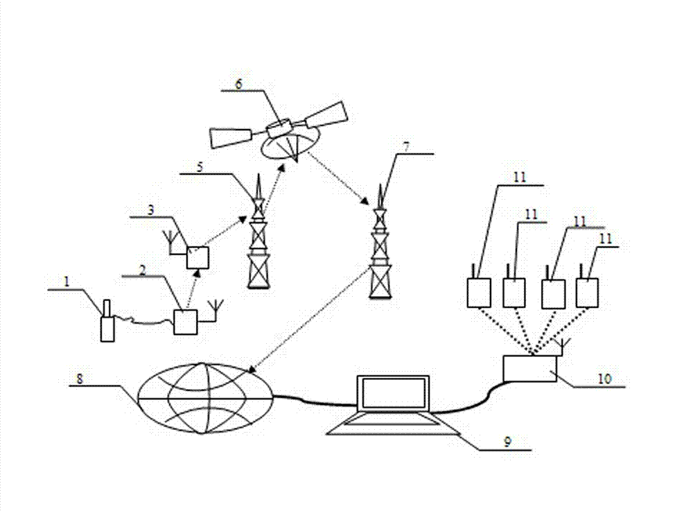
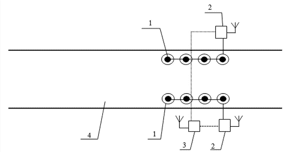
[0019] System embodiment such as figure 1 versus image 3 Shown: a remote intelligent three-dimensional digital early warning system for roadbed surface settlement, including several static level gauges 1, and also automatic data acquisition instrument 2, GPRS static data acquisition instrument 3, communication transmitter base station 5, commercial satellite 6, connected in sequence, Communication receiving base station 7, Internet 8 and remote computer 9; Several static level gauges 1 are connected in series and then wired to the input end of the automatic data acquisition instrument 2; the output end of the automatic data acquisition instrument 2 is wirelessly connected to the GPRS static data acquisition instrument 3. The GPRS static data acquisition instrument 3, the communication transmitting base station 5, the commercial satellite 6, the communication receiving base station 7 and the Internet 8 are connected by wireless signal communication. The Internet 8 is connected wi...
PUM
 Abstract
Description
Claims
Application Information
 - R&D
- Intellectual Property
- Life Sciences
- Materials
- Tech Scout
- Unparalleled Data Quality
- Higher Quality Content
- 60% Fewer Hallucinations
Browse by: Latest US Patents, China's latest patents, Technical Efficacy Thesaurus, Application Domain, Technology Topic, Popular Technical Reports.
© 2025 PatSnap. All rights reserved.Legal|Privacy policy|Modern Slavery Act Transparency Statement|Sitemap|About US| Contact US: help@patsnap.com


