Position-based marine fishery information serving method
An information service and fishery technology, applied in the directions of location-based service, wireless communication, message/mail/announcement, etc., can solve the problems of high service cost, difficult to popularize, and only one-way service.
- Summary
- Abstract
- Description
- Claims
- Application Information
AI Technical Summary
Problems solved by technology
Method used
Image
Examples
Embodiment 1
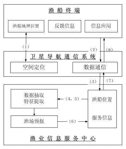
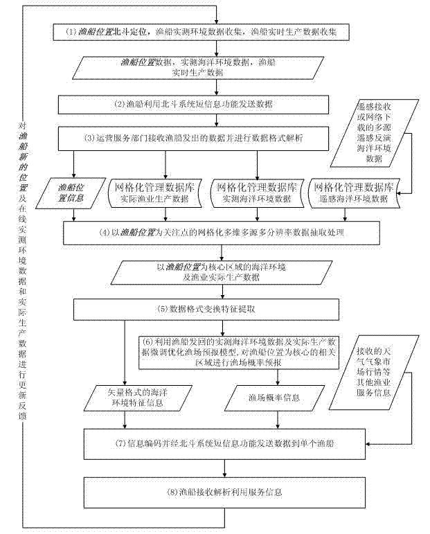
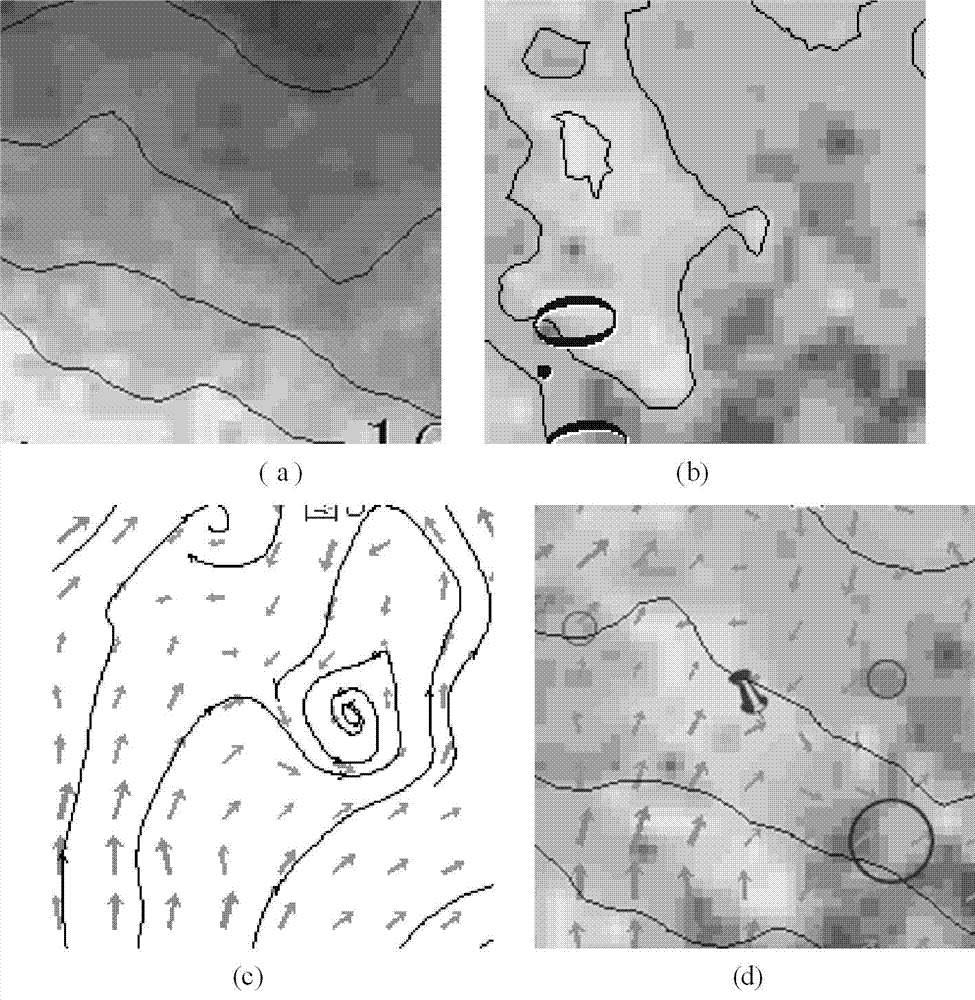
[0043] figure 1 An exemplary block diagram for the implementation of the method of the present invention. Processing flow chart such as figure 2 As shown, it includes positioning of fishing boats and receiving and processing of feedback information from fishing boats, extraction and transformation of surrounding environmental information of boats, forecasting of fishing grounds around boats, coding of forecast information and related environmental information, sending fishery service information to fishing boats, etc. Here is an L2-level product of MODIS (Moderate Resolution Imaging Spectrometer) data—the image size is 2160×4320 pixels, including sea surface temperature and chlorophyll concentration products, which already have geocoding information. At the same time, the corresponding ocean current data is selected. image 3 Displays environmental information such as sea surface temperature, chlorophyll concentration, and ocean current vector.
[0044] (1) Beidou position...
PUM
 Abstract
Description
Claims
Application Information
 - R&D
- Intellectual Property
- Life Sciences
- Materials
- Tech Scout
- Unparalleled Data Quality
- Higher Quality Content
- 60% Fewer Hallucinations
Browse by: Latest US Patents, China's latest patents, Technical Efficacy Thesaurus, Application Domain, Technology Topic, Popular Technical Reports.
© 2025 PatSnap. All rights reserved.Legal|Privacy policy|Modern Slavery Act Transparency Statement|Sitemap|About US| Contact US: help@patsnap.com


