Supercharge Your Innovation With Domain-Expert AI Agents!

System and method for generating recommended driving routes for an electric vehicle

A technology for vehicles and travel routes, applied in the field of systems and methods for generating recommended driving routes for electric vehicles, capable of solving problems such as non-optimization

Inactive Publication Date: 2013-01-23
GM GLOBAL TECH OPERATIONS LLC
View PDF3 Cites 22 Cited by
  • Summary
  • Abstract
  • Description
  • Claims
  • Application Information

AI Technical Summary

Problems solved by technology

However, traditional navigation systems may operate in a suboptimal manner when combined with emerging battery electric vehicle and range-extended electric vehicle designs that include electric powertrains

Method used


Image

  • System and method for generating recommended driving routes for an electric vehicle
  • System and method for generating recommended driving routes for an electric vehicle
  • System and method for generating recommended driving routes for an electric vehicle

Examples


Embodiment Construction

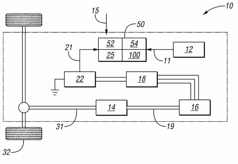
[0018] Referring to the drawings, wherein like reference numerals correspond to like or similar parts throughout the several views, figure 1 An exemplary vehicle 10 is schematically shown in . Vehicle 10 includes navigation system 50 , which may be configured as a host or server installed within vehicle 10 , or alternatively as a handheld device carried by a user seated in vehicle 10 . In various embodiments, the vehicle 10 may be a battery electric vehicle (BEV) or an extended-range electric vehicle (EREV), as described below, or any other vehicle that includes an electric powertrain. As is understood in the art, such a vehicle may be driven using only electrical energy, in which case it is referred to as an electric vehicle or EV mode.

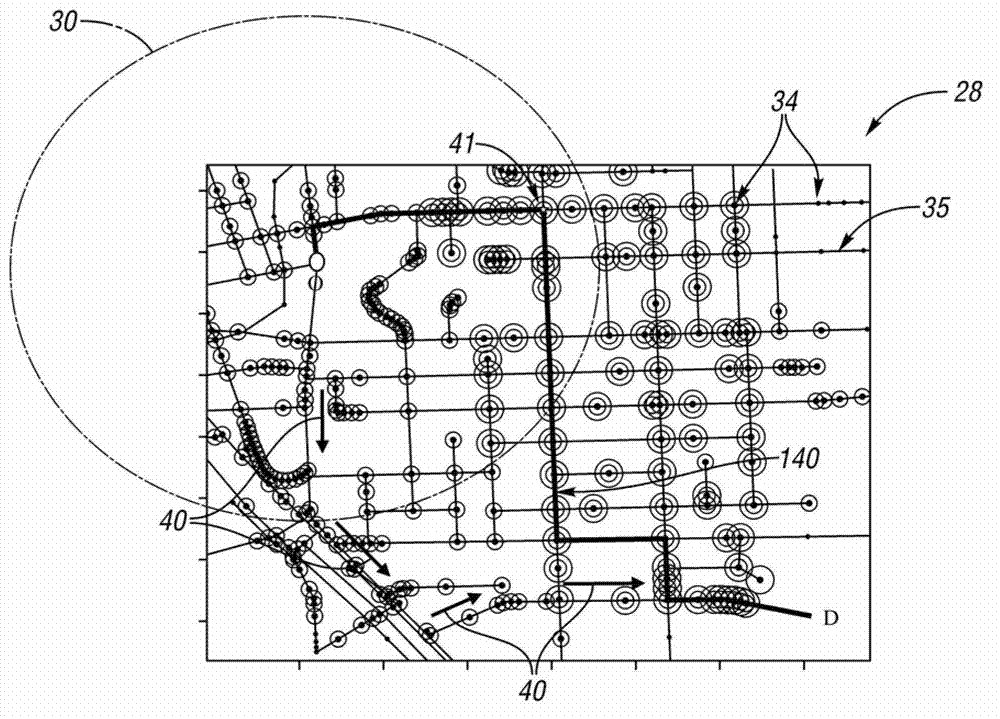
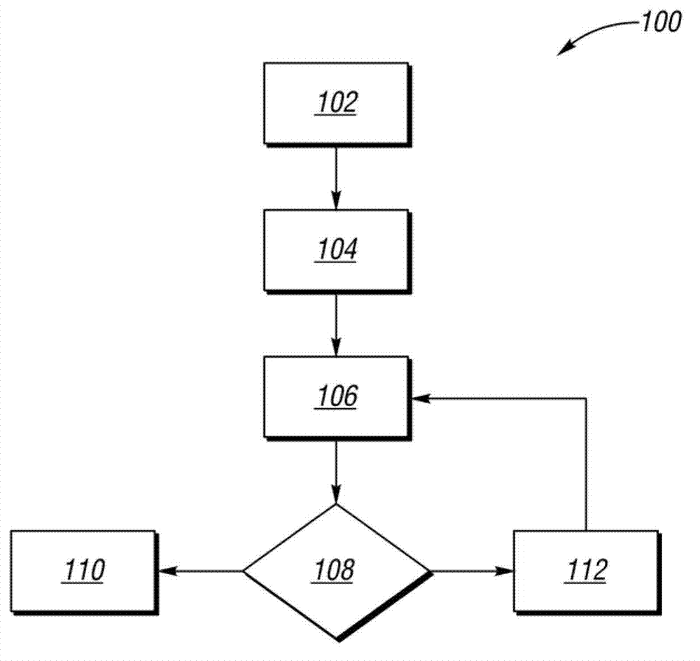
[0019] The navigation system 50 automatically generates and displays a geocoded map with recommended EV travel routes using the method 100 of the present invention, which may be implemented as a set of processing instructions or computer co...


PUM


Abstract

A navigation system for a vehicle includes a display device and host machine. The host machine communicates with a map database containing information describing a geocoded road network. The network includes nodes each describing a point within the network, with some nodes describing charging waypoints. The host machine executes a method, including recording a destination, determining a remaining state of charge (SOC) of a battery, and calculating a remaining electric vehicle (EV) range of the vehicle using the remaining SOC for every node. The host machine generates a first recommended EV travel route to the destination using a shortest distance or travel time approach when the destination lies within the remaining EV range. The host machine generates a second recommended EV travel route to the destination through a charging waypoint(s) when the destination lies outside of the remaining EV range. The EV route is displayed via the display device.

Description

technical field [0001] The present disclosure relates to generating a recommended travel route in a vehicle having an electric powertrain. Background technique [0002] A vehicle navigation system is a networked computer device that uses global positioning data to accurately determine the location of a vehicle or device on a geocoded map. A server or host computer typically calculates a recommended travel route using a shortest distance or fastest drive time algorithm through the road network and using associated geospatial, terrain and road network information. The navigation system may also provide turn-by-turn directions to the destination, in text and / or spoken form, with the corresponding route trajectory displayed on the map. However, conventional navigation systems may operate in a suboptimal manner when combined with emerging battery electric vehicle and range-extended electric vehicle designs that include electric powertrains. Contents of the invention [0003] ...

Claims


Application Information

Patent Timeline
IPC IPC(8): G01C21/34B60L11/18
CPCB60L2240/622G01C21/3469Y02T90/168Y04S30/12B60L2250/16B60L11/1862B60L11/18G01C21/3476G01C21/34Y02T90/16B60L58/13Y02T10/70Y02T10/72Y02T90/167
Inventor 小爱德华.D.泰特
Owner GM GLOBAL TECH OPERATIONS LLC
Features
  • R&D
  • Intellectual Property
  • Life Sciences
  • Materials
  • Tech Scout
  • Unparalleled Data Quality
  • Higher Quality Content
  • 60% Fewer Hallucinations
Learn More