Method of extracting values of pixels corresponding to rubber forest from remote-sensing image
A remote sensing image and pixel value technology, which is applied in the field of remote sensing image processing, can solve problems such as outliers and remote sensing image pixel impurity, and achieve the effect of improving accuracy
- Summary
- Abstract
- Description
- Claims
- Application Information
AI Technical Summary
Problems solved by technology
Method used
Image
Examples
Embodiment
[0028] The following takes the ENVI remote sensing analysis software platform as an example to realize the detailed flow of the present invention.
[0029] 1. Use ENVI to open a geometrically corrected medium-resolution image for image enhancement.
[0030] 2. Open the rubber forest plot vector map (shapefile or evf format). Vector maps can be drawn manually from high-resolution remote sensing images, and it is necessary to ensure that each rubber forest has a unique ID number.
[0031] 3. Create an ROI (Region of Interest) based on the rubber forest sample plot vector map. When creating an ROI, the ID number of the rubber forest is used as an identification to ensure that each rubber forest is an independent ROI.
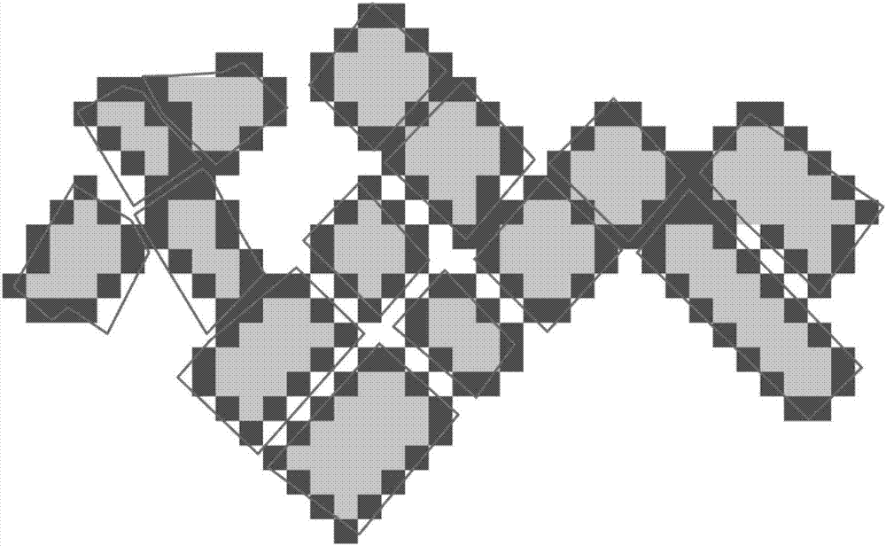
[0032] 4. Use the ROI file to crop the remote sensing image to obtain the remote sensing image of the rubber forest plot area. Because some pixels of the image clipped by ENVI are on the rubber forest vector boundary ( image 3 ), they may be polluted by roads ...
PUM
 Abstract
Description
Claims
Application Information
 - R&D
- Intellectual Property
- Life Sciences
- Materials
- Tech Scout
- Unparalleled Data Quality
- Higher Quality Content
- 60% Fewer Hallucinations
Browse by: Latest US Patents, China's latest patents, Technical Efficacy Thesaurus, Application Domain, Technology Topic, Popular Technical Reports.
© 2025 PatSnap. All rights reserved.Legal|Privacy policy|Modern Slavery Act Transparency Statement|Sitemap|About US| Contact US: help@patsnap.com


