Information extraction method for plant diseases and insect pests based on satellite images

A satellite image and information extraction technology, which is applied in the field of remote sensing image processing and agronomy, to achieve the effect of reducing costs

Inactive Publication Date: 2013-02-20
BEIJING RES CENT FOR INFORMATION TECH & AGRI
View PDF3 Cites 28 Cited by
  • Summary
  • Abstract
  • Description
  • Claims
  • Application Information

AI Technical Summary

Problems solved by technology

There is currently no method for large-scale monitoring of crop diseases on a regional scale using multi-temporal satellite imagery data

Method used


Image

  • Information extraction method for plant diseases and insect pests based on satellite images
  • Information extraction method for plant diseases and insect pests based on satellite images
  • Information extraction method for plant diseases and insect pests based on satellite images

Examples


Embodiment Construction

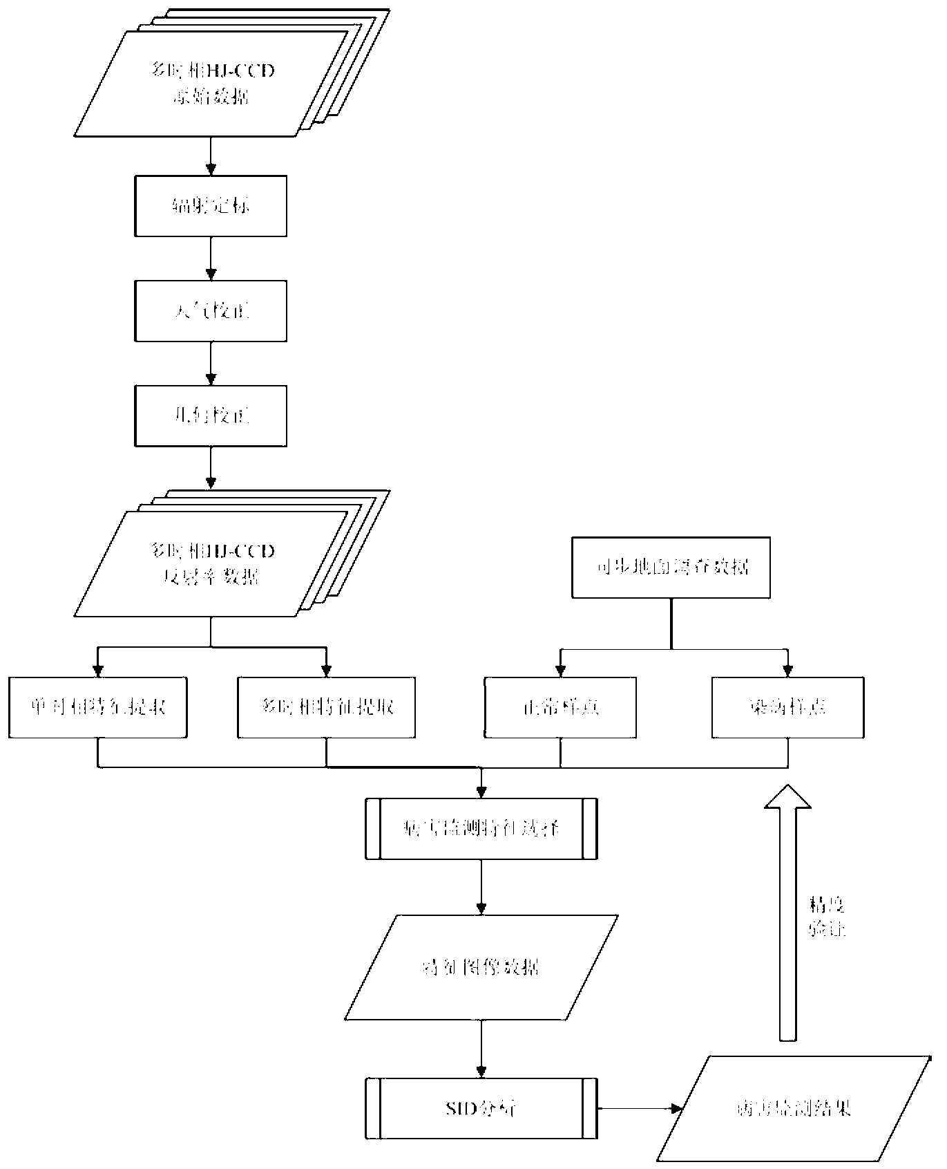
[0032] The specific embodiments of the present invention will be described in further detail below in conjunction with the drawings and embodiments. The following examples are used to illustrate the present invention, but not to limit the scope of the present invention.

[0033] The implementation of the present invention adopts the following technical solutions:

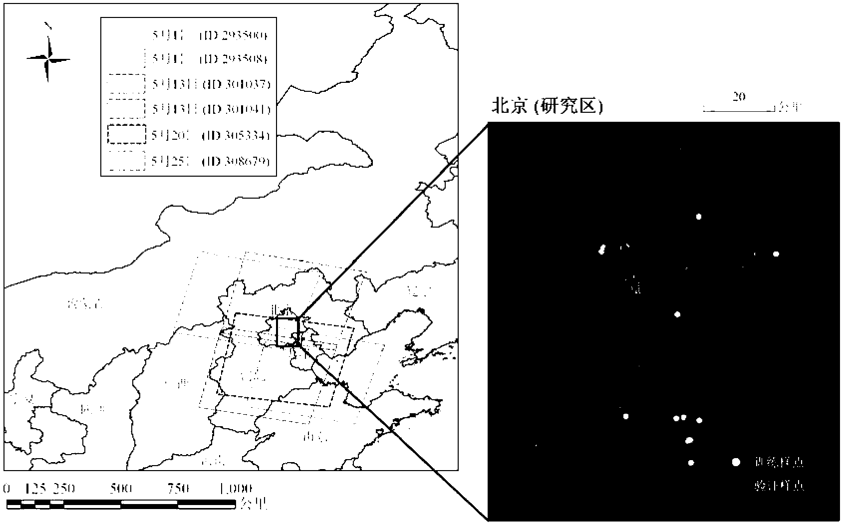
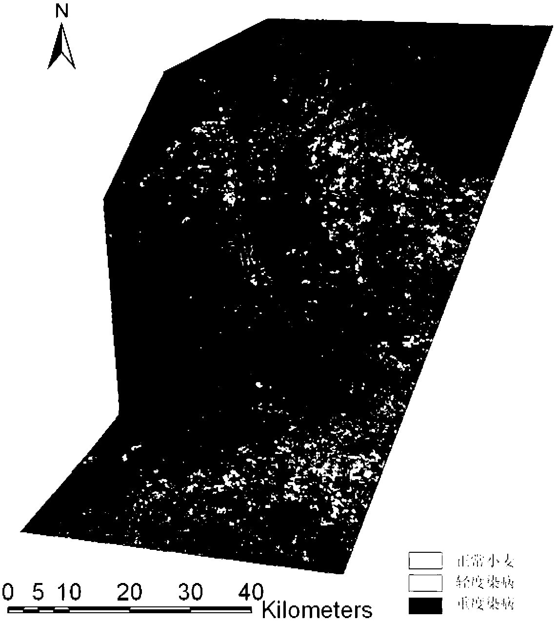
[0034] Step 1: Order, download and preprocess multi-temporal satellite remote sensing images. According to the characteristics of rapid occurrence of most crop diseases and the currently available satellite remote sensing data sources, it is recommended to use medium and high resolution satellite images with high revisit cycles. The band range needs to cover the visible and near-infrared bands. Combining the experience of agronomy and plant protection, first determine the most suitable monitoring period for local crop diseases (usually the period when the visual symptoms are obvious in the field). Obtain satellite ima...


PUM


Abstract

The invention provides a regional-scale monitoring method for crop diseases based on multi-temporal satellite images. The method makes full use of spectral information and temporal information in time sequence image data, combines technologies of GIS, GPS and RS, introduces spectral information divergence analysis to the crop disaster monitoring field, and provides a method and technology for large-scale monitoring the diseases by using satellite-earth synchronous data in a certain regions. The method can effectively reduce field operation cost of disease monitoring, expands a conventional disease monitoring modes from point to surface, and provides convenience for government departments and agricultural administrative departments to master and to know important information such as generation, serious degree and the like of regional-scale diseases timely and accurately.

Description

Technical field [0001] The invention relates to the technical fields of remote sensing image processing and agronomy, in particular to a method for extracting crop disease information at a regional scale by using multi-temporal satellite image data. Background technique [0002] Traditional pest surveys mainly rely on manual visual inspection, field sampling and other methods. Although these methods have high authenticity and reliability, they are time-consuming and labor-intensive, and have drawbacks such as representativeness, poor timeliness, and strong subjectivity. They have been difficult to adapt to the current needs for real-time monitoring and forecasting of large-scale pests. [0003] Remote sensing technology is currently the only method that can quickly obtain spatial continuous surface information on a large scale. It has different degrees of research and application in crop yield estimation, quality forecasting, and pest monitoring. These applications have changed th...

Claims


Application Information

Patent Timeline
Patent Type & Authority Applications(China)
IPC IPC(8): G01N21/25
Inventor 张竞成王纪华赵春江袁琳杨小冬李存军杨贵军杨浩
Owner BEIJING RES CENT FOR INFORMATION TECH & AGRI
Why Eureka
Try Eureka