Fine partition method of soil pollutant content spatial distribution

A technology of spatial distribution and pollutants, applied in image analysis, image data processing, instruments, etc., can solve the problem of high interpolation results, achieve the effect of wide application, guarantee objectivity and accuracy

Active Publication Date: 2015-03-04
INST OF SUBTROPICAL AGRI CHINESE ACAD OF SCI
View PDF3 Cites 2 Cited by
  • Summary
  • Abstract
  • Description
  • Claims
  • Application Information

AI Technical Summary

Problems solved by technology

Using the existing spatial interpolation method to estimate the pollutant content of unknown point 1, due to the participation of sample points of plot B in the interpolation process, the interpolation result of the pollutant content of unknown point 1 will be high; The interpolation result of the pollutant content is low due to the participation of the sampling points of plot A

Method used


Image

  • Fine partition method of soil pollutant content spatial distribution
  • Fine partition method of soil pollutant content spatial distribution
  • Fine partition method of soil pollutant content spatial distribution

Examples


Embodiment 1

[0027] A fine zoning method for the spatial distribution of soil pollutant content, comprising the following steps:

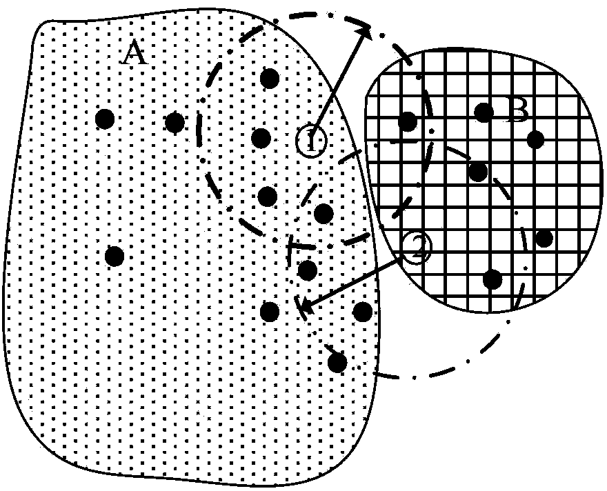
[0028] Step 1. By classifying remote sensing images or aerial photographs, extract the restricted area BArea of ​​the research area;

[0029] The constraint area BArea is the spatial range covered by the spatial interpolation operation. The extraction of the restricted area includes extracting two parts, the non-monitoring target area NMArea and the monitoring target area MArea. Non-target monitoring areas refer to monitoring areas that are not usually involved in soil pollutant monitoring, such as water areas, construction areas, forest land, etc. The monitoring target area refers to the actual monitoring area in soil pollution sampling monitoring, usually referring to agricultural land. The three of the restricted area, the non-target monitoring area and the monitoring target area obey the following spatial relationship:

[0030]

[0031] ...

Embodiment 2

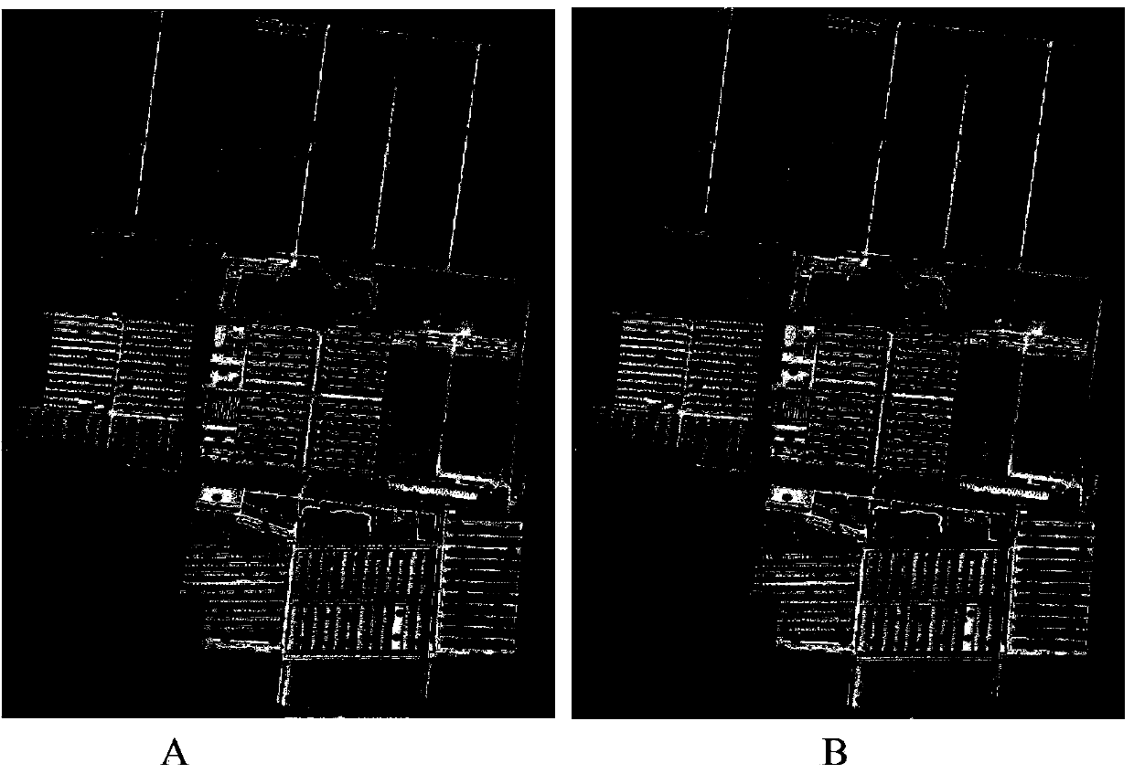
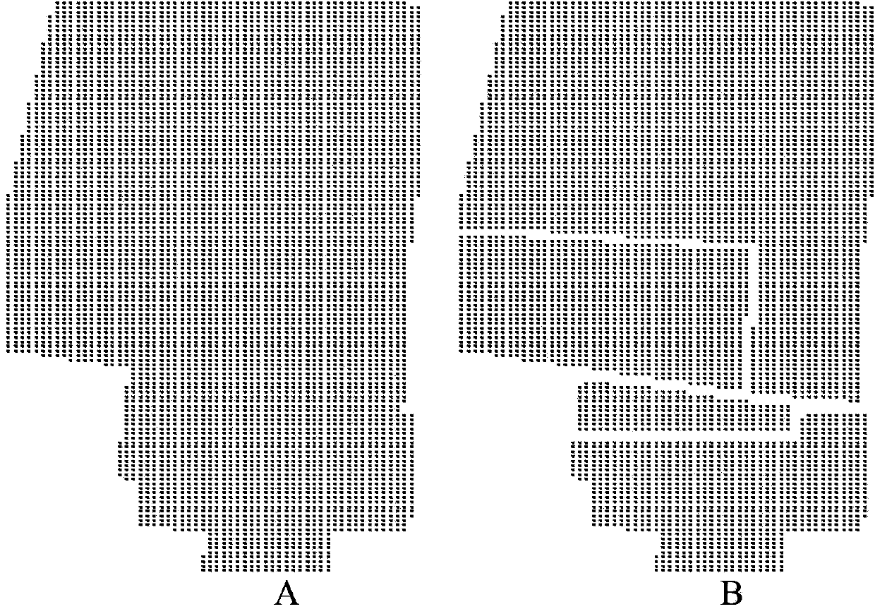
[0053] The following examples are used to illustrate the present invention, but are not intended to limit the scope of application of the present invention. This example comes from an organic agricultural product producing area in Shanghai, which is 1000 meters long from east to west and 600 meters wide from north to south, with a total area of ​​0.6k square meters. There are two main types of land use in this production area: field and facility vegetable land. In 2010, 193 samples were taken according to the regular grid sampling method to monitor the soil heavy metal Cu content in this production area. The distribution of sample points is shown in ( figure 2 -A). The survey found that the content of heavy metal Cu in the soil of the facility vegetables was significantly higher than that of the field soil. Therefore, the facility vegetable land is considered as the potential pollution area of ​​heavy metal Cu in this production area. Adopt the present invention to make th...


PUM


Abstract

The invention aims at providing a fine partition method of soil pollutant content spatial distribution. The fine partition method of the soil pollutant content spatial distribution solves the problem that an existing spatial interpolation method cannot achieve fine partition of soil pollutant distribution due to the problem of interpolation transboundary. The fine partition method uses a spatial relation between the soil pollutant content distribution and a pollution source as a reference, extracts a constraint region, builds a boundary constraint space interpolation algorithm based on the constraint region, enables spatial interpolation to be restrained in a reliable space region, and achieves the fine partition of the soil pollutant content distribution. The fine partition method of the soil pollutant content spatial distribution has the advantages of extracting the pollution source influence range serving as a boundary constraint condition, restraining spatial interpolation of unknown sites in the reliable space region, and achieving accuracy and reliability of partition of the soil pollutant content distribution. The fine partition method of the soil pollutant content spatial distribution is suitable for digital map production of the pollutant content distribution of the fields of soil, zoology, hydrology and the like.

Description

technical field [0001] The invention belongs to the spatial interpolation technology of soil pollutant content, and more specifically relates to a fine zoning method for the spatial distribution of soil pollutant content, which is applicable to the production of digital maps for the content distribution of relevant pollution indicators in the fields of ecology and hydrology. Background technique [0002] Affected by manpower and material resources, the sampling observation of soil pollutant content in the research area is always limited. How to accurately describe the non-point source distribution of soil pollutants through limited and discrete observation sample data has always been of interest Difficult question. At present, the main method to describe the spatial distribution information of soil pollutants is spatial interpolation. However, the existing spatial interpolation methods all have the problem of cross-border spatial interpolation, that is, the interpolation re...

Claims


Application Information

Patent Timeline
Patent Type & Authority Patents(China)
IPC IPC(8): G06T7/60
Inventor 周脚根吴金水黄道友肖润林
Owner INST OF SUBTROPICAL AGRI CHINESE ACAD OF SCI
Why Eureka
Try Eureka