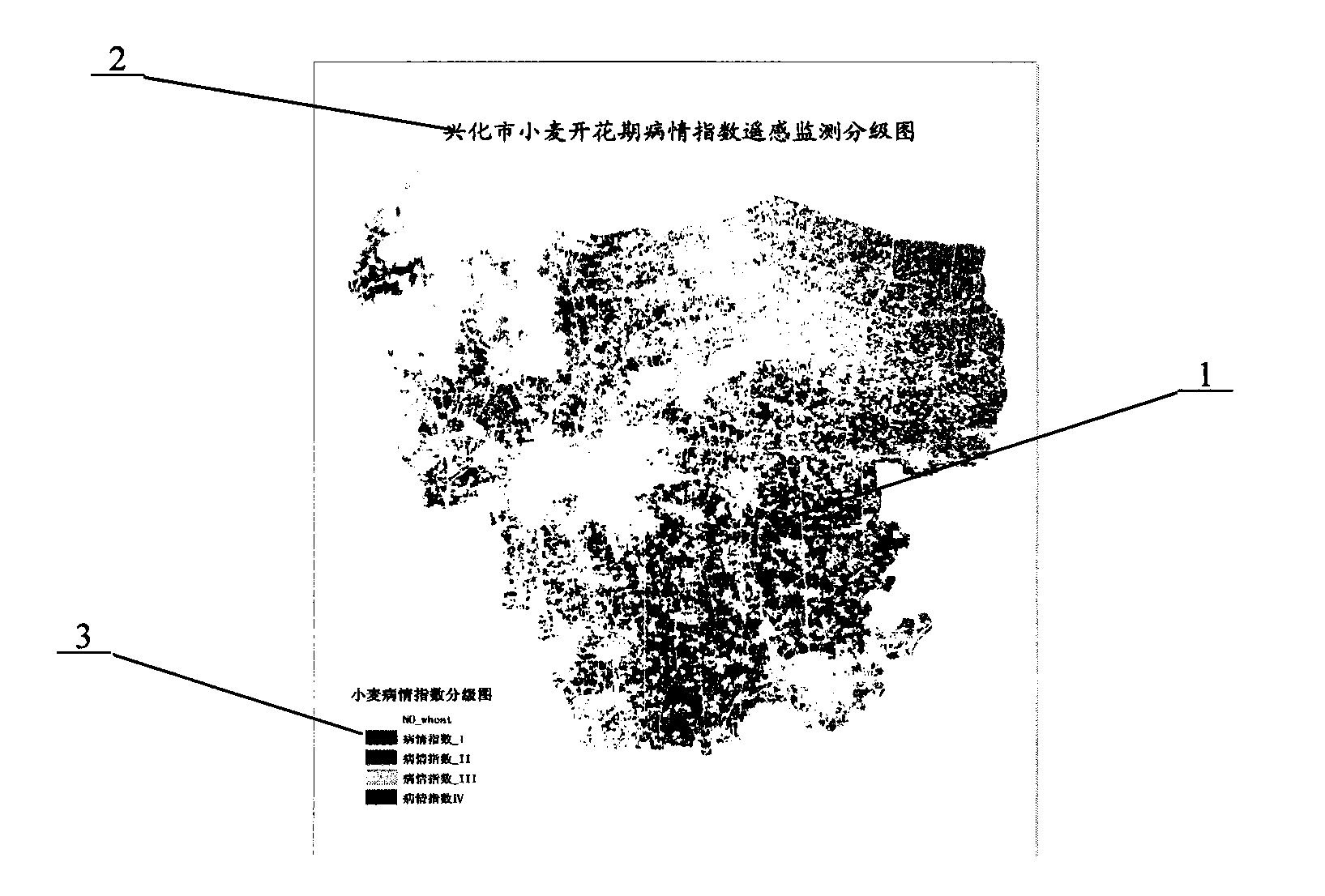
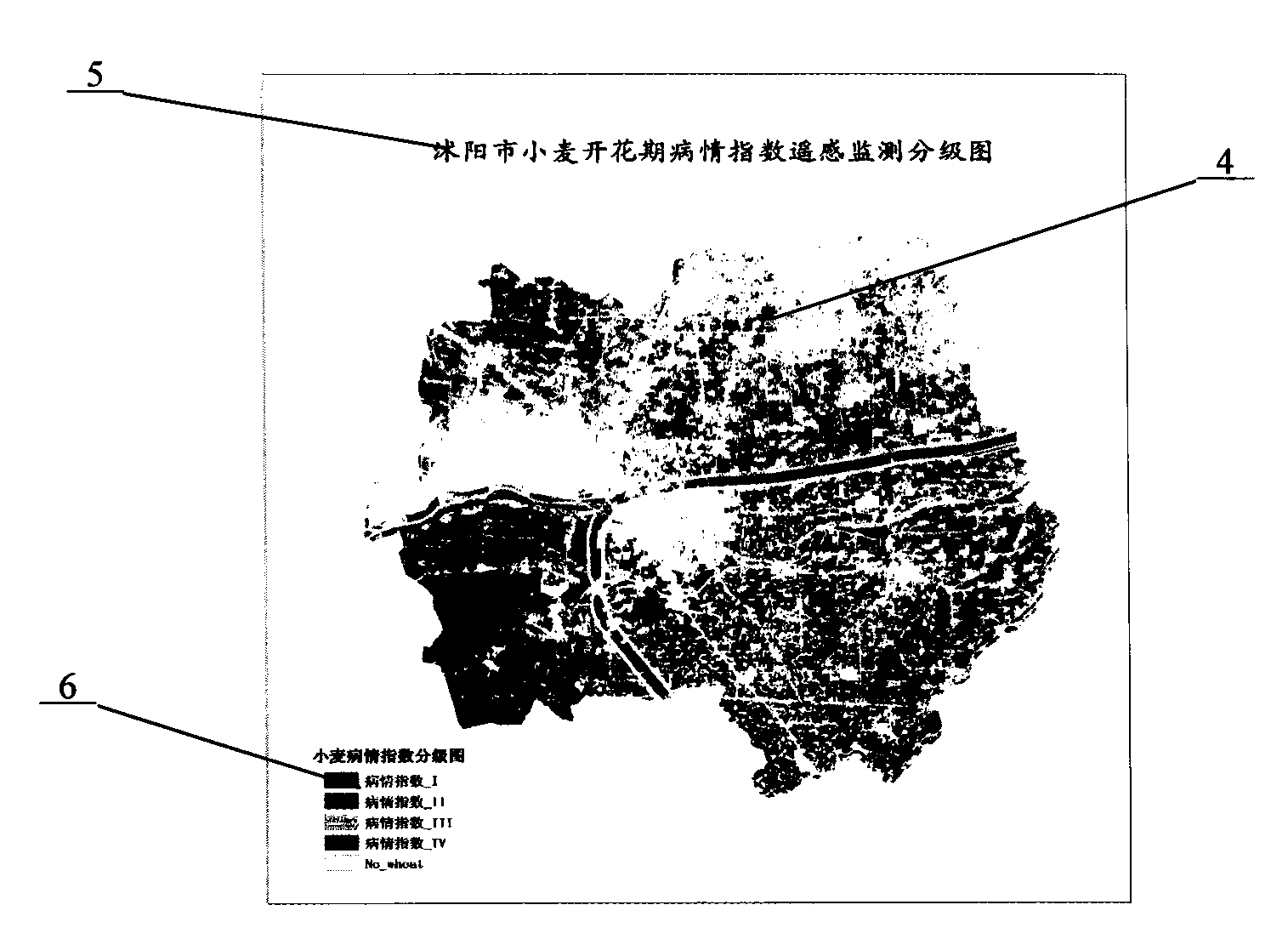
Remote-sensing quick monitoring method of winter wheat powdery mildew in field
A technology for winter wheat and powdery mildew, which is applied in the field of crop growth monitoring, can solve the problems of affecting the accuracy of monitoring and the accurate implementation of control measures, difficulty in obtaining large-scale disease data in a timely manner, and limited sampling scope and sample size. To achieve the effect of easy recognition and use, increase the scope of monitoring, and reduce the workload of investigation
- Summary
- Abstract
- Description
- Claims
- Application Information
AI Technical Summary
Problems solved by technology
Method used
Image
Examples
Embodiment 1
[0017] (1) During the growth period of winter wheat in Xinghua City, query and order the environmental satellite remote sensing images (spatial resolution of 30 meters) of Xinghua City on April 16 (winter wheat flowering period), after preprocessing of geometric correction and atmospheric correction stand-by;
[0018] (2) Synchronized with the satellite transit day, set up 10 ground monitoring points in Xinghua City, each ground monitoring point is located in the center of the winter wheat contiguous planting area greater than 10,000 square meters, and the distance between each ground monitoring point is 3 about kilometers;
[0019] (3) information collection of chlorophyll content of leaves of winter wheat plants at ground monitoring points, collecting 10 points altogether, and then calculating the average value, the average value of chlorophyll content of leaves of winter wheat plants is 32.84% in this example;
[0020] (4) Water content information collection of winter whe...
Embodiment 2
[0025] (1) During the growth period of winter wheat in Shuyang City, query and order the environmental satellite remote sensing images (spatial resolution of 30 meters) of Shuyang City until April 26 (the flowering period of winter wheat), and perform geometric correction and atmospheric correction preprocessing before use ;
[0026] (2) Synchronized with the satellite transit day, set up 10 ground monitoring points in Shuyang City, each ground monitoring point is located in the center of the winter wheat contiguous planting area greater than 10,000 square meters, and the distance between each ground monitoring point is 3 kilometers about;
[0027] (3) information collection of chlorophyll content of leaves of winter wheat plants at ground monitoring points, collecting 10 points altogether, and then calculating the average value, the average value of chlorophyll content of leaves of winter wheat plants is 33.45% in this example;
[0028] (4) Water content information collecti...
PUM
 Abstract
Description
Claims
Application Information
 - R&D
- Intellectual Property
- Life Sciences
- Materials
- Tech Scout
- Unparalleled Data Quality
- Higher Quality Content
- 60% Fewer Hallucinations
Browse by: Latest US Patents, China's latest patents, Technical Efficacy Thesaurus, Application Domain, Technology Topic, Popular Technical Reports.
© 2025 PatSnap. All rights reserved.Legal|Privacy policy|Modern Slavery Act Transparency Statement|Sitemap|About US| Contact US: help@patsnap.com


