Three-dimensional digital city digital elevation model (DEM) processing method in surveying and mapping industry
A technology of three-dimensional numbers and processing methods, applied in the field of geographic information systems, can solve problems such as models and roads that are difficult to coordinate, and achieve the effect of reducing production costs
- Summary
- Abstract
- Description
- Claims
- Application Information
AI Technical Summary
Problems solved by technology
Method used
Image
Examples
Embodiment Construction
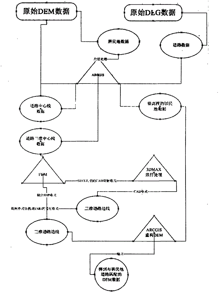
[0024] see figure 1 , a kind of surveying and mapping industry three-dimensional digital city DEM processing method of the present invention has the following steps:
[0025] 1. Extract residential area elements based on the digital line drawing;
[0026] Residential elements were extracted based on the digital line graph (DLG). (The digital line drawing is the original data provided by Party A, which contains the residential area element data required for model making);
[0027] 2 Based on the ARCGIS tool, the mean value processing of the elevation in the residential area is realized to ensure that the connection between the terrain of the residential area and the surrounding terrain is not abrupt;
[0028] Based on the DEM (Digital Elevation Model) and the extracted residential elements, use the ARCGIS tool to process the mean value of the terrain with the residential element unit as a unit, and assign the obtained mean value to the corresponding residential element unit; ...
PUM
 Abstract
Description
Claims
Application Information
 - R&D
- Intellectual Property
- Life Sciences
- Materials
- Tech Scout
- Unparalleled Data Quality
- Higher Quality Content
- 60% Fewer Hallucinations
Browse by: Latest US Patents, China's latest patents, Technical Efficacy Thesaurus, Application Domain, Technology Topic, Popular Technical Reports.
© 2025 PatSnap. All rights reserved.Legal|Privacy policy|Modern Slavery Act Transparency Statement|Sitemap|About US| Contact US: help@patsnap.com

