Water and soil erosion monitoring method for highway construction

A technology in construction and highway, applied in special data processing applications, instruments, electrical and digital data processing, etc., can solve the problems of large manpower and material resources, inaccurate monitoring of soil erosion, etc., and achieve accurate and good prediction of soil erosion modulus. effect, improve work efficiency

Inactive Publication Date: 2013-08-07
CHINA ACAD OF TRANSPORTATION SCI
View PDF2 Cites 12 Cited by
  • Summary
  • Abstract
  • Description
  • Claims
  • Application Information

AI Technical Summary

Problems solved by technology

[0007] The technical problem to be solved by the present invention is: in the existing road soil erosion monitoring, the DEM is established to obtain the slope length and slope factor from the measured data before the road construction, resulting in inaccurate monitoring of water and soil erosion, and the problem of consuming relatively large manpower and material resources

Method used


Image

  • Water and soil erosion monitoring method for highway construction
  • Water and soil erosion monitoring method for highway construction
  • Water and soil erosion monitoring method for highway construction

Examples


Embodiment

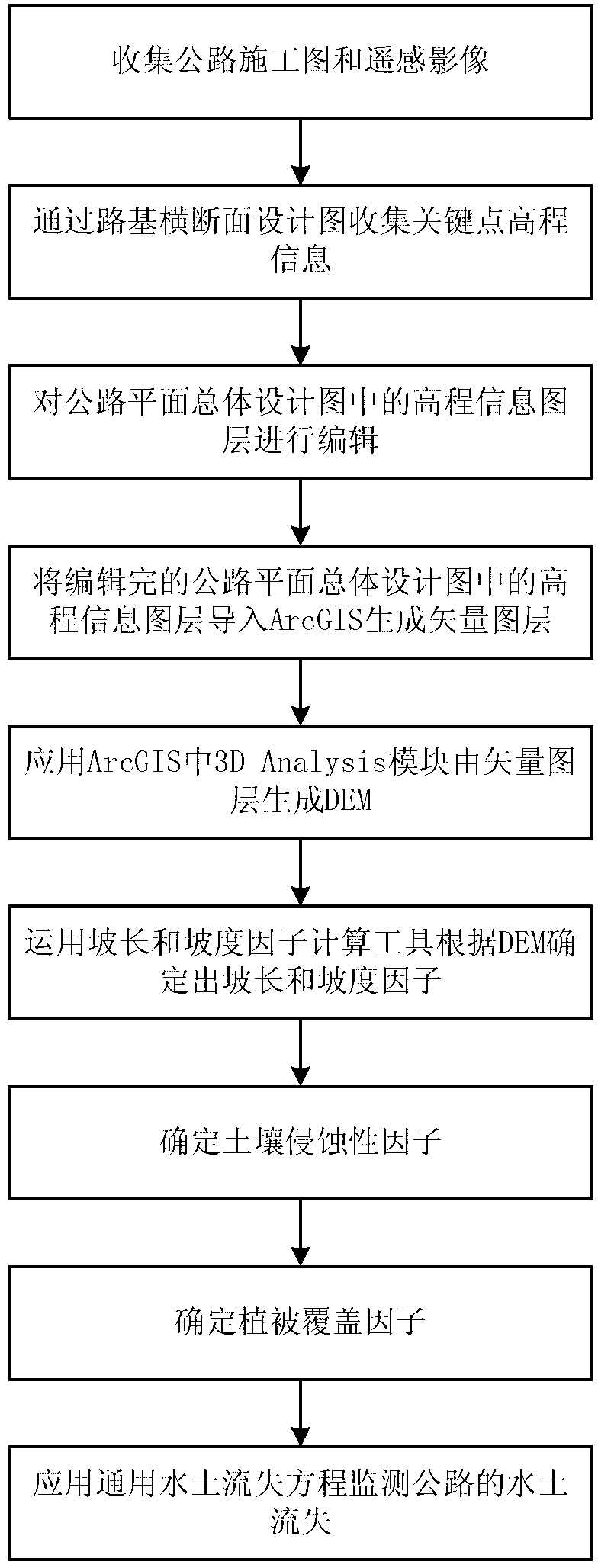
[0054] Application method of the present invention carries out soil erosion monitoring to Xianyang-Xunyi expressway section 10km demonstration road section under construction in Shaanxi Province, carries out according to the following steps:

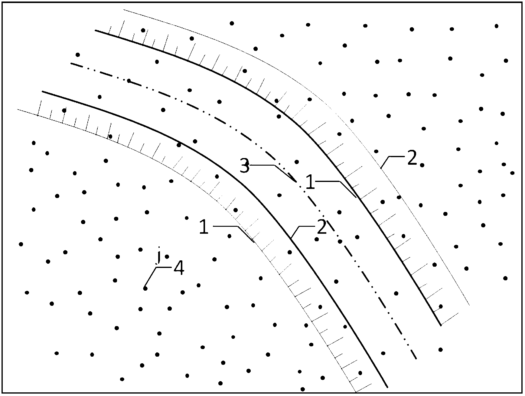
[0055] (1) Collect highway construction drawings and remote sensing image data in CAD format for the 10km demonstration section of the Xianyang-Xunyi Expressway section, including subgrade cross-sectional design drawings with an average interval of 20m, and highways with elevation information (elevation points or contour lines) Plane overall design drawings and remote sensing images of suitable periods are used as the basic data for the research.

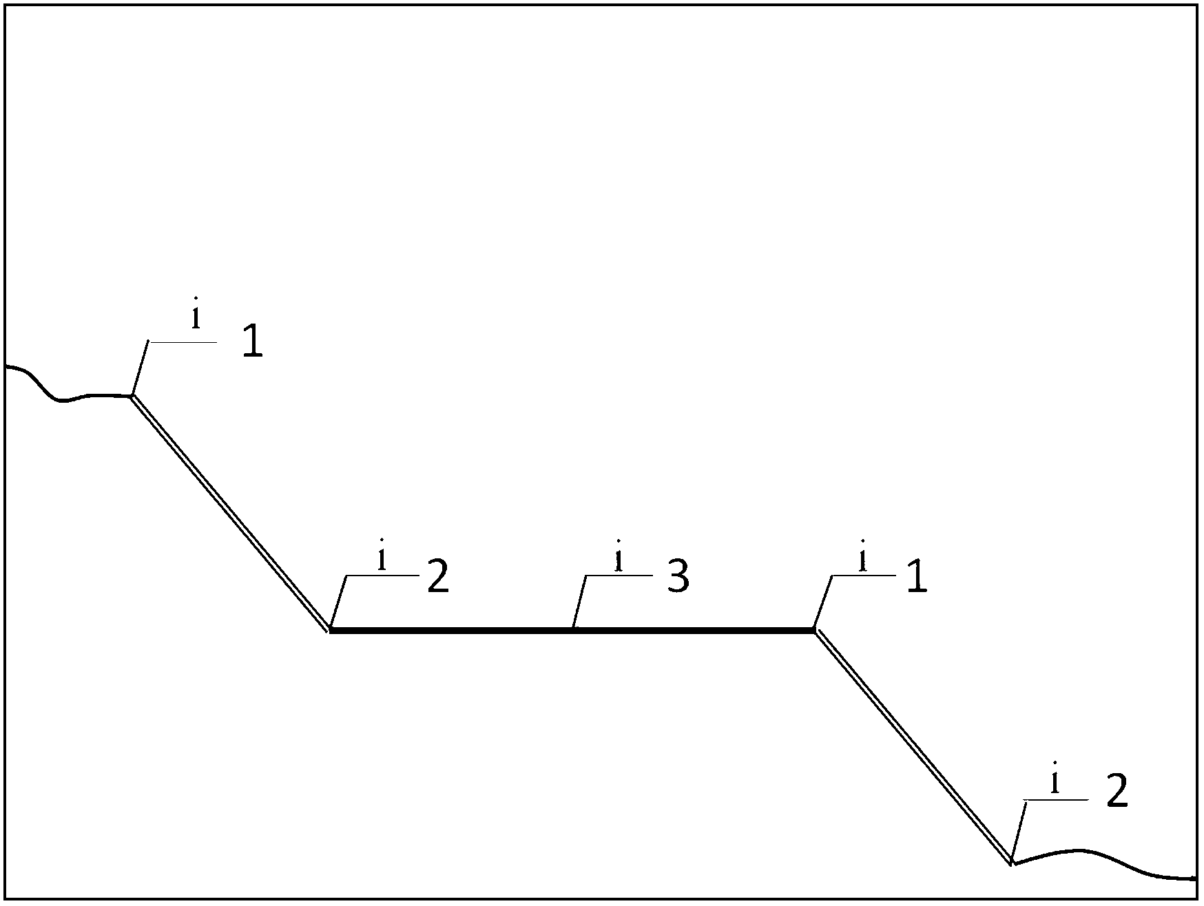
[0056] (2) According to the existing subgrade cross-section design drawing, start from the subgrade cross-section at the starting position (K42+000) of the demonstration road section, record the pile number and the elevation information of key points, such as figure 2 As shown, the key points...


PUM


Abstract

The invention discloses a water and soil erosion monitoring method for highway construction. The water and soil erosion monitoring method for the highway construction comprises collecting highway construction drawings and remote-sensing images of highway sections to be monitored; editing elevation information of an elevation information layer in a highway plane integral design drawing according to elevation information which is recorded in a design drawing of a subgrade cross-section and is about stake marks and key points of the highway sections to be monitored and obtaining vector format files which are corresponding to the elevation information layer; generating a DEM (Dynamic Effect Model) by utilizing a three dimensional analyzing module to further obtain the slop length and the gradient factors; confirming soil denudation factors on different engineering portions in highway construction; setting an original vegetation coverage of highway construction portions to be 0 and obtaining distribution of vegetation coverage factors through ArcGIS software; and monitoring distribution of water and soil erosion modes in highway sections through a common water and soil erosion equation. The water and soil erosion monitoring method for the highway construction has the advantages of reducing working time and strength in a water and soil erosion monitoring field and being consistent with the actual situation and good in prediction through the obtained water and soil erosion modulus.

Description

technical field [0001] The invention relates to the technical field of water and soil loss monitoring, in particular to a method for monitoring water and soil loss in road construction. Background technique [0002] Development and construction projects will destroy the surface and cause a certain degree of soil erosion. In modernization construction, road construction is inevitable, so soil erosion caused by road construction is also inevitable. Soil erosion will destroy the natural environment and ecological balance. How to minimize soil erosion during road construction, or how to predict soil erosion and take measures in advance to control soil erosion is an important issue. [0003] At present, during the construction period of highway construction, the Universal Soil Loss Equation (USLE) is used to predict the amount of soil loss, so as to monitor the soil erosion caused by highway construction, and take reasonable measures to control soil erosion or optimize constructi...

Claims


Application Information

Patent Timeline
Patent Type & Authority Applications(China)
IPC IPC(8): G06F17/50
Inventor 李华关磊陈建业孔亚平陈济丁
Owner CHINA ACAD OF TRANSPORTATION SCI
Why Eureka
Try Eureka