Tile loading method for 2.5-dimensional map service

A technology of map tiles and maps, applied in the field of mobile communications, can solve the problems of slow map drawing and increased program memory usage, and achieve the effects of reducing the number of judgments, improving efficiency, and improving computing efficiency.

Inactive Publication Date: 2014-02-19
吉奥时空信息技术股份有限公司
View PDF8 Cites 19 Cited by
  • Summary
  • Abstract
  • Description
  • Claims
  • Application Information

AI Technical Summary

Problems solved by technology

[0011] Loading too much tile data will result in

Method used


Image

  • Tile loading method for 2.5-dimensional map service
  • Tile loading method for 2.5-dimensional map service
  • Tile loading method for 2.5-dimensional map service

Examples


Embodiment Construction

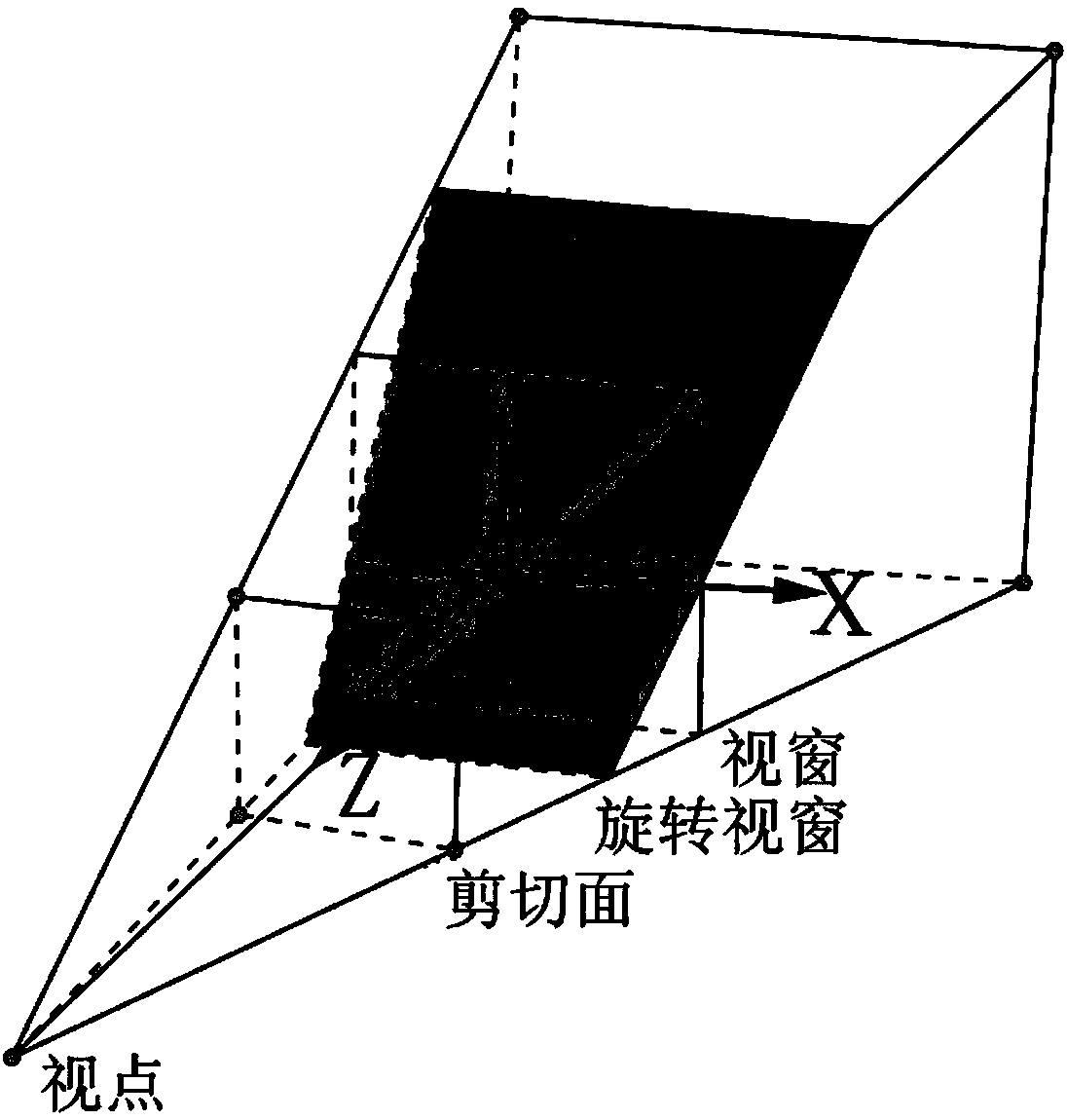
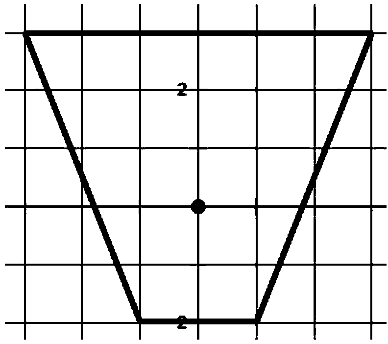
[0032] Scanning Algorithm Description

[0033] When the map window is rotated in different situations, the range of tiles that need to be loaded is a grid of tiles covered by quadrilaterals, such as Figure 7 shown. Its algorithm is described as follows:

[0034] Input: The vertex coordinates M, O, P and N of the known quadrilateral, such as Figure 7 As shown, the size of the side length of the grid is Size, the coordinate x value Left of the upper left corner of the grid (column 0, row 0), and the y value Top.

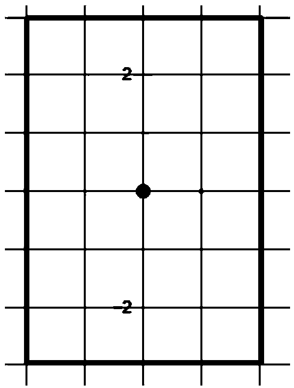
[0035] Output: A collection of grids covered by quadrilaterals (i.e. Image 6 The number of grids in the shaded part of the middle).

[0036] The column number of the grid to be obtained must be between point M and point N. Therefore, each column grid can be scanned to obtain the required row number respectively. For example: when scanning M+1 columns, the intersection points A and B of the grid and the quadrilateral can be obtained, and the row numbers where A...


PUM


Abstract

The invention discloses a tile loading method for 2.5-dimensional map service. The method comprises a map service application display device, a 2.5-dimensional map service application module and a map service module. The 2.5-dimensional map service application module calls the map service module, needed map tiles are retuned, and the map tiles are loaded and displayed on the display device. The map service module calculates requested minimum tile set through the tile scanning algorithm on the basis of map view window pitching and rotary changes, and sends tile loading service requests to a server side, and the server returns a tile service response. The tile scanning algorithm can rapidly scan and calculate the number and the range of the minimum tiles which need to be loaded during 2.5-dimensional map service, and therefore the purposes of fast loading and map browsing are obtained.

Description

technical field [0001] The invention belongs to the technical field of mobile communication, and more specifically relates to a method for loading tile data in a 2.5-dimensional map service based on mobile communication, which can be used in the development of distributed geographic information system network map services. Background technique [0002] On mobile terminals such as smartphones, web map service is an important online service application of geographic information. Compared with traditional two-dimensional map services, 2.5-dimensional or even true three-dimensional map services can bring users a realistic application experience. The so-called 2.5-dimensional map is a two-dimensional map that is based on a three-dimensional model and mapped onto a certain plane according to certain projection rules, and can display a three-dimensional effect. In the network environment, the 2.5-dimensional map on the mobile terminal is displayed by loading tiles from the server....

Claims


Application Information

Patent Timeline
IPC IPC(8): G06T11/00
Inventor 万波蒋东青屈敏梅龙宋爱红范业稳魏延峰朱伟奇张龙黄俊韬陈胜鹏程方李轩贺楷锴吴杰赵瑜
Owner 吉奥时空信息技术股份有限公司
Why Eureka
Try Eureka