Intelligent navigation method and system based on mass vehicle data

A vehicle data and navigation method technology, applied in the field of vehicle navigation, can solve the problems of long time consumption, increased time consumed by drivers, and ineffective navigation functions, etc., and achieve the effect of improving navigation efficiency and shortening time consumption

Active Publication Date: 2014-06-25
SHENZHEN SEG SCI NAVIGATIONS CO LTD
View PDF5 Cites 20 Cited by
  • Summary
  • Abstract
  • Description
  • Claims
  • Application Information

AI Technical Summary

Problems solved by technology

The shortcoming of existing vehicle-mounted navigator is: when vehicle-mounted navigator provides the local section of the shortest driving route for the driver and congested situation occurs because of the large traffic flow, or road traffic accident occurs in the local section of this shortest driving route, Or when the road condition of the local section of the shortest driving route is quite bad, the time consumed by the driver on the shortest route will be greatly increased, making the shortest driving route provided by the car navigator for the driver become a road instead. The longest driving path, which seriously affects the user's driving experience
Therefore, in the bustling sections of road traffic such as urban areas, the navigation function of the existing car navigator plays little role, and the navigation route provided by the car navigator is only of reference significance

Method used


Image

  • Intelligent navigation method and system based on mass vehicle data
  • Intelligent navigation method and system based on mass vehicle data
  • Intelligent navigation method and system based on mass vehicle data

Examples


Embodiment Construction

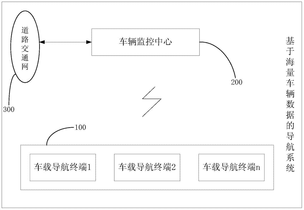
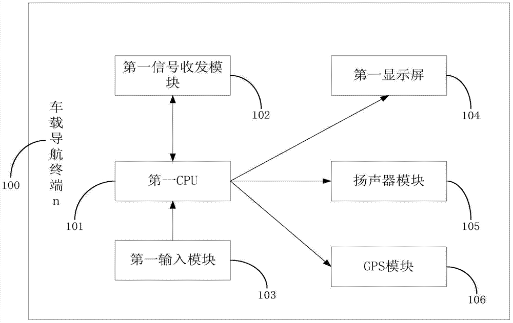
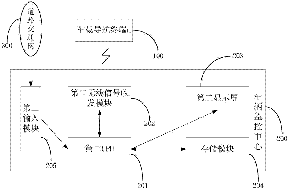
[0053] In order to solve the problem that the vehicle-mounted navigator existing in the prior art can only simply calculate the shortest navigation route between the navigation starting point and the navigation end point, and cannot recognize and avoid congested road sections or road traffic accidents on the shortest navigation route, causing driving The defect that the actual time consumption of personnel on the shortest driving route provided by the car navigator cannot be guaranteed, the innovation of the present invention is: 1) connecting the vehicle monitoring center 200 to the road traffic network 300; 2) the vehicle monitoring center 200 receiving When inquiring information about the driving route of the vehicle navigation terminal 100, the optimal driving route calculation formula is used to calculate the driving route with the shortest accumulative time-consuming among all feasible navigation routes of the monitoring vehicle from the navigation starting point to the na...


PUM


Abstract

The invention discloses an intelligent navigation method and system based on mass vehicle data. The system comprises a plurality of vehicle-mounted navigation terminals (100), a road traffic network (300) and a vehicle monitoring center (200) which is connected with the road traffic network (300) and is in wireless communication with the plurality of vehicle-mounted navigation terminals (100) respectively, wherein each vehicle-mounted navigation terminal (100) sends a driving path query request containing vehicle location and navigation destination to the vehicle monitoring center (200) when receiving a navigation instruction input from outside, and the vehicle monitoring center (200) is used for calculating one driving path through an optimal driving path computation formula according to the monitored basic road traffic condition of a region in which a monitored vehicle is located and real-time traffic broadcast messages from the road traffic network (300), and the driving path, as an optimal driving path, is sent to the vehicle-mounted navigation terminal (100) requiring navigation service from the vehicle monitoring center (200).

Description

technical field [0001] The invention relates to the technical field of vehicle navigation, and more specifically, relates to an intelligent navigation method and a navigation system based on massive vehicle data. Background technique [0002] The intelligence level of the existing car navigator is not high, and it is impossible to provide intelligent navigation services for drivers in combination with real-time road traffic conditions. The car navigator can only calculate a shortest driving route for the driver according to the starting point and end point of the navigation input by the driver on the navigation interface, and provide navigation services for the user according to the shortest driving route, so as to shorten the time consumed by the user on the road. time. The shortcoming of existing vehicle-mounted navigator is: when vehicle-mounted navigator provides the local section of the shortest driving path for the driver and congested situation occurs because of the ...

Claims


Application Information

Patent Timeline
Patent Type & Authority Applications(China)
IPC IPC(8): G01C21/28G01C21/34
CPCG01C21/3492G08G1/096811
Inventor 丁伟楚甲良杨电文
Owner SHENZHEN SEG SCI NAVIGATIONS CO LTD
Why Eureka
Try Eureka