Cell switching method and device
A cell handover and target cell technology, applied in the field of communications, can solve problems such as poor user experience and impact
- Summary
- Abstract
- Description
- Claims
- Application Information
AI Technical Summary
Problems solved by technology
Method used
Image
Examples
Embodiment 1
[0206] Such as Figure 7 As shown, it is a schematic flowchart of a cell handover method in a specific application scenario proposed by an embodiment of the present invention, which specifically includes the following steps:
[0207] in, Figure 7 Most of the steps in the Figure 4 Same, only different local steps are explained here:
[0208]A new process—a pre-synchronization process—is inserted between steps S703 and S704:
[0209] Step a. After determining that the candidate target access point is a satellite, the source eNB notifies the UE to perform pre-synchronization in the designated cell; the pre-synchronization message at least includes: identification information of the candidate target cell, such as a physical cell ID (Physical Cell Identify, PCI) and frequency points and other information.
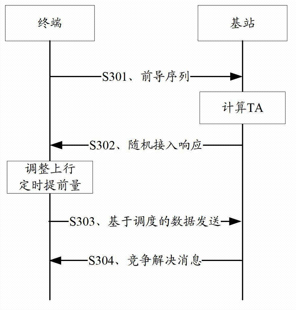
[0210] In step b, the UE obtains its timing advance in the candidate target cell through a random access procedure (that is, establishes uplink synchronization).
[0211]...
Embodiment 2
[0223] Embodiment 2 is similar to Embodiment 1, the difference is that Figure 7 Step b of the pre-synchronization process: the satellite terminal calculates the timing advance required to establish uplink synchronization with the satellite based on the Global Navigation Satellite System (GNSS). There are two specific methods:
[0224] method 1:
[0225] 1) The target satellite periodically broadcasts its own current position information, such as the three-dimensional coordinates, polar coordinates or longitude, latitude and altitude of the satellite's current position. A possible location broadcast information design scheme is as follows:
[0226] Satellite height: 100-40000Km. It can be encoded as 16-bit information in units of Km.
[0227] Satellite longitude and latitude: 0.01 degrees can be used as the basic unit, and the longitude and latitude are encoded as 16-bit information respectively.
[0228] 2) The UE obtains the position information of the target satellite b...
PUM
 Abstract
Description
Claims
Application Information
 - R&D
- Intellectual Property
- Life Sciences
- Materials
- Tech Scout
- Unparalleled Data Quality
- Higher Quality Content
- 60% Fewer Hallucinations
Browse by: Latest US Patents, China's latest patents, Technical Efficacy Thesaurus, Application Domain, Technology Topic, Popular Technical Reports.
© 2025 PatSnap. All rights reserved.Legal|Privacy policy|Modern Slavery Act Transparency Statement|Sitemap|About US| Contact US: help@patsnap.com


