

Remote sensing satellite data processing method and system
A remote sensing satellite and data processing technology, which is applied in the field of remote sensing satellite data management, can solve the problems of high requirements, single retrieval method, useless remote sensing satellite image data, etc., and achieve the effect of improving accuracy, increasing retrieval and management methods
- Summary
- Abstract
- Description
- Claims
- Application Information
AI Technical Summary
Problems solved by technology
Method used
Image

Examples
Embodiment Construction
[0027] In the following description, for purposes of explanation, numerous specific details are set forth in order to provide a thorough understanding of one or more embodiments. It may be evident, however, that these embodiments may be practiced without these specific details. In other instances, well-known structures and devices are shown in block diagram form in order to facilitate describing one or more embodiments.
[0028] Specific embodiments of the present invention will be described in detail below in conjunction with the accompanying drawings.
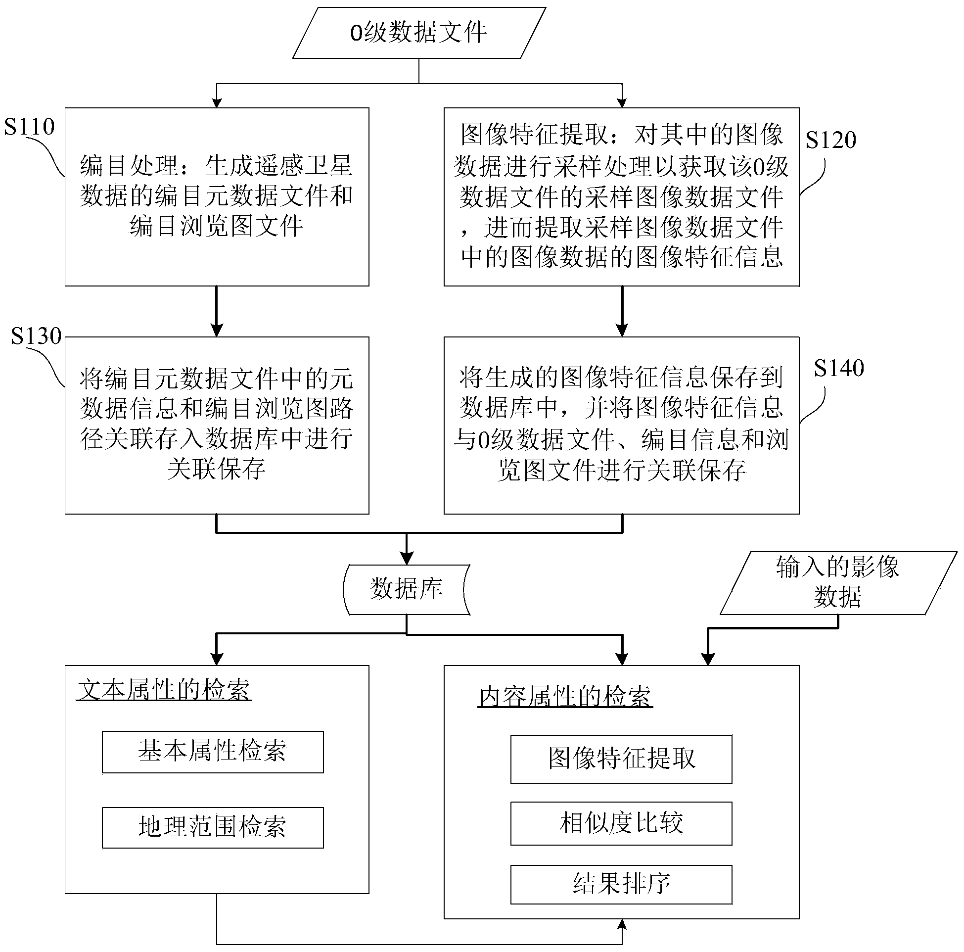
[0029] figure 1 A flow chart of a remote sensing satellite data processing method according to an embodiment of the present invention is shown.
[0030] The remote sensing satellite data processing method provided by the invention combines the text attribute and content attribute of the remote sensing satellite data, so as to break through the limitations of the simple text attribute-based remote sensing satellite data proc...
PUM
 Abstract
Description
Claims
Application Information