Airborne digital topographic data compression method for low altitude penetration
A technology of data compression and digital terrain, applied in image data processing, instruments, calculations, etc., can solve the problems of restricting the use of common data storage devices, and achieve the effect of reducing storage space
- Summary
- Abstract
- Description
- Claims
- Application Information
AI Technical Summary
Problems solved by technology
Method used
Image
Examples
Embodiment Construction
[0022] Describe the present invention below in conjunction with specific embodiment:
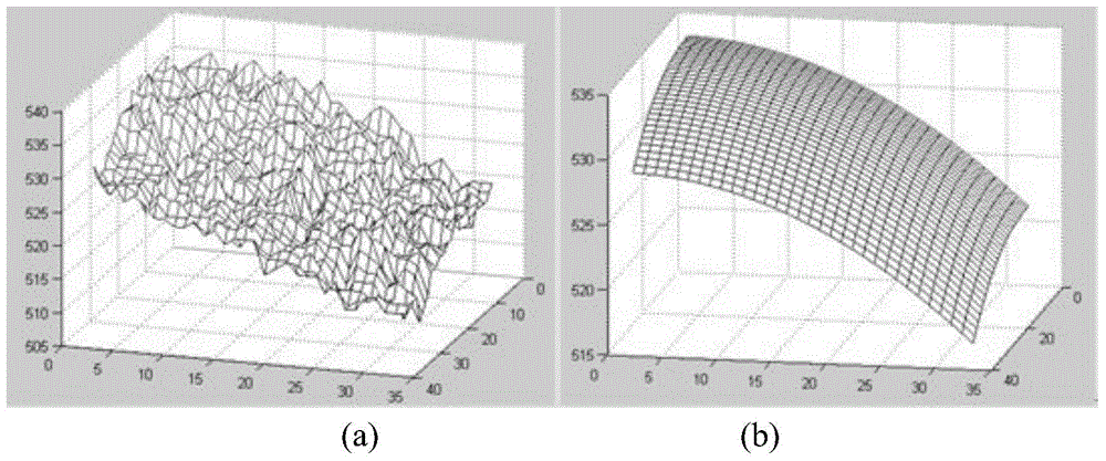
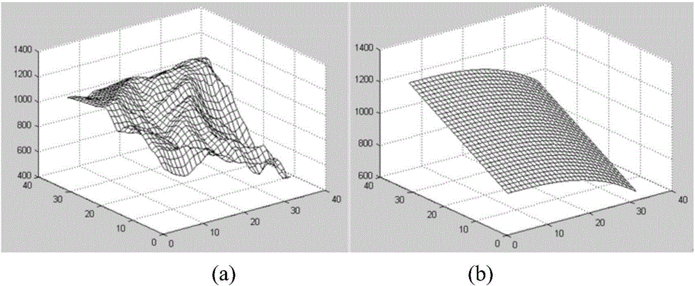
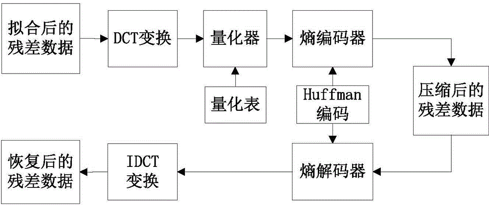
[0023] What this embodiment uses is the terrain elevation data composed of 32×32 points of flat and complex terrain intercepted from the SRTM3 file at 108 degrees east longitude and 34 degrees north latitude. The 32×32 elevation data points are used. JPEG lossy compression can be used to obtain better compression effect. The number of selected elevation data points is a multiple of 8×8 point blocks; on the other hand, the use of 32x32 elevation data points can meet the verification requirements of this algorithm, and can also be used according to actual needs. Other 8×8 multiples of elevation data blocks.
[0024] First, the Levenberg-Marquardt method in the nonlinear least squares optimization method is adopted, the number of repetitions is 30, and the number of control iterations is 20. Perform surface fitting optimization calculation on terrain elevation data to obtain optimal parameters...
PUM
 Abstract
Description
Claims
Application Information
 - R&D
- Intellectual Property
- Life Sciences
- Materials
- Tech Scout
- Unparalleled Data Quality
- Higher Quality Content
- 60% Fewer Hallucinations
Browse by: Latest US Patents, China's latest patents, Technical Efficacy Thesaurus, Application Domain, Technology Topic, Popular Technical Reports.
© 2025 PatSnap. All rights reserved.Legal|Privacy policy|Modern Slavery Act Transparency Statement|Sitemap|About US| Contact US: help@patsnap.com


