Method for automatically drawing navigable area central line on inland river electronic chart

An electronic nautical chart and regional center technology, applied in the field of nautical mapping, can solve the problems of lack of generalizability and universal applicability, unstable route safety, and influence, and achieve the effect of expanding automation and intelligence

Active Publication Date: 2014-12-24
WUHAN ZHONGYUAN ELECTRONICS GRP
View PDF4 Cites 3 Cited by
  • Summary
  • Abstract
  • Description
  • Claims
  • Application Information

AI Technical Summary

Problems solved by technology

[0011] The disadvantage of prior art 1 is that the safety of the centerline route of the navigable area completely depends on the driver's accumulated knowledge of the waters in the long-term practice, and it does not have generalizability and universal applicability. The rough estimation of the route to the center line has a large estimation error, which is not the optimal route
[0012] The second shortcoming of the existing technology: Although the center line drawn by it utilizes some data obtained from scientific surveying and mapping and relatively actual water depth information, it generally requires careful, serious, and concentrated identification of water level information, resulting in a large workload and misdrawing Sometimes it is necessary to draw repeatedly, which makes the drawing efficiency very low. Therefore, the safety of the route is affected by large unstable factors, and there is also a large error in the estimation of the center line, which is not the optimal route.

Method used


Image

  • Method for automatically drawing navigable area central line on inland river electronic chart
  • Method for automatically drawing navigable area central line on inland river electronic chart
  • Method for automatically drawing navigable area central line on inland river electronic chart

Examples


Embodiment Construction

[0050] The present invention will be further described below in conjunction with accompanying drawing.

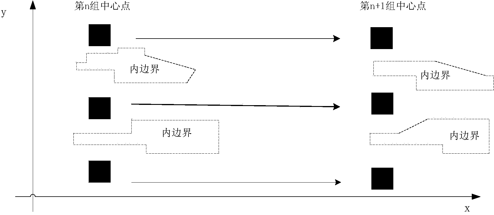
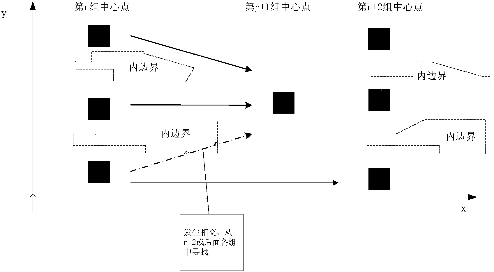
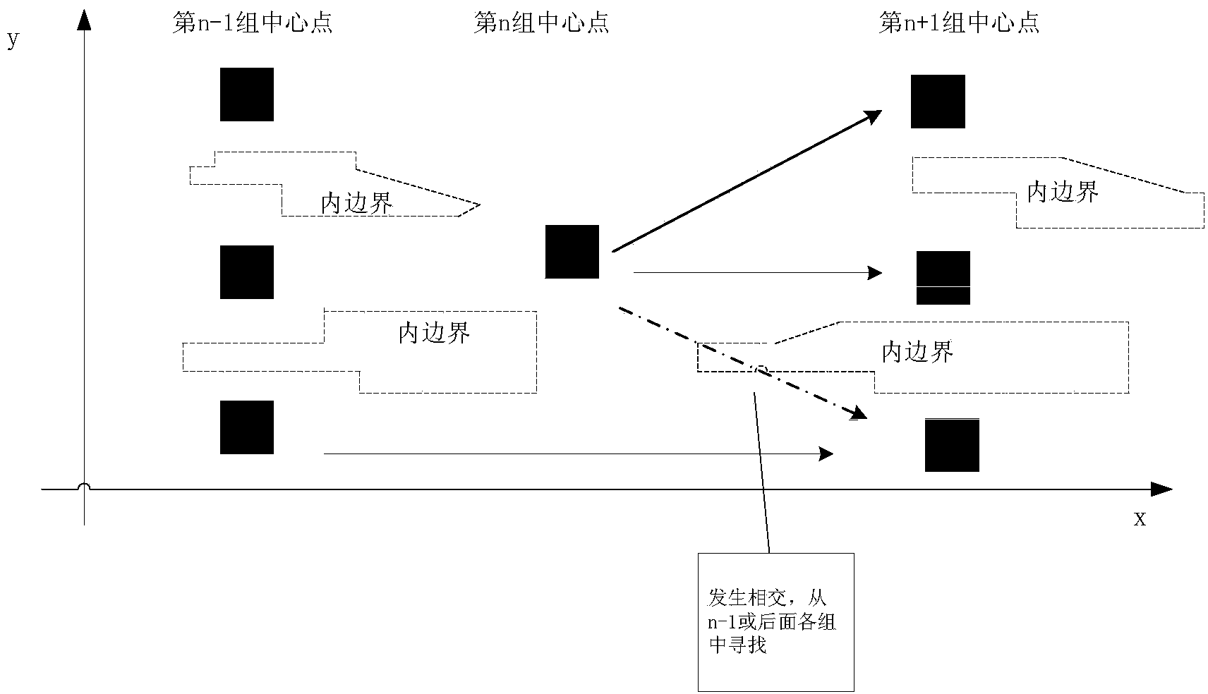
[0051] The method of automatically drawing the centerline of the inland navigable area actually includes two major processes: one is to use the sounding points on the electronic chart to form the navigable water surface according to the draft of the ship. The second is to use the navigable water depth surface obtained in the first process, and obtain the center line of the navigable water depth surface with the help of the skeleton line of the trunk line of the inland river.

[0052] Formation method of navigable water depth surface

[0053] Modern electronic charts generally contain a group of sounding points representing water level information. The distribution of sounding points is as follows: at intervals along the trend of the inland river (not a fixed value, but the average difference is not large), there will be a row of discrete plane geometric points (abbreviated...


PUM


Abstract

The invention discloses a method for automatically drawing a navigable area central line on an inland river electronic chart. The method comprises the following steps: partitioning a high-water-level point set and a low-water-level point set; acquiring an outer boundary according to high-water-level points; acquiring an inner boundary according to low-water-level points; partitioning each line segment of a channel skeleton line of a Yangtze River main line into a plurality of small segments to obtain normal lines of connecting points for each segment; evaluating intersection points between each normal line and the inner and outer boundaries of a navigable area, and dividing every two intersection points into one group; evaluating the central point of each group of intersection points of each normal line respectively; connecting the central point obtained on each normal line to obtain the navigable area central line. By adopting the method, the navigable area central line can be drawn automatically as a navigation route for a ship to sail, and safe sailing of the ship can be ensured more scientifically, more effectively and more economically.

Description

technical field [0001] The invention relates to the field of navigation drawing, in particular to a method for automatically drawing the center line of a navigable area on an inland river electronic chart, which is suitable for realizing the navigable center line on an inland river electronic chart with massive water depth point data and obtainable skeleton line data of an inland river trunk line. Drawing of the centerline of the navigation area. Background technique [0002] Electronic chart is a modern navigation technology. Generally, all kinds of digital charts and their application systems are collectively referred to as electronic charts. It is another great technological revolution in ship navigation after radar. Its development history has roughly gone through three stages: [0003] 1. The equivalent of paper charts. From the late 1970s to 1984, in order to reduce the size and labor intensity of chart operations, people simply digitized paper charts and stored them...

Claims


Application Information

Patent Timeline
Patent Type & Authority Applications(China)
IPC IPC(8): G06F17/50
Inventor 张东华任学锋李宁代志强吴勇
Owner WUHAN ZHONGYUAN ELECTRONICS GRP
Why Eureka
Try Eureka