High-resolution remote sensing image segmentation method based on inter-scale mapping

A high-resolution, remote-sensing image technology, applied in the field of high-resolution remote-sensing image segmentation, can solve the problems of difficult image segmentation, JSEG algorithm is difficult to achieve satisfactory results, etc.

Inactive Publication Date: 2015-02-18
HOHAI UNIV
View PDF3 Cites 27 Cited by
  • Summary
  • Abstract
  • Description
  • Claims
  • Application Information

AI Technical Summary

Problems solved by technology

[0006] In view of the inherent limitations of the JSEG algorithm and the difficulties caused by high-resolution remote sensing images, especially in urban scenes

Method used


Image

  • High-resolution remote sensing image segmentation method based on inter-scale mapping
  • High-resolution remote sensing image segmentation method based on inter-scale mapping
  • High-resolution remote sensing image segmentation method based on inter-scale mapping

Examples


Embodiment Construction

[0065] Below in conjunction with specific embodiment, further illustrate the present invention, should be understood that these embodiments are only used to illustrate the present invention and are not intended to limit the scope of the present invention, after having read the present invention, those skilled in the art will understand various equivalent forms of the present invention All modifications fall within the scope defined by the appended claims of the present application.

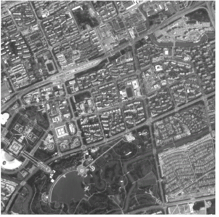
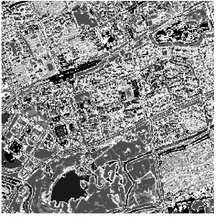
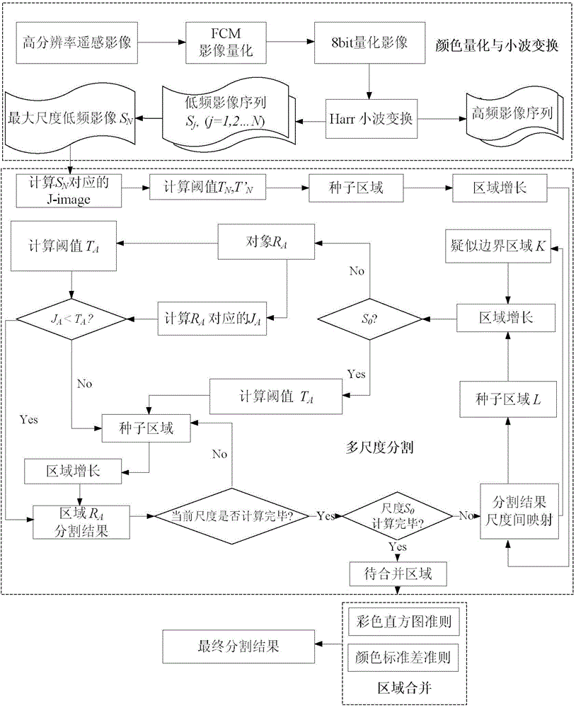
[0066] This embodiment first introduces the basic flow of the JSEG algorithm segmentation, and then analyzes in detail the key issues affecting the segmentation accuracy of the JSEG algorithm in the high-resolution remote sensing image segmentation, and expounds the improvement strategy and specific implementation of the method of the present invention for these issues. The experiment uses high-resolution IKONOS panchromatic images and SPOT 5 multispectral images, and compares and analyzes the segm...


PUM


Abstract

The invention discloses a high-resolution remote sensing image segmentation method based on inter-scale mapping. The high-resolution remote sensing image segmentation method has the advantages that aiming at geographical object extraction involved in objet-level change detection, the high-resolution remote sensing image multi-scale segmentation method based on wavelet transform and an improved JSEG (joint systems engineering group) algorithm is provided; aiming at a key problem that a conventional JSEG algorithm affects segmentation accuracy in high-resolution remote sensing image segmentation, a corresponding improvement strategy is adopted to achieve a good effect; wavelet transform is introduced to serve as a multi-scale analysis tool, excessive rough color quantization of the conventional JSEG algorithm is abandoned, and thus, detail information in original images is kept to the utmost; a novel inter-scale segmentation result mapping mechanism is set up, image segmentation of a current scale is realized on the basis of a segmentation result of a previous scale, and correction of the segmentation result of the previous scale is also realized, and thus, accumulation of inter-scale segmentation errors is decreased effectively; finally, an improved multi-scale segmentation strategy and an improved region merging strategy are provided, and over-segmentation and mistaken merging are effectively reduced.

Description

technical field [0001] The invention relates to a high-resolution remote sensing image segmentation method based on inter-scale mapping, and belongs to the technical field of remote sensing image segmentation. Background technique [0002] Compared with ordinary images, remote sensing images have the characteristics of multi-band, numerous types of ground objects, rich texture features, multi-scale, and wide coverage. First of all, remote sensing images usually contain data of multiple bands, which makes it difficult for traditional single-band image segmentation methods to be directly applied to multispectral or hyperspectral remote sensing image segmentation; in addition, remote sensing images usually contain rich texture information, which can be integrated Reflecting the complex spatial structure characteristics of various ground objects makes it more difficult to effectively extract and express the texture features of objects; moreover, remote sensing images usually cov...

Claims


Application Information

Patent Timeline
IPC IPC(8): G06T7/00G06K9/62
CPCG06T2207/10032G06T2207/20016G06T2207/20156G06T2207/30181
Inventor 王超石爱业王鑫吴方明黄凤辰徐立中
Owner HOHAI UNIV
Why Eureka
Try Eureka