Map covering region rendering method and related equipment
An overlay and map technology, applied in the field of map overlay area rendering methods and objects in the system, can solve the problems of increased memory space and CPU resource occupation, large map load, high memory and CPU resource occupation, and achieve distribution and utilization. , the effect of reducing resource occupation and reducing consumption
- Summary
- Abstract
- Description
- Claims
- Application Information
AI Technical Summary
Problems solved by technology
Method used
Image

Examples
Embodiment 1
[0080] Embodiment 1: When layer information changes caused by timing location information push.
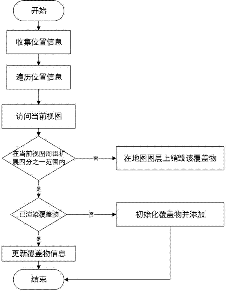
[0081] figure 1 It is a flowchart of a preferred embodiment of a map overlay area rendering method, such as figure 1 As shown, the method of this embodiment may include:
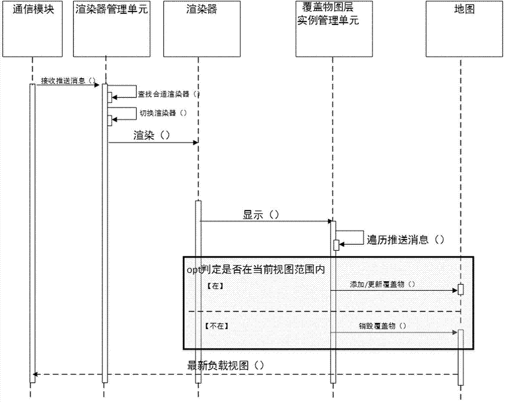
[0082] figure 2 It is a sequence diagram of a preferred embodiment of a map overlay area rendering method;
[0083] Figure 4 It is a schematic diagram of the current view of Embodiment 1 of the map overlay area rendering method of the present invention;
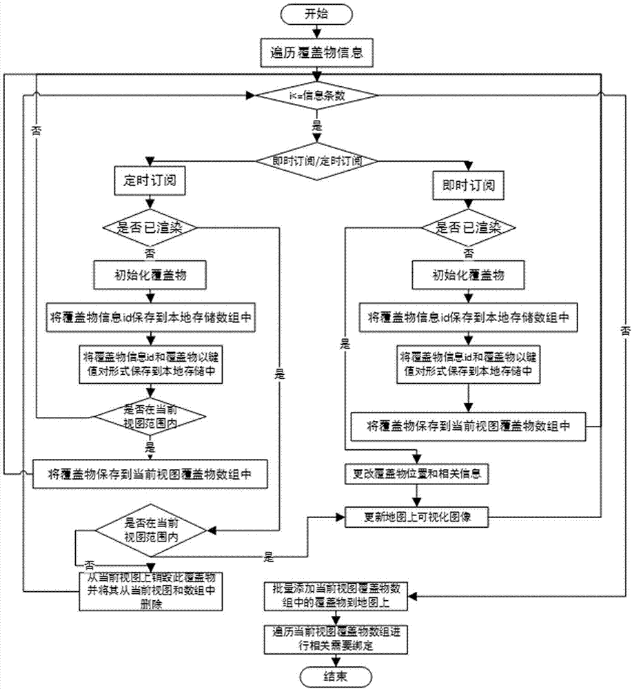
[0084] Timing location information push is a response triggered by the client regularly sending location requests. This situation is related to the user subscription operation, and the returned data corresponds to the user subscription information (excluding unknown information, if it is unknown information, return an empty array), It has nothing to do with the user's operation on the map. When new regular subscription information comes, the layer will ...
Embodiment 2
[0109] Example 2: When a map event is triggered, the boundary of the view layer is changed
[0110] Figure 5 It is a flow chart of Embodiment 2 of the map overlay area rendering method of the present invention;
[0111] Image 6 It is a sequence diagram of Embodiment 2 of the map overlay area rendering method of the present invention;
[0112] Figure 7 It is a schematic diagram of the current view of Embodiment 2 of the map overlay area rendering method of the present invention;
PUM
 Abstract
Description
Claims
Application Information
 - Generate Ideas
- Intellectual Property
- Life Sciences
- Materials
- Tech Scout
- Unparalleled Data Quality
- Higher Quality Content
- 60% Fewer Hallucinations
Browse by: Latest US Patents, China's latest patents, Technical Efficacy Thesaurus, Application Domain, Technology Topic, Popular Technical Reports.
© 2025 PatSnap. All rights reserved.Legal|Privacy policy|Modern Slavery Act Transparency Statement|Sitemap|About US| Contact US: help@patsnap.com