Processing method and device for remote sensing image data

An image data and satellite remote sensing technology, which is applied in the field of satellite remote sensing image data processing, can solve the problems of poor timeliness of the satellite remote sensing image preprocessing system, achieve the effect of solving poor timeliness and improving processing efficiency

Active Publication Date: 2015-04-29
ZHONGKE JIUDU BEIJING SPATIAL INFORMATION TECH
View PDF7 Cites 14 Cited by
  • Summary
  • Abstract
  • Description
  • Claims
  • Application Information

AI Technical Summary

Problems solved by technology

[0008] The main purpose of the present invention is to provide a method and device for processing satellite remote sensing image data, at least solving the problem of poor timeliness of the satellite remote sensing image preprocessing system in the related art

Method used


Image

  • Processing method and device for remote sensing image data
  • Processing method and device for remote sensing image data
  • Processing method and device for remote sensing image data

Examples


Embodiment Construction

[0030] It should be noted that, in the case of no conflict, the embodiments in the present application and the features in the embodiments can be combined with each other. The present invention will be described in detail below with reference to the accompanying drawings and examples.

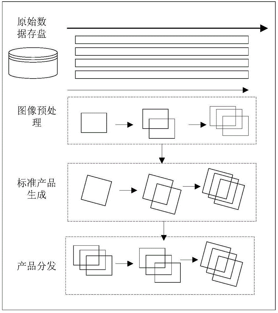
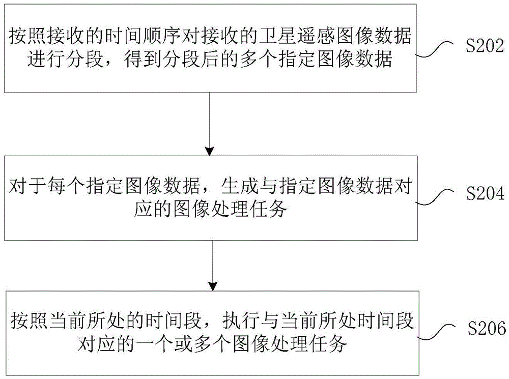
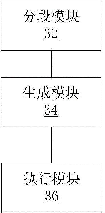
[0031] This embodiment provides a method for processing satellite remote sensing image data, figure 2 It is a flowchart of a method for processing satellite remote sensing image data according to an embodiment of the present invention, such as figure 2 As shown, the steps of the method include:

[0032] Step S202: Segment the received satellite remote sensing image data according to the received time sequence to obtain a plurality of segmented specified image data;

[0033]Wherein, a plurality of designated image data constitute satellite remote sensing image data;

[0034] Step S204: For each specified image data, generate an image processing task corresponding to the specified image data...


PUM


Abstract

The invention provides a processing method and a device for remote sensing image data. The processing method comprises: the subsection is carried out on received remote sensing image data in a receiving time sequence, and obtaining multiple assigned image data after the subsection; as for each assigned image data, an image processing task corresponding to the assigned image data is generated; according to a current time slot, one or more image processing tasks corresponding to the current time slot are conducted, that is to say, based on the timing sequence corresponding to remote sensing data which is based on a time decoding, the processing task is generated by the remote sensing data corresponding to each time slot, and therefore the multichannel parallel can be achieved, in another word, aims of processing different tasks in different time slots can be achieved. According to the processing method and the device for the remote sensing image data, the poor timeliness problem of remote sensing image preprocessing system in the relevant technology is solved, and the efficiency for processing a remote sensing image is improved.

Description

technical field [0001] The present invention relates to the communication field, in particular to a method and device for processing satellite remote sensing image data. Background technique [0002] With the rapid development of aerospace remote sensing technology, the demand for remote sensing image products in the process of national economic production is also increasing; especially in military application fields such as homeland defense and regional reconnaissance, disaster monitoring, emergency relief, disaster prevention and early warning, etc. Civilian fields all play an extremely important role. With the rapid development of various modern communication methods and information sharing methods, while people are applying remote sensing image products, they also have higher and higher requirements for the effectiveness of the products; especially in emergencies and emergencies, whether hot spots can be obtained in time The monitoring information in the region is of gr...

Claims


Application Information

Patent Timeline
Patent Type & Authority Applications(China)
IPC IPC(8): G06T1/60G06T3/00
Inventor 刘玲玲孟云鹏刘秀朋曲木威振王海蛟徐成华
Owner ZHONGKE JIUDU BEIJING SPATIAL INFORMATION TECH
Why Eureka
Try Eureka