

Method and system for quickly setting up map to assist indoor positioning under emergency rescue scene
A technology of emergency rescue and positioning method, which is applied in the directions of measuring devices, instruments, surveying and mapping, and navigation, etc. It can solve the problems of inability to command and dispatch emergency rescue, provide assistance for the life support of rescuers, and fail to meet the needs of emergency rescue.
- Summary
- Abstract
- Description
- Claims
- Application Information
AI Technical Summary
Problems solved by technology
Method used
Image

Examples
Embodiment 1
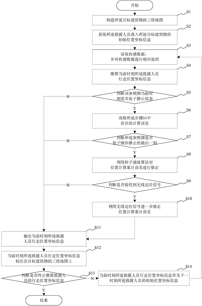
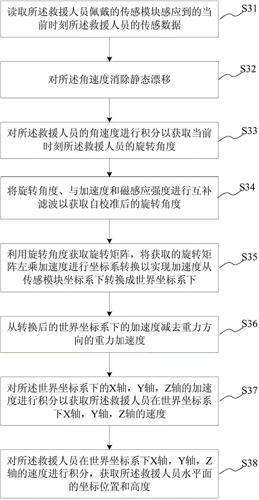
[0048] This embodiment provides a method for quickly constructing a map to assist indoor positioning in an emergency rescue scene. The emergency rescue scene occurs in a target building, and the method for quickly constructing a map to assist indoor positioning in the emergency rescue scene is performed by rescuers. Rescuers wear sensing modules. see figure 1 , which is shown as a schematic flow diagram of the rapid construction of map-assisted indoor positioning method in the emergency rescue scene, as shown in figure 1 As shown, the rapid construction map-assisted indoor positioning method in the emergency rescue scene includes:
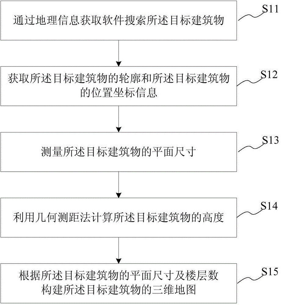
[0049] S1. Construct a three-dimensional map of the target building. In this embodiment, the target building is searched through Google Maps, and the outline of the target building is obtained. Measure the length of each side of the target building through the distance measurement function of Google Maps. Draw a plan map of the target building ...
Embodiment 2
[0093] This embodiment provides an indoor positioning system for quickly building a map in an emergency rescue scene. The emergency rescue scene occurs in a target building. The positioning system is implemented by a rescuer who wears a sensor module. In the emergency rescue scene, a map-assisted indoor positioning system is quickly built, and the handheld terminal and the remote control center cooperate to complete the emergency rescue. see Figure 5 , which is a schematic diagram of the principle structure of the rapid construction of map-assisted indoor positioning system in the emergency rescue scene. Such as Figure 4 As shown, the rapid construction map-assisted indoor positioning system 1 in the emergency rescue scene includes: a three-dimensional map construction module 11, an instruction output module 12, an initial position acquisition module 13, a data reading module 14, a data processing module 15, and a calculation module 16 , a first judgment module 17 , a firs...
PUM
 Abstract
Description
Claims
Application Information