

Road condition detection system based on vehicle GPS data
A GPS data, road condition detection technology, applied in the direction of road vehicle traffic control system, traffic flow detection, traffic control system, etc., can solve the problems of high installation cost, many coverage blind spots, and many faults of the detector, and achieve reliable and stable data. Transmission, efficient and stable algorithm, high calculation accuracy
- Summary
- Abstract
- Description
- Claims
- Application Information
AI Technical Summary
Problems solved by technology
Method used
Image

Examples
Embodiment Construction
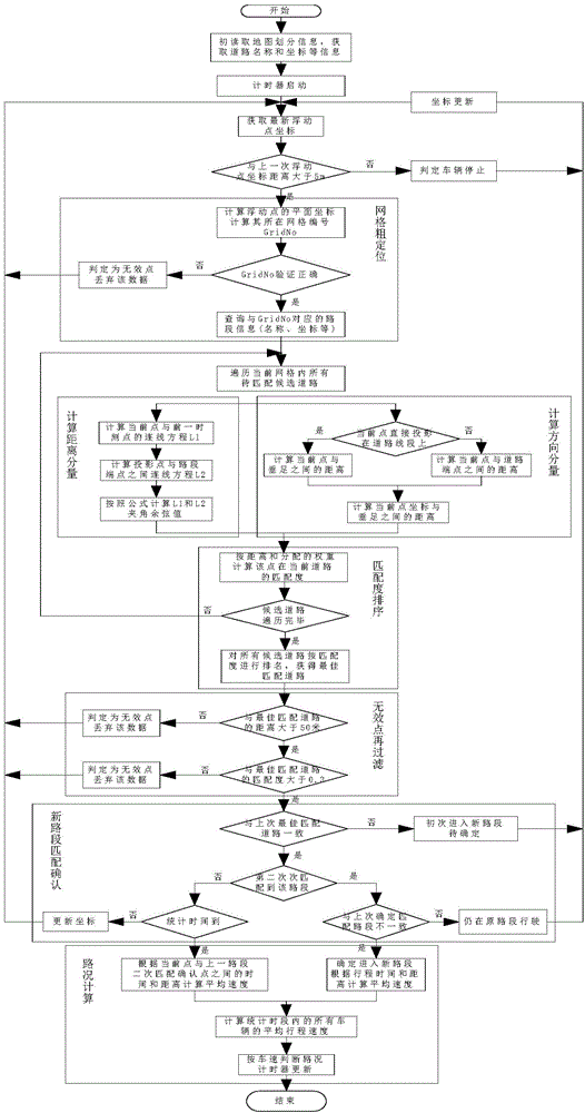
[0058] The vehicle GPS data-based road condition detection method of the present invention makes full use of big data thinking, utilizes the GPS data of floating vehicles driving in the urban road network, and utilizes an efficient map matching algorithm to match the vehicle to the road it is driving in real time.
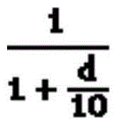
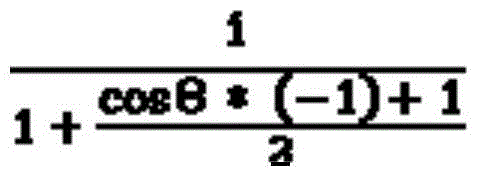
[0059] The map matching algorithm mainly uses the GPS coordinates of the vehicle and the coordinates of the road section to match, and calculates the matching degree of the two with the weight of distance and direction. When the vehicle leaves a road section, the time stamp of the floating car data mark can be used to calculate the driving distance and travel time of the vehicle on the previous road section, and further calculate the average travel speed of the vehicle on this road section.
[0060] The timer counts all floating vehicles driving in the road network at intervals of 5 minutes, calculates the average speed of all vehicles passing the road section withi...
PUM
 Abstract
Description
Claims
Application Information