Polarization aided navigation method based on solar vectors

A sun vector and auxiliary navigation technology, applied in the field of integrated navigation, can solve problems such as online calculation difficulties, large influence, and large amount of matching data

Active Publication Date: 2015-09-02
青岛智融领航科技有限公司
View PDF6 Cites 29 Cited by
  • Summary
  • Abstract
  • Description
  • Claims
  • Application Information

AI Technical Summary

Problems solved by technology

A navigation and positioning method based on sky polarization distribution pattern, patent number: 201410012966.7, proposes a navigation and positioning method based on polarization distribution pattern, uses the tested all-sky distribution pattern and the established model for data matching, but establishes sky polarization The distribution mode is greatly affected by the external environment, and the databases in different regions are incomplete, the amount of matching data is large, and online calculations are difficult

Method used


Image

  • Polarization aided navigation method based on solar vectors
  • Polarization aided navigation method based on solar vectors
  • Polarization aided navigation method based on solar vectors

Examples


Embodiment Construction

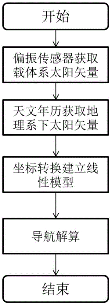
[0043] Such as figure 1 Shown, the concrete realization steps of the present invention are as follows:

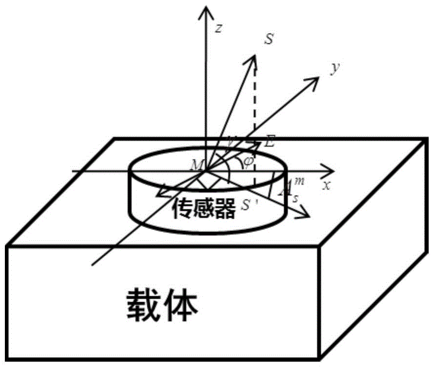
[0044] (1) Using the main polarization sensor to obtain the polarization azimuth angle, the azimuth angle under the sensor module can be obtained Then use three sensors to measure three observation points in the sky, and use the polarization information of the three observation points to obtain the sun altitude angle Then get the unit sun vector S in the module coordinate system m ;

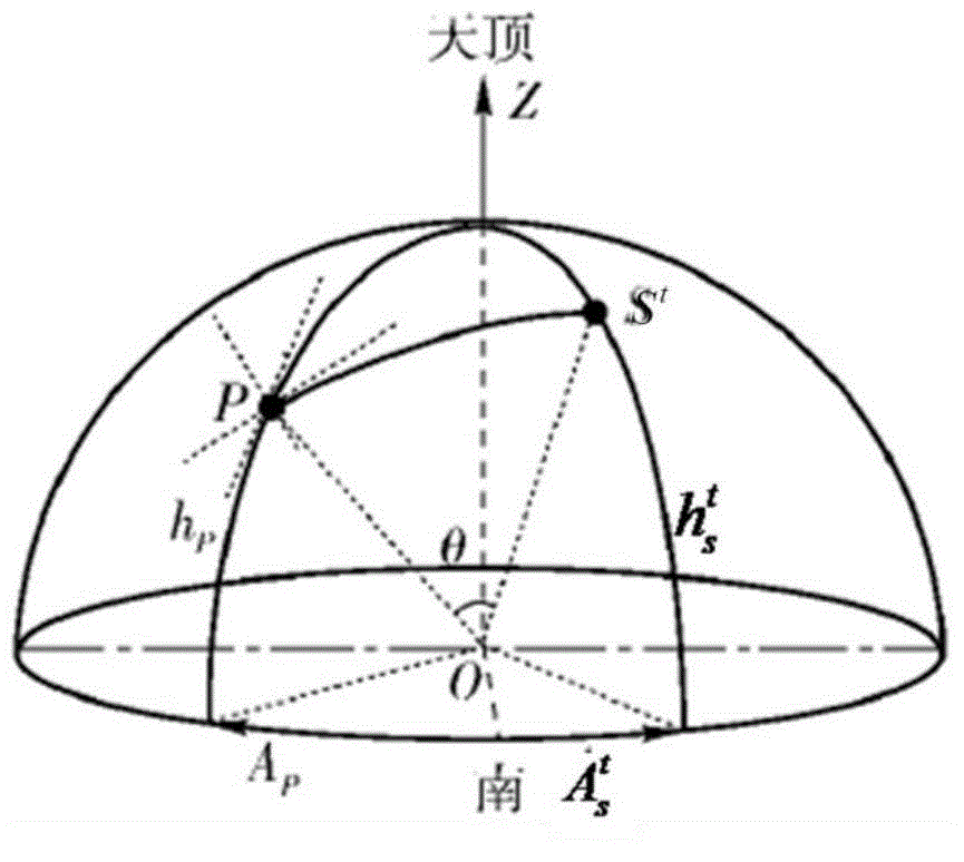
[0045] (2) Use the astronomical almanac to determine the azimuth of the sun vector direction in the geographic system according to the geographic location information and time information of the carrier and elevation angle Then get the unit sun vector S in the geographic system t ;

[0046] (3) Use polarized light to observe the attitude error, and calculate the projection of the sun vector in the geographic coordinate system The state equation of the carrier is obtained through th...


PUM


Abstract

The invention relates to a polarization aided navigation method based on solar vectors. The polarization aided navigation method based on the solar vectors comprises the following steps of firstly, obtaining a unit solar vector Sm under a module coordinate system by using a polarization sensor array carried by a carrier; secondly, calculating a unit solar vector St under a geographic coordinate system on the basis of the geographic position and the time information of the carrier according to an astronomical almanac value; and finally, establishing a polarization navigation linear model by using the unit solar vectors under the different coordinate systems and estimating navigation parameters by using a Kalman filter. By the method, the solar vectors are obtained by an atmosphere polarization mode to perform aided navigation, the precision is high, the polarization aided navigation method is not disturbed by other factors of the outside, and passive, non-radiative and full-autonomous navigation can be implemented.

Description

technical field [0001] The invention relates to a polarization-assisted navigation method based on a sun vector, belonging to the field of integrated navigation. Background technique [0002] After sunlight enters the atmosphere, it is scattered by atmospheric molecules to produce different polarization states. In 1871, the famous British physicist Rayleigh proposed the Rayleigh scattering law, which revealed the light scattering characteristics, and then people obtained the full-space atmospheric polarization distribution model based on the Rayleigh scattering law. The atmospheric polarization distribution pattern is relatively stable, which contains rich navigation information. Many creatures in nature can use sky polarized light for navigation or auxiliary navigation. Polarization navigation mechanism is a very effective means of navigation. It has the characteristics of passive, no radiation, and good concealment. It can provide new solutions for navigation tasks in com...

Claims


Application Information

Patent Timeline
Patent Type & Authority Applications(China)
IPC IPC(8): G01C21/16
CPCG01C21/165
Inventor 郭雷李晨阳杨健杜涛齐孟超
Owner 青岛智融领航科技有限公司
Why Eureka
Try Eureka