
Binocular vision measuring method

A binocular visual measurement and binocular technology, which is applied in the directions of measuring devices, photogrammetry/video metrology, surveying and navigation, etc., can solve the problems of high cost, difficult operation and analysis, inconvenient use, etc., and achieve the goal of equipment Undemanding, speed-increased, image-matching simple effects

Inactive Publication Date: 2015-11-11
MINJIANG UNIV +1
View PDF3 Cites 34 Cited by
  • Summary
  • Abstract
  • Description
  • Claims
  • Application Information

AI Technical Summary

Problems solved by technology

[0004] However, most of these airborne devices are expensive, inconvenient to use, and difficult to perform real-time calculation processing and analysis.

Method used


Image

  • Binocular vision measuring method
  • Binocular vision measuring method
  • Binocular vision measuring method

Examples


Embodiment Construction

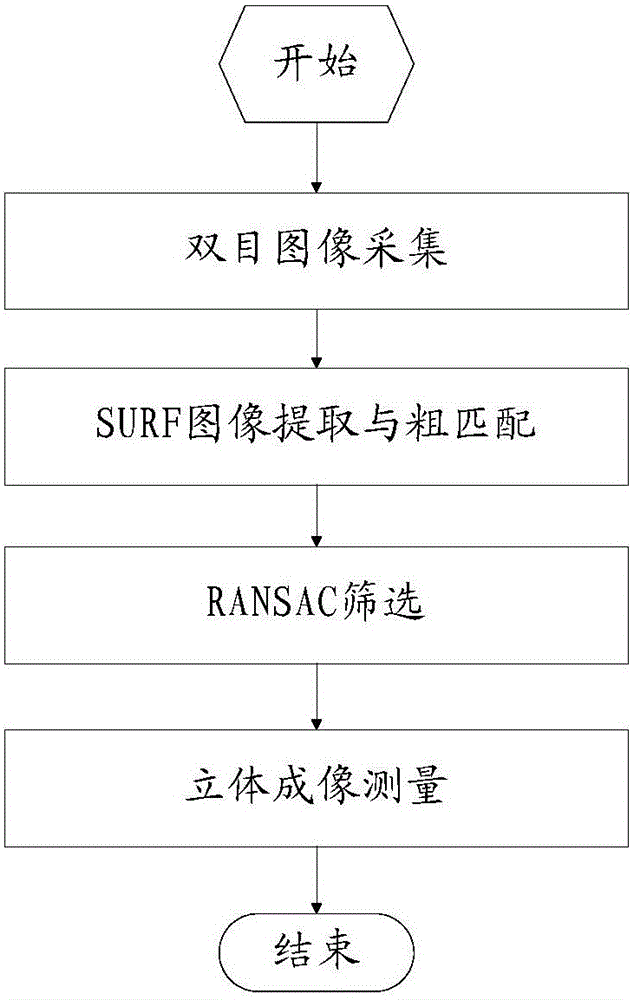
[0030] Such as figure 1 Shown, binocular vision measuring method of the present invention comprises:

[0031] Step 10, use the left and right cameras of the binocular camera to capture the same object at the same time for binocular image acquisition, and obtain two left and right images;

[0032] Step 20, using the SURF algorithm to extract feature points from the left and right images, and roughly matching feature point pairs;

[0033] Using the SURF algorithm to extract feature points from the left and right images is an existing technology. The SURF algorithm completes the matching of objects in the left and right images under moderate conditions and basically realizes real-time processing, which can achieve fast results. The above is based on the haar derivative of the integral image. In the present invention, the SURF algorithm uses the integral image to complete the convolution operation of the left and right images respectively, uses the Hessian matrix to detect the c...


PUM


Abstract

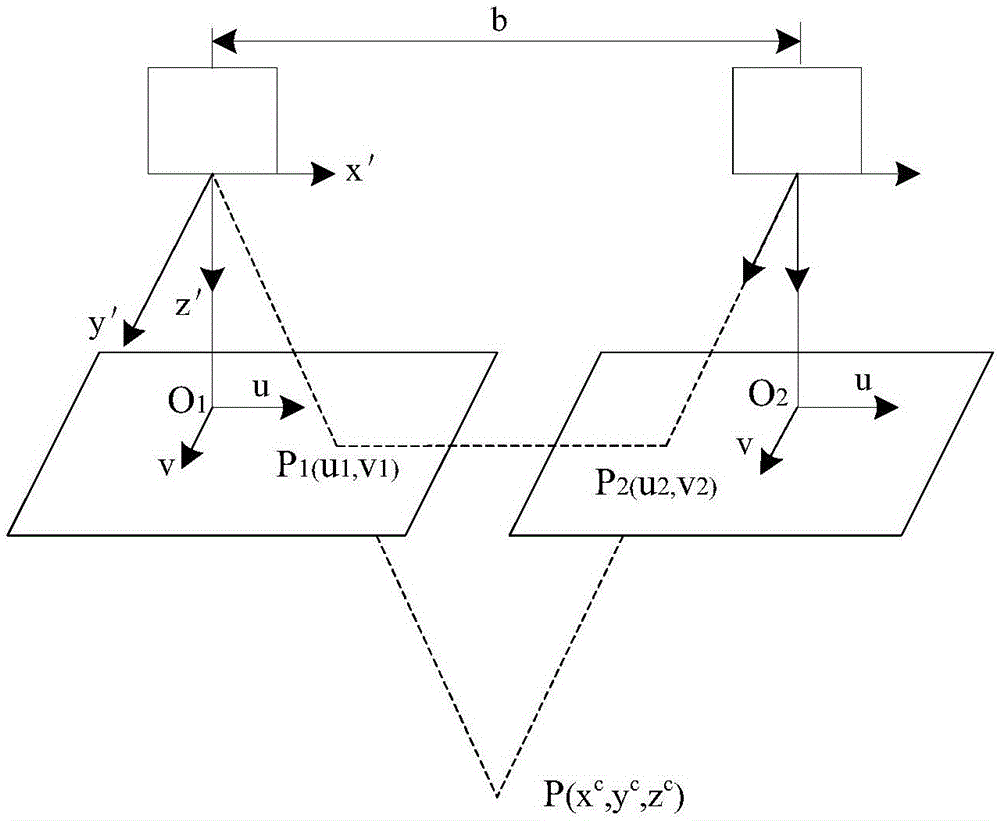
The invention provides a binocular vision measuring method which comprises the following steps: shooting the same object by a left camera and a right camera of a binocular camera synchronously for binocular image acquisition, so as to obtain a left image and a right image; performing feature point extraction on the left image and the right image by using an SURF algorithm, and roughly matching feature point pairs; screening the feature point pairs subjected to the rough matching by using an RANSAC algorithm according to the linear relationship of geometrical imaging, so as to obtain credible feature point pairs; measuring the object by using relevant formulas of binocular stereoscopic vision three-dimensional measurement according to location information of the credible feature point pairs in the left image and the right image. According to the invention, the binocular vision principle is utilized and the SURF algorithm and the RANSAC algorithm are combined to realize the real-time measurement on the distance between the object and the camera; when the method is used for unmanned planes, the distance measuring problem of the unmanned planes during the flight process can be solved, so that the method has practical significance.

Description

technical field [0001] The invention relates to a binocular vision measurement method. Background technique [0002] The large-scale application of UAV technology in the field of scientific research and production has promoted the rapid development of related fields. The demand for real-time shooting and measurement during UAV flight is increasingly apparent. Usually, drones can obtain information from airborne remote sensing equipment, such as high-resolution CCD digital cameras, light optical cameras, infrared scanners, laser scanners, magnetic detectors, etc. Ask to be made into an image. [0003] As disclosed on 2011.04.20, the Chinese invention with the publication number CN102023003A discloses a three-dimensional positioning and mapping method for unmanned helicopters based on laser detection and image recognition, including: a distance sensor based on laser detection and image recognition, a height sensor and The flight control computer, wherein the ranging sensor ...

Claims


Application Information

Patent Timeline
Patent Type & Authority Applications(China)
IPC IPC(8): G01C11/00G01C11/08
CPCG01C11/00G01C11/08
Inventor 樊春明余卫平林立然管庆林程千涛
Owner MINJIANG UNIV
Learn More