

Building indoor floor plan establishment method based on laser ranging sensor
A technology of laser distance measurement and establishment method, which is applied in the direction of measuring distance, instruments, measuring devices, etc., can solve the problem of lack of indoor maps, etc., and achieve the effect of track tracking
- Summary
- Abstract
- Description
- Claims
- Application Information
AI Technical Summary
Problems solved by technology
Method used
Image

Examples
specific Embodiment approach
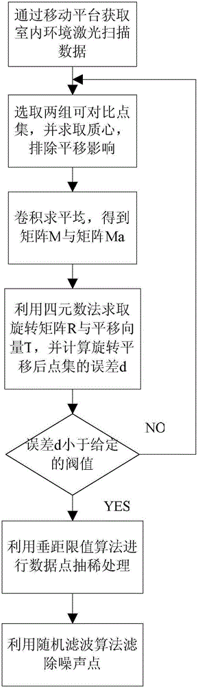
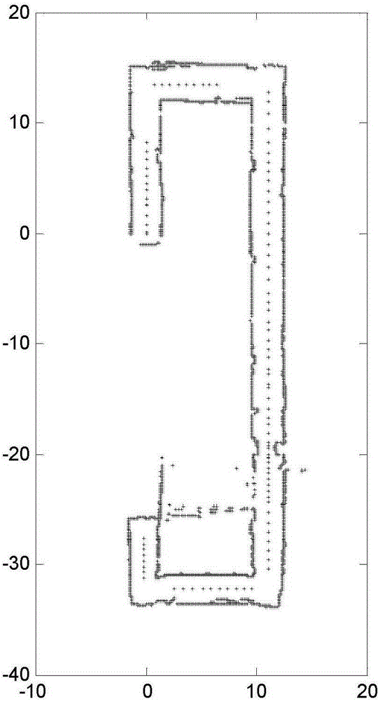
[0052] Specific implementation methods: such as Figure 1~2 As shown, the present embodiment will be described below in conjunction with the accompanying drawings. Based on laser measurement data registration (improved ICP algorithm) and correction optimization algorithm are realized through the following steps:
[0053] Step 1: Use the completed laser ranging sensor to move along the predetermined trajectory in the room where the floor plan is to be established, obtain multiple sets of laser measurement data, and transmit the obtained laser measurement data to the computer for subsequent data processing. Each group of laser measurement data is regarded as an independent point set under different coordinate systems, and the coordinate origin of each group of laser measurement data is a point on a predetermined trajectory;
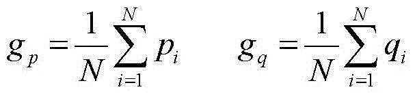
[0054] Step 2. Stitching the laser measurement data images generated by multiple sets of laser measurement data:
[0055] Since the coordinate origin of ...
PUM
 Abstract
Description
Claims
Application Information