Sun shadow global space-time positioning method based on space vector
A positioning method and space vector technology, applied in the direction of navigation calculation tools, etc., can solve the problems of large manpower and less research, and achieve the effect of saving costs
- Summary
- Abstract
- Description
- Claims
- Application Information
AI Technical Summary
Problems solved by technology
Method used
Image

Examples
specific Embodiment approach 1
[0034] Specific embodiment one: the sun shadow global space-time positioning method based on space vector comprises the following steps:
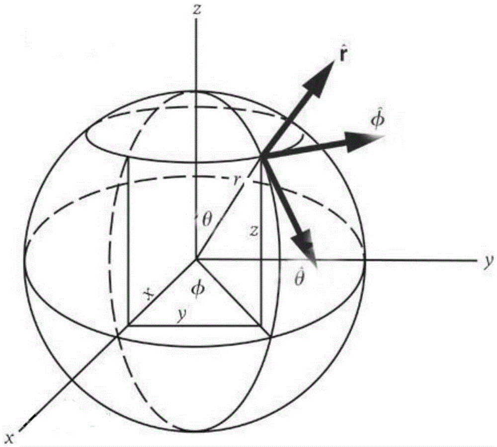
[0035] The location or date of shooting can be determined by the change of the sun shadow of the reference object in the photo or video. Since sunlight is parallel light, the direct sunlight can represent all parallel light. The reference object always rotates with the earth, so a unit vector is introduced to represent the direction of the sun's rays and the reference object pointing outward perpendicular to the earth's surface. Use the opposite direction vector of the sun's rays to calculate, and after obtaining the angle between the two, use trigonometric functions and the length of the reference object to obtain the length of the shadow. Based on the above method, the longitude and latitude of the reference object or the date of the shooting day can be obtained by knowing the changing length of the shadow.
[0036] Step 1: If figure ...
specific Embodiment approach 2
[0053]Specific embodiment two: the difference between this embodiment and specific embodiment one is: the specific steps of obtaining the Cartesian coordinate unit vector in the opposite direction of the direction of sunlight irradiation in the second step are as follows:
[0054] (1) Obtain the L length of the reference object and the change length L of the shadow through photos or videos s ;
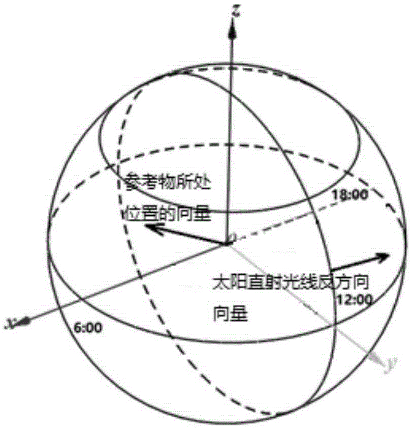
[0055] (2) The longitude and latitude (φ, β) of the point that is too direct can be obtained through the shooting date T, and the spherical coordinates are obtained according to the establishment rules of the spherical coordinate system and the motion rules of the earth The r is a radius, and the value is 1;
[0056] The earth is divided into four solar terms, vernal equinox, summer solstice, autumnal equinox and winter solstice. The sun is directly on the equator on March 21, the sun is directly on the Tropic of Cancer on June 22, the sun is directly on the equator on September 23, ...
specific Embodiment approach 3
[0058] Specific embodiment three: the difference between this embodiment and specific embodiment one or two is that: in the step three, the reference object is perpendicular to the earth's surface and the specific steps of obtaining the Cartesian coordinate unit vector are as follows:
[0059] Since the Earth rotates 360° in 24 hours, the Earth rotates 15° in 1 hour and rotates in 1 minute N i minute rotates N i It is the interval time between the i-th photo and the first photo. The value of i is 1, 2, 3.....n, and the time interval between every two adjacent photos is greater than or equal to 3 minutes and less than or equal to 30 minutes. Then N i The Earth's rotation in minutes is The coordinates are obtained based on the establishment of the coordinate system, and the coordinates are all in radians, the relationship is π 180 · N i 4 = ...
PUM
 Abstract
Description
Claims
Application Information
 - R&D Engineer
- R&D Manager
- IP Professional
- Industry Leading Data Capabilities
- Powerful AI technology
- Patent DNA Extraction
Browse by: Latest US Patents, China's latest patents, Technical Efficacy Thesaurus, Application Domain, Technology Topic.
© 2024 PatSnap. All rights reserved.Legal|Privacy policy|Modern Slavery Act Transparency Statement|Sitemap