Method for manufacturing building digital line map based on vehicle-mounted laser radar point cloud

A vehicle-mounted laser radar and digital line drawing technology, which is applied in the directions of electromagnetic wave re-radiation, radio wave measurement system, and utilization of re-radiation, can solve the problem of incomplete features and achieve the effect of improving accuracy and fitting accuracy

Inactive Publication Date: 2016-05-11
CHINESE ACAD OF SURVEYING & MAPPING
View PDF5 Cites 21 Cited by
  • Summary
  • Abstract
  • Description
  • Claims
  • Application Information

AI Technical Summary

Problems solved by technology

[0012] This type of method provides an effective point cloud processing method, that is, an object-oriented point cloud processing method, which can quickly extract and reconstruct building facades directly from the original scattered laser point cloud, making full use of the point cloud The geometric features of the data are rich, and the topological relationship between building facades can be extracted. However, the main defect of this method is that the features that can be extracted are not yet comprehensive.

Method used


Image

  • Method for manufacturing building digital line map based on vehicle-mounted laser radar point cloud
  • Method for manufacturing building digital line map based on vehicle-mounted laser radar point cloud
  • Method for manufacturing building digital line map based on vehicle-mounted laser radar point cloud

Examples


Embodiment Construction

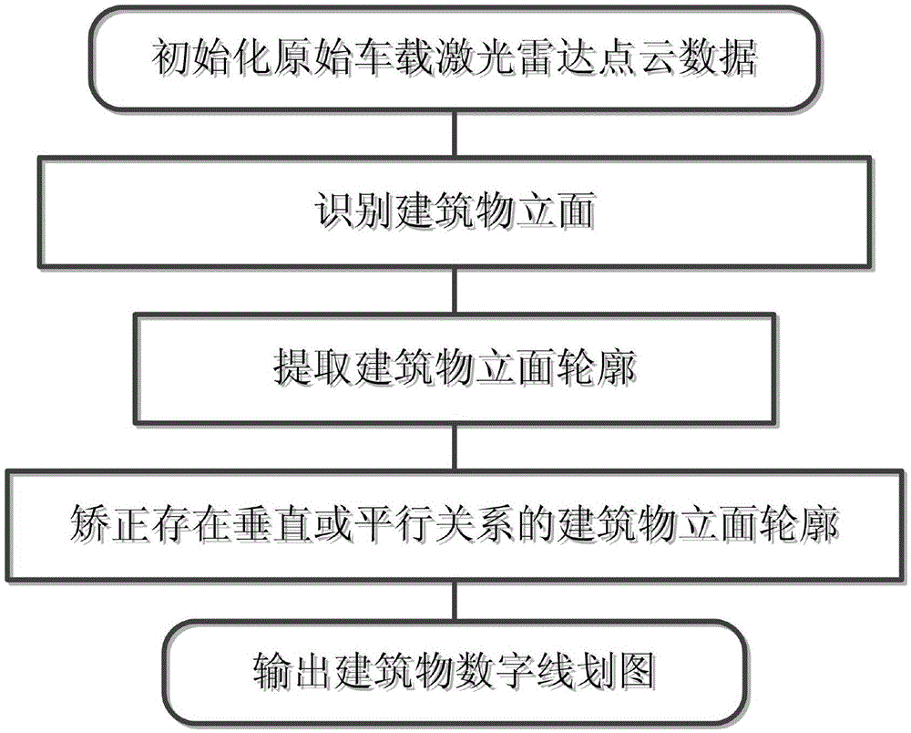
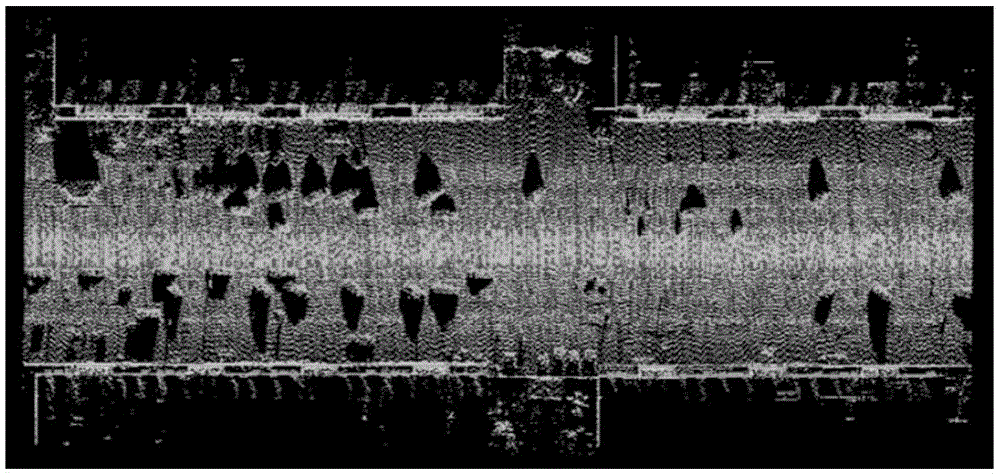
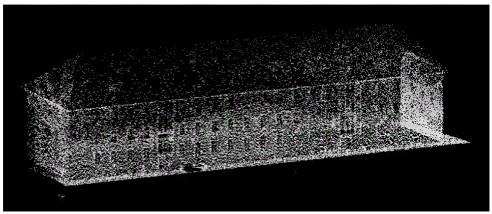
[0058] In order to clearly illustrate the technical features of this solution, the present invention will be described in detail below through specific implementation modes and in conjunction with the accompanying drawings. The following disclosure provides many different embodiments or examples for implementing different structures of the present invention. To simplify the disclosure of the present invention, components and arrangements of specific examples are described below. Furthermore, the present invention may repeat reference numerals and / or letters in different instances. This repetition is for the purpose of simplicity and clarity and does not in itself indicate a relationship between the various embodiments and / or arrangements discussed. It should be noted that components illustrated in the figures are not necessarily drawn to scale. Descriptions of well-known components and processing techniques and processes are omitted herein to avoid unnecessarily limiting the...


PUM


Abstract

The invention provides a method for manufacturing a building digital line map based on vehicle-mounted laser radar point cloud. The method comprises steps of 1: initializing original vehicle-mounted laser radar point cloud data and arranging all laser foot points as to-be-distinguished points; 2: identifying building vertical faces; 3: extracting building vertical face profiles; 4: correcting the building vertical face profiles where vertical or parallel relations exist; and 5: outputting a building digital line map. According to the invention, scattered point cloud data is organized into a space data structure via a point cloud segmentation method, wherein the space data structure is easy to understand by human beings, obeys natural laws and is provided with the topology relation. A building vertical face detection and extraction method based on prior knowledge is suitable for vehicle-amounted laser radar data with disordered point cloud data and complex distribution of region scene targets. By use of normal vector quantity of fitting panels of the building vertical faces, vertical and parallel topology relations of the building vertical faces are corrected, so precision of topology relations among the building vertical faces is effectively improved.

Description

technical field [0001] The invention relates to a method for making a digital line drawing of a building based on a vehicle-mounted laser radar point cloud, and belongs to the technical field of laser radar point cloud data information extraction. Background technique [0002] The 3D model of buildings plays a vital role in the fields of urban planning, 3D navigation, and virtual tourism. Compared with 2D maps, it is more intuitive and effective; The 3D model of an object is a project with a huge workload. In order to achieve automation, research on 3D urban reconstruction has been increasing at home and abroad in recent years. Due to the ease of data acquisition, images have been adopted by quite a few researchers as the dominant data source for building reconstruction. However, the research results over the years have not been satisfactory. This is mainly because the image-based reconstruction technology has been unable to solve several technical problems such as stereo ...

Claims


Application Information

Patent Timeline
Patent Type & Authority Applications(China)
IPC IPC(8): G01S17/89
CPCG01S17/89
Inventor 林祥国倪欢张继贤
Owner CHINESE ACAD OF SURVEYING & MAPPING
Why Eureka
Try Eureka