Arrangement method of multi-ground calibration station used for GEOSAR phase calibration

A ground-based calibration and phase technology used in the use of re-radiation, special data processing applications, reflection/re-radiation of radio waves, etc.

Active Publication Date: 2016-06-01
INST OF ELECTRONICS CHINESE ACAD OF SCI
View PDF4 Cites 1 Cited by
  • Summary
  • Abstract
  • Description
  • Claims
  • Application Information

AI Technical Summary

Problems solved by technology

[0006] The purpose of the present invention is to propose a multi-terrestrial calibration station layout method for geosynchronous orbit SAR phase calibration under the condition of no mature technology or available reference technology, and solve the problem of geosynchronous orbit SAR phase calibration in a targeted manner. The problem of multi-station site selection for SAR phase calibration system, in order to obtain imaging compensation phase calibration information, and provide the multi-station layout site of ground calibration station for GEOSAR phase calibration system

Method used


Image

  • Arrangement method of multi-ground calibration station used for GEOSAR phase calibration
  • Arrangement method of multi-ground calibration station used for GEOSAR phase calibration
  • Arrangement method of multi-ground calibration station used for GEOSAR phase calibration

Examples


Embodiment Construction

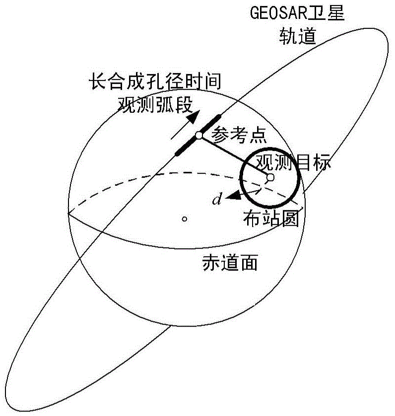
[0020] The specific implementation of the present invention will be described below in conjunction with the accompanying drawings. The multi-terrestrial calibration station layout structure diagram for geosynchronous orbit synthetic aperture radar phase calibration adopted by the present invention is as follows figure 1 As shown,.

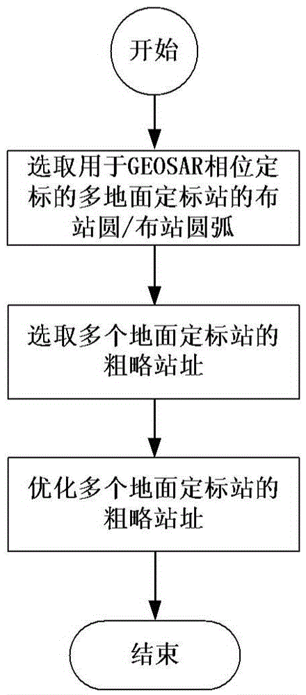
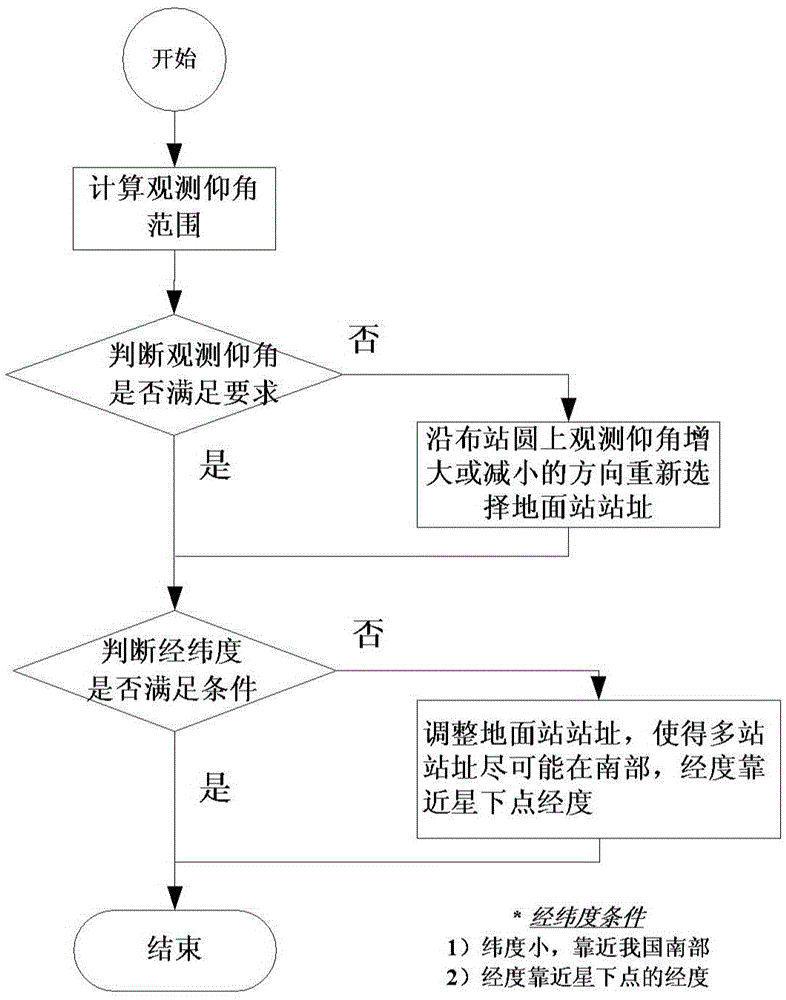
[0021] The layout method of the multi-terrestrial calibration stations used for GEOSAR phase calibration in this embodiment, as attached figure 2 As shown, its specific implementation process is as follows:

[0022] 1. Select the station layout circle / arc of multi-surface calibration stations for GEOSAR phase calibration

[0023] ① Use the earth-centered and ground-fixed coordinate system as the reference coordinate system;

[0024] ② In the earth-centered earth-fixed coordinate system, calculate the position of the observation target;

[0025] ③ Select the location of the observation target as the center of the circle and the great circle of ...


PUM


Abstract

The invention belongs to the technical field of spaceborne synthetic aperture radar signal processing, and particularly relates to an arrangement method of a multi-ground calibration station used for geosynchronous synthetic aperture radar (GEOSAR) phase calibration. The method comprises the steps that station arrangement circles/ station arrangement arcs of the multi-ground calibration station used for GEOSAR phase calibration are selected; a rough station address of the multi-ground calibration station is selected; and the rough station address of the multi-ground calibration station is optimized. With application of the method, the address selection problem of the multi-ground calibration station of a geosynchronous orbit SAR phase calibration system can be solved in a targeted way, and the requirement of phase calibration of a GEOSAR specific observation target can be met through resource optimization configuration of limited land span of our country.

Description

technical field [0001] The invention belongs to the technical field of spaceborne synthetic aperture radar signal processing, and in particular relates to a layout method of multi-ground calibration stations used for GEOSAR phase calibration. Background technique [0002] Geosynchronous Synthetic Aperture Radar (Geosynchronous Synthetic Aperture Radar, GEOSAR) is a spaceborne SAR based on a geosynchronous satellite with an orbital height of 36,000km. Geosynchronous orbit SAR phase calibration is a technology for obtaining motion compensation information for GEOSAR echoes. Transmit pulsed chirp calibration signals to GEOSAR satellites through ground calibration stations whose positions are precisely known, and use matched filter pulse compression method to extract phase information from calibration echo signals to provide accurate phase for post-imaging processing benchmark. The accuracy of GEOSAR phase calibration depends on equipment accuracy, atmospheric propagation distu...

Claims


Application Information

Patent Timeline
Patent Type & Authority Applications(China)
IPC IPC(8): G01S13/90G01S7/42G06F17/50
CPCG01S7/42G01S13/90G06F30/00G01S13/9058
Inventor 江冕胡文龙丁赤飚
Owner INST OF ELECTRONICS CHINESE ACAD OF SCI
Why Eureka
Try Eureka