
A method for identifying residences of commercially employed people based on mobile phone location data

A technology for positioning data and identification methods, which is applied in services based on location information and services based on specific environments. Effect

Active Publication Date: 2019-04-30
SOUTHEAST UNIV
View PDF3 Cites 2 Cited by
  • Summary
  • Abstract
  • Description
  • Claims
  • Application Information

AI Technical Summary

Problems solved by technology

Therefore, it is only possible to obtain information on residents’ occupation and residence within a long period of time, but it is impossible to form a dynamic analysis network of changing characteristics.

Method used


Image

  • A method for identifying residences of commercially employed people based on mobile phone location data
  • A method for identifying residences of commercially employed people based on mobile phone location data
  • A method for identifying residences of commercially employed people based on mobile phone location data

Examples


Embodiment Construction

[0031] The following will combine the urban area of ​​Shanghai (excluding the three islands of Chongming Island, Changxing Township and Hengsha Township, its spatial distribution covers the central urban area of ​​Shanghai and the new towns on the periphery, with an area of ​​about 6540km 2 ) method case and accompanying drawings to describe the method scheme of the present invention in detail.

[0032] The purpose of the present invention is to provide a method for identifying the residence of business workers based on mobile phone positioning data, comprising the following steps:

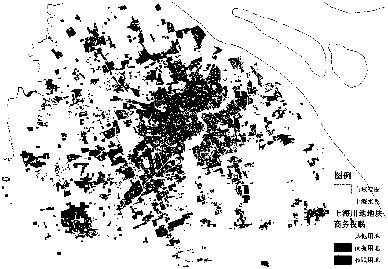
[0033] Step 1) Label the types of commercial land and residential land in the whole city of Shanghai.

[0034] 1.1) Re-divide the space according to the road red lines of expressways, main and secondary arterial roads and some major branch roads in the Shanghai urban area, refer to the "Urban Land Classification and Planning and Construction Land Use Standards", and use the graphics drawing module...


PUM


Abstract

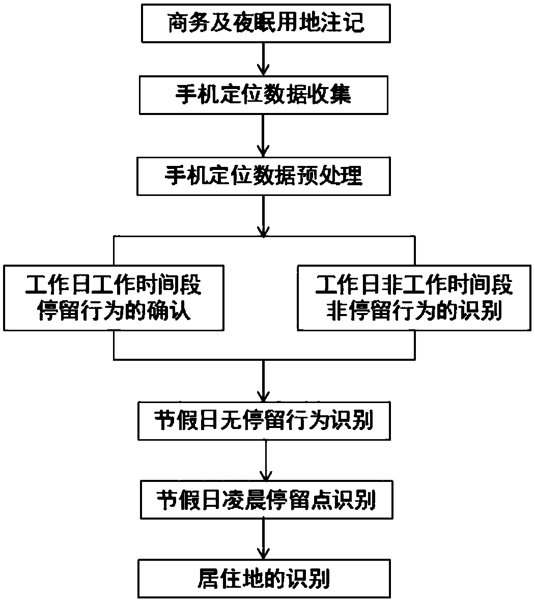
The invention discloses a method for identifying residences of business and employment groups based on mobile phone positioning data, and proposes (1) research, marking and statistics on the types of business land and residential land; (2) 10:00am and 15 :00pm is located in the same signal cell or adjacent signal cell of the commercial site; (3) more than 80% of the working days at 2:00 am are located outside the commercial site; (4) more than 80% of the holidays do not appear in the condition (2) The signal cell where it is located. Mark the users who meet the above conditions, and record the signal cell they are in at 2:00 am. If more than 80% of the signal cells are the same residential signal cell or adjacent residential signal cells, it will be marked as a commercial land for employment. land. The present invention relies on the existing mobile communication network resources, utilizes the positioning information in the mobile phone communication network to identify the residences of employed people in a specific land type, and has the characteristics of low cost, high frequency, automation and strong timeliness.

Description

technical field [0001] The invention belongs to the technical field of mobile phone signaling processing and urban planning data analysis, and relates to a method for identifying residences of commercially employed people based on mobile phone positioning data. Background technique [0002] With the process of urbanization and the introduction of the new normal, the urban spatial structure is constantly evolving and changing, which is also directly reflected in the changes in the spatial distribution of the urban population and the spatial distribution of industries. In other words, the identification of residents' occupation and residence and their spatial relationship are important components of urban spatial structure. However, the traditional survey method of residents' occupation and residence is costly, involves many people, is difficult to organize, and takes a long time to implement. Generally speaking, only large-scale cities have the strength to carry out large-sc...

Claims


Application Information

Patent Timeline
Patent Type & Authority Patents(China)
IPC IPC(8): H04W4/02H04W4/35
CPCH04W4/02
Inventor 杨俊宴熊伟婷史宜
Owner SOUTHEAST UNIV
Learn More