

Trans-scale geographic information linkage updating technical method based on spatial automatic matching
An automatic matching and geographic information technology, which is applied in geographic information databases, electronic digital data processing, special data processing applications, etc., can solve the problems of poor overall coordination of results, low degree of automatic processing, and low potential utilization of data. Achieve the effect of seamless integration of incremental information, improvement of production efficiency and accuracy, and perfect coverage
- Summary
- Abstract
- Description
- Claims
- Application Information
AI Technical Summary
Problems solved by technology
Method used
Image

Examples
Embodiment Construction
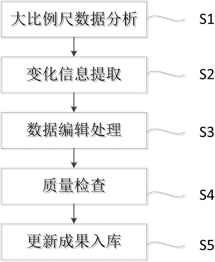
[0019] figure 1 It is a flow chart of a technical method for synchronous updating of cross-scale geographic information based on automatic spatial matching in an embodiment of the present invention. Please refer to figure 1 , in this embodiment, the cross-scale geographic information linkage update technology method based on automatic spatial matching includes:
[0020] S1: Perform integrity analysis, current situation analysis, and status update analysis on large-scale data, and obtain analysis results.
[0021] S2: Extract the update information in the large-scale data according to the analysis results, and combine the element model matching and comparison method. If the incremental change information is complete, the update status of the elements in the large-scale data (addition, attribute change, graphic change, relationship change, etc.) ) to be marked as an incremental information source and an important reference for the next editing process. And delete the large-sc...
PUM
 Abstract
Description
Claims
Application Information