Modeling method and modeling system for long-distance pipeline station model
A modeling method and pipeline station technology, applied in 3D modeling, instruments, calculations, etc., can solve problems such as construction inconvenience, errors, and deviations, and achieve the effect of improving accuracy
- Summary
- Abstract
- Description
- Claims
- Application Information
AI Technical Summary
Problems solved by technology
Method used
Image


Examples
Embodiment 1
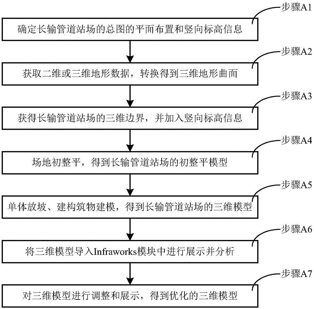
[0042] Embodiment 1, a modeling method of a long-distance pipeline station model in the embodiment of the present invention, including the modeling method in the early stage of the scheme stage and the modeling method in the later stage of construction, combining the modeling method of the early stage of the project stage and the later stage of construction Phase modeling methods are integrated together, where,
[0043] Such as figure 1 As shown, the modeling methods in the early planning stage include:
[0044] Step A1, determine the plane layout and vertical elevation information of the general drawing of the long-distance pipeline station from the perspective of a top view;
[0045]Step A2, obtaining the two-dimensional or three-dimensional terrain data of the long-distance pipeline station, and using the terrain processing tool of the Civil3D module to convert the two-dimensional or three-dimensional terrain data into a three-dimensional topographic surface of the long-di...
Embodiment 2
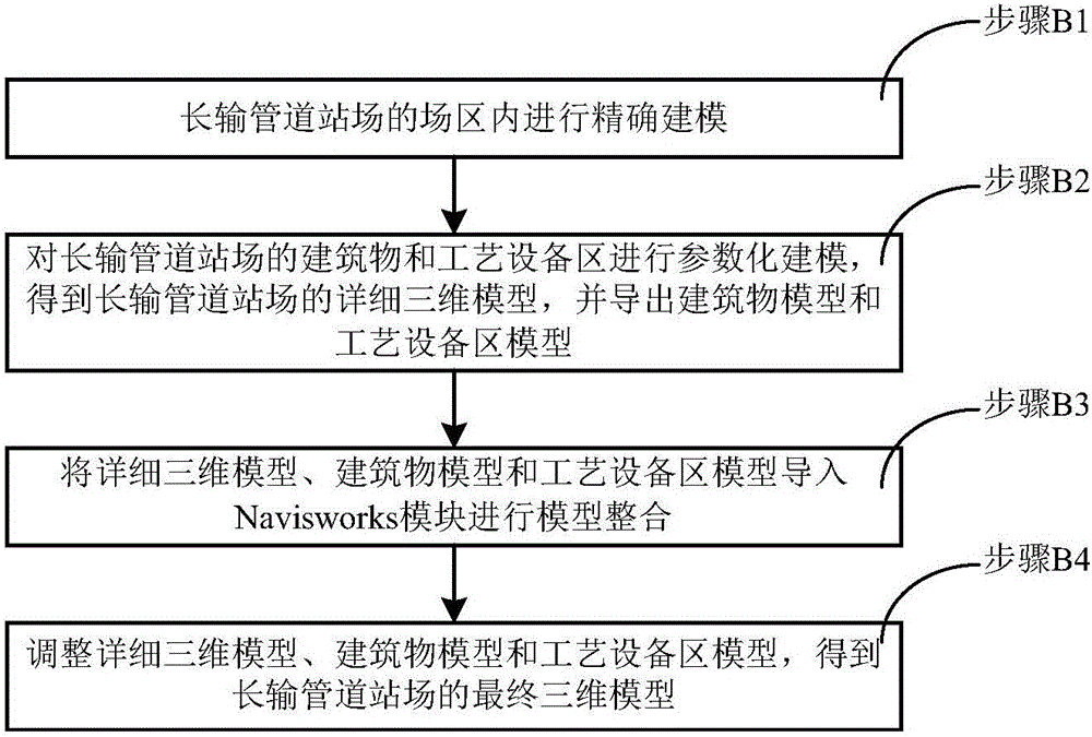
[0056] Embodiment 2, the present invention also provides a long-distance pipeline station model modeling system, including a modeling module in the early stage of the scheme stage and a modeling module in the later construction stage, wherein,
[0057] Such as image 3 As shown, the modeling modules in the pre-planning stage include:
[0058] General plan determination module, which determines the plane layout and vertical elevation information of the general plan of the long-distance pipeline station from the perspective of the top view;
[0059] The terrain processing module obtains the two-dimensional or three-dimensional terrain data of the long-distance pipeline station, and uses the terrain processing tool of the Civil3D module to convert the two-dimensional or three-dimensional terrain data into a three-dimensional terrain surface of the long-distance pipeline station;
[0060] The boundary processing module adopts the element line tool of the Civil3D module to obtain ...
PUM
 Abstract
Description
Claims
Application Information
 - R&D
- Intellectual Property
- Life Sciences
- Materials
- Tech Scout
- Unparalleled Data Quality
- Higher Quality Content
- 60% Fewer Hallucinations
Browse by: Latest US Patents, China's latest patents, Technical Efficacy Thesaurus, Application Domain, Technology Topic, Popular Technical Reports.
© 2025 PatSnap. All rights reserved.Legal|Privacy policy|Modern Slavery Act Transparency Statement|Sitemap|About US| Contact US: help@patsnap.com