Micro-terrain surface reconstruction method

A technology of micro-topography and topography, applied in the field of remote sensing technology and surveying and mapping, can solve problems such as time-consuming, data accuracy depends on business proficiency, and laborious

Active Publication Date: 2016-07-13
CHINA AGRI UNIV
View PDF7 Cites 21 Cited by
  • Summary
  • Abstract
  • Description
  • Claims
  • Application Information

AI Technical Summary

Problems solved by technology

At this stage, computer hardware and algorithms are no longer obstacles to reconstruction, but the information capacity and accuracy of original terrain data are still the bottleneck restricting the establishment of accurate terrain models
The data obtained by traditional manual survey methods are difficult to describe the small details of terrain changes in detail, and manual data collection is time-consuming and laborious. It is difficult to collect topographic data in areas that are difficult for people to reach. The accuracy of the data also depends on the business proficiency of the surveyors.

Method used


Image

  • Micro-terrain surface reconstruction method
  • Micro-terrain surface reconstruction method
  • Micro-terrain surface reconstruction method

Examples


Embodiment Construction

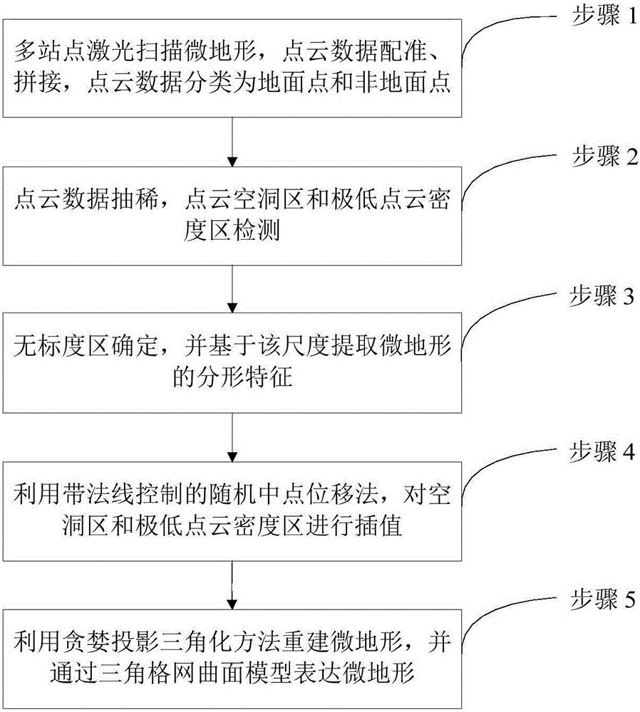
[0047] Taking the micro-topography reconstruction process of a coal mine reclamation area in Wangping Town, Mentougou District, Beijing as an example, as follows: figure 1 Shown, the concrete implementation method of the present invention is as follows, as figure 1 Shown:

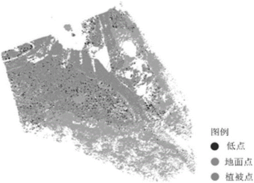
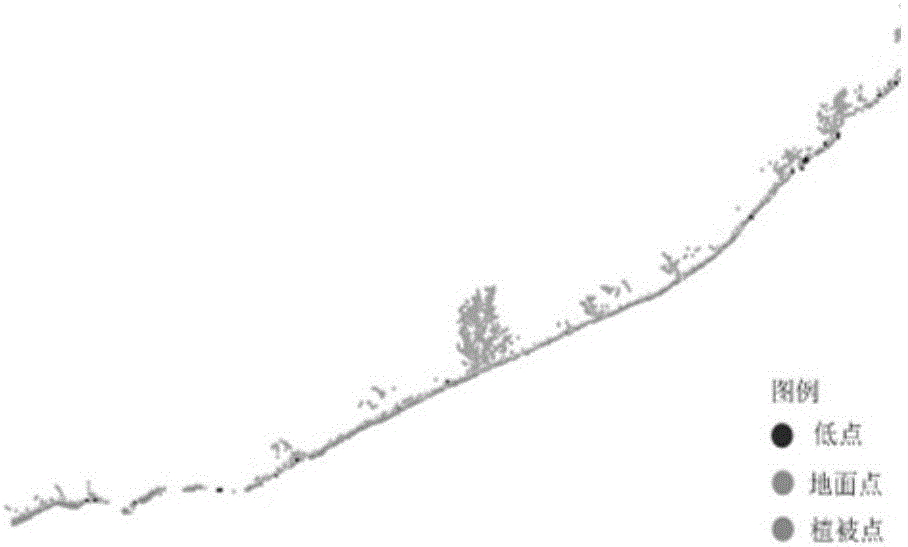
[0048] Step 1. Set up multiple stations in the research area, obtain point cloud data by laser scanning, register and stitch the point cloud data of multiple sites, and classify the point cloud data into ground point cloud and non-ground point cloud. Among them, the classification results of the point cloud are as follows: Figure 2a , 2b , 2c, 2d shown.

[0049] According to the principle of ensuring full coverage and a certain proportion of repeated scanning areas between adjacent stations, minimizing occlusion, easy selection of points with the same name, and moderate scanning accuracy, the laser scanning scheme is determined; 4 laser radars are placed between adjacent stations. - 6 target balls are ...


PUM


Abstract

The invention discloses a micro-terrain reconstruction method based on laser radar. The method comprises the following steps that (1) mass and discrete laser radar point cloud data are acquired through laser scanning and then point cloud data splicing between different station points is performed, and ground points and non-ground points are separated; (2) point cloud data thinning and boundary point detection of point cloud hole areas or areas of extremely low point cloud density are performed; (3) the fractal feature of a micro-terrain is calculated, and a scale-free area is determined; (4) interpolation is performed in the point cloud hole areas and the areas of extremely low point cloud density by a random midpoint displacement method with normal line control; and (5) micro-terrain reconstruction is performed on the ground points by utilizing a greedy projection triangulation method.

Description

technical field [0001] The invention relates to the technical fields of remote sensing technology and surveying and mapping, and more specifically relates to a micro-topography surface reconstruction method. Background technique [0002] Micro-topography refers to local terrains of different sizes and shapes formed by natural forces or human activities, which have the characteristics of complex surface details and random terrain fluctuations. For vegetation, micro-topography causes differences in conditions such as water, heat, and nutrients, which affect the growth of surface vegetation; for garden landscapes, it imitates the ups and downs in nature according to natural landforms or artificially created micro-topography The topography determines the distribution of water bodies, garden structures, trees, flowers and plants in the garden. Therefore, the fine reconstruction of micro-topography is of great significance to the study of micro-topography environment and the util...

Claims


Application Information

Patent Timeline
Patent Type & Authority Applications(China)
IPC IPC(8): G06T17/05G06T17/30
CPCG06T17/05G06T17/30
Inventor 苏伟朱德海吴代英张明政张蕊郭浩赵晓凤
Owner CHINA AGRI UNIV
Why Eureka
Try Eureka