Construction method of regional spatial pattern intervention gravity field optimization model of multi-data sources

A technology with spatial pattern and multiple data sources, applied in image data processing, 3D modeling, instruments, etc., to facilitate fusion analysis, avoid data loss, and make the model realistic

Inactive Publication Date: 2016-07-27
SOUTHWEST JIAOTONG UNIV
View PDF1 Cites 2 Cited by
  • Summary
  • Abstract
  • Description
  • Claims
  • Application Information

AI Technical Summary

Problems solved by technology

However, more accurate and high-precision site CAD data or DEM models are required, or accurate data related to other formats that can be recognized by GIS

Method used


Image

  • Construction method of regional spatial pattern intervention gravity field optimization model of multi-data sources
  • Construction method of regional spatial pattern intervention gravity field optimization model of multi-data sources
  • Construction method of regional spatial pattern intervention gravity field optimization model of multi-data sources

Examples


Embodiment Construction

[0029] The present invention will be further described in detail below in conjunction with the accompanying drawings, so that those skilled in the art can implement it with reference to the description.

[0030] It should be understood that terms such as "having", "comprising" and "including" used herein do not exclude the presence or addition of one or more other elements or combinations thereof.

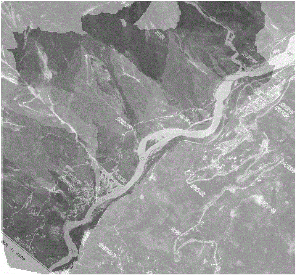
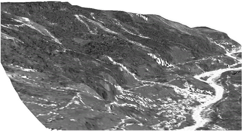
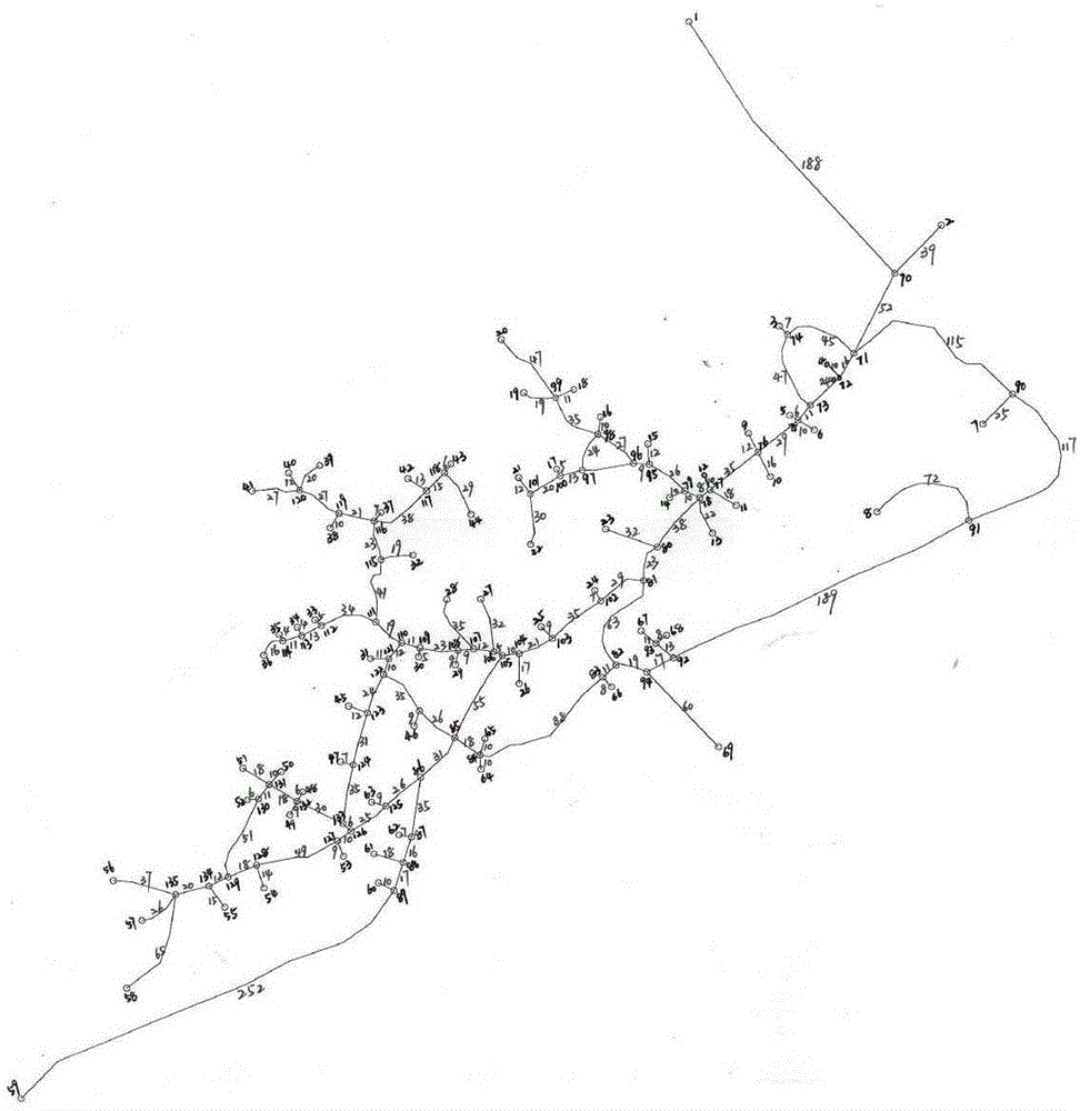
[0031] The invention uses the most congested road network node on the shortest path to simulate and describe the gravitational effect of the road network node on the flow, and researches a relatively smooth path selection strategy based on the gravitational constraint of the road network node. In this case, the shortest path optimization pattern of the street network needs to consider two factors: one is to alleviate the congestion of local nodes in the network caused by choosing the shortest path strategy; Restrictions. The invention analyzes the human-environment interaction mec...


PUM


Abstract

The invention relates to a gravity field model construction method and specifically relates to a construction method of a regional spatial pattern intervention gravity field optimization model of multi-data sources. The method comprises the following steps of: firstly, constructing a three-dimensional space model of an area according to the regional space structure and human space behaviors; and secondly, extracting all road network nodes in the area according to the three-dimensional space model in the first step, calculating intervention center values of all the road network nodes and the distance between any two road network nodes, obtaining the gravitation intensity between any two road network nodes, and further establishing a three-dimensional gravity field model of the area. According to the invention, the real three-dimensional expression of the area is realized, high-efficiency and scientific space analysis is carried out on the area by the utilization of the gravity field theory, and the selecting efficiency of an optimal path is improved.

Description

technical field [0001] The invention relates to a method for constructing a gravitational field model. More specifically, the present invention relates to a method for constructing a multi-data source regional spatial pattern intervention gravitational field optimization model. Background technique [0002] In ARCGIS, CAD, DEM and other elevation data are used for spatial analysis, and the analysis results are accurate and intuitive, which is convenient for data query, but the planar analysis results are suitable for communication and use by professionals, so that non-related professionals can understand and facilitate management. difficulty. In ARCSCENCE, the three-dimensional conversion of the plane layer can be realized, and the obtained images of some analysis factors (such as slope, aspect, hydrological conditions, etc.) can be integrated into a single spatial geographic model to realize the three-dimensional space perception of the spatial analysis results, which is c...

Claims


Application Information

Patent Timeline
Patent Type & Authority Applications(China)
IPC IPC(8): G06T17/05
CPCG06T17/05
Inventor 付飞刘刚
Owner SOUTHWEST JIAOTONG UNIV
Why Eureka
Try Eureka