Anemometric device and method based on GNSS autonomous velocity measurement

A technology of speed measurement and speed, which is applied in the field of satellite navigation, can solve the problems of dependence, etc., and achieve the effect of low equipment requirements, improved measurement accuracy, and less equipment

Active Publication Date: 2016-09-07
NO 54 INST OF CHINA ELECTRONICS SCI & TECH GRP
View PDF8 Cites 5 Cited by
  • Summary
  • Abstract
  • Description
  • Claims
  • Application Information

AI Technical Summary

Problems solved by technology

However, some existing wind measurement systems rely on external augmentation systems

Method used


Image

  • Anemometric device and method based on GNSS autonomous velocity measurement
  • Anemometric device and method based on GNSS autonomous velocity measurement
  • Anemometric device and method based on GNSS autonomous velocity measurement

Examples


Embodiment Construction

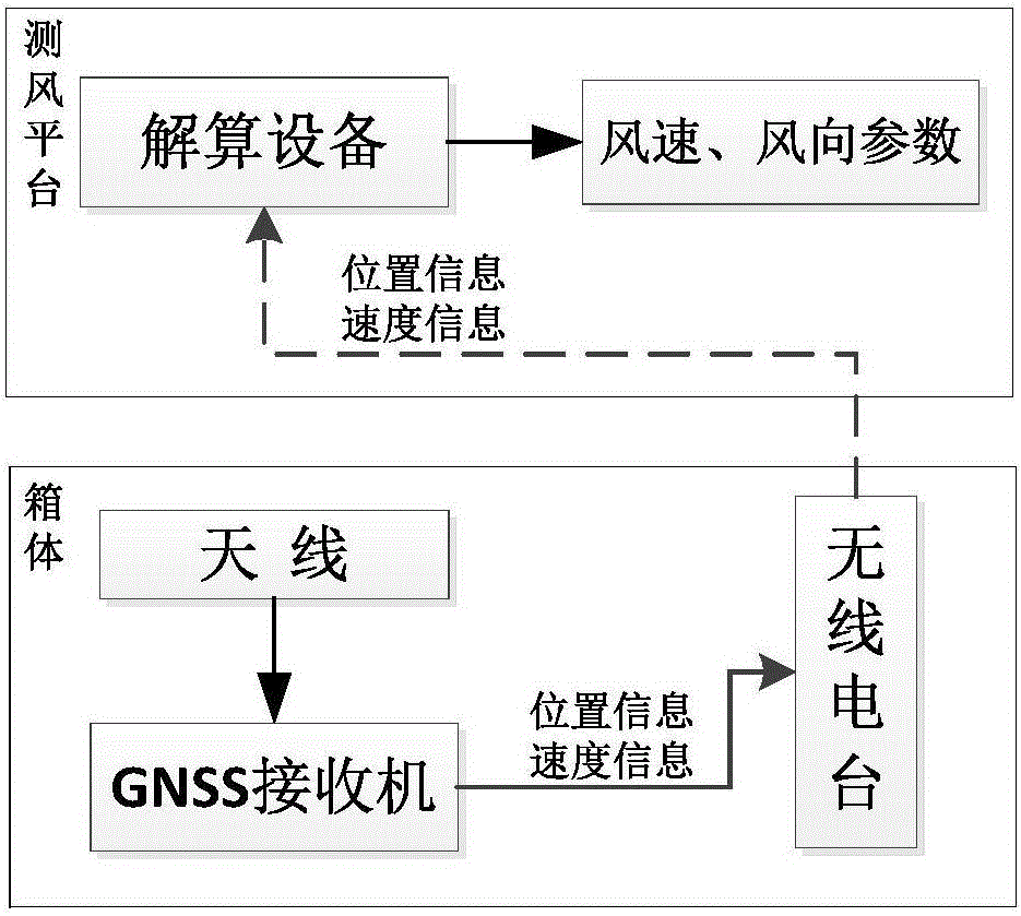
[0027] The invention provides a wind measurement method based on GNSS autonomous speed measurement, without the assistance of an external augmentation system, and realizes autonomous speed measurement through a GNSS receiver. The present invention will be further described below in conjunction with the accompanying drawings.

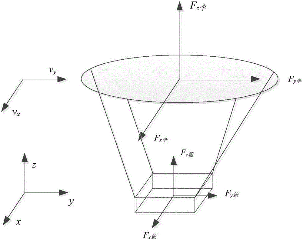
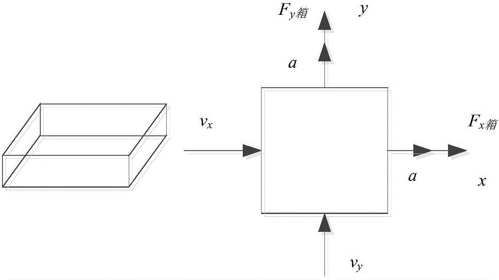
[0028] like figure 1 As shown, the wind measuring device of the present invention includes a wind measuring platform (such as a drone), a carrier (such as a parachute), an antenna, a radio station and a GNSS receiver, and the wind measuring platform includes a computing device, an antenna, a radio station and a GNSS receiver The aircraft are all installed in the same box, and the box is installed on the parachute, and the installed parachute is dropped in the air at a certain height. When the parachute stabilizes for a period of time, it starts to land smoothly. At the same time, the GNSS receiver starts positioning and speed measurement; GNSS The recei...


PUM


Abstract

The invention provides an anemometric device and method based on GNSS autonomous velocity measurement, and relates to the field of satellite navigation. A GNSS receiver is used for implement single-point velocity measurement, and according to single-point position information and velocity information of the GNSS receiver as well as the relation between the wind velocity and the velocity information of the GNSS receiver, the high-altitude wind velocity, wind direction and wind profile are calculated and measured. According to the invention, anemometry is carried out without external high-precision auxiliary equipment, the complex degree of equipment is greatly reduced, the measuring precision is improved, and the anemometric device is simple in structure, practical, low in complex degree and wide in application.

Description

technical field [0001] The invention relates to the field of satellite navigation, in particular to a device and method for measuring high-altitude wind speed, wind direction and wind profile based on GNSS autonomous speed measurement without the assistance of an external augmentation system. Background technique [0002] GPS wind measurement is a measurement system that was applied in the 1990s, and has now become an important means of atmospheric wind field measurement. The principle of GPS wind measurement is to use satellites to determine the wind direction and wind speed where the target is located by determining the position change of the freely moving target in the atmosphere. Since the GPS system can determine the target with high precision, theoretically, the accuracy of this wind measurement system is also high. At present, there are two methods of GPS technology wind measurement, one is Doppler frequency shift method, its accuracy is limited by the receiver; the ...

Claims


Application Information

Patent Timeline
Patent Type & Authority Applications(China)
IPC IPC(8): G01P5/00G01P13/02G01S19/52G01S19/42
CPCG01P5/00G01P13/02G01S19/42G01S19/52
Inventor 杨开伟蔚保国盛传贞时小飞张京奎范广伟
Owner NO 54 INST OF CHINA ELECTRONICS SCI & TECH GRP
Why Eureka
Try Eureka