Rotor unmanned aerial vehicle coverage search flight path planning method for polygonal region having no-fly zone

A technology of unmanned rotor and track planning, applied in navigation calculation tools and other directions, to achieve the effect of reducing the number of decomposition search units

Active Publication Date: 2016-09-28
BEIJING INSTITUTE OF TECHNOLOGYGY
View PDF5 Cites 28 Cited by
  • Summary
  • Abstract
  • Description
  • Claims
  • Application Information

AI Technical Summary

Problems solved by technology

[0006] The purpose of the present invention is to solve the problem of the coverage search trajectory planning of the rotor UAV in the polygonal area with no-fly zones, and proposes a c

Method used


Image

  • Rotor unmanned aerial vehicle coverage search flight path planning method for polygonal region having no-fly zone
  • Rotor unmanned aerial vehicle coverage search flight path planning method for polygonal region having no-fly zone
  • Rotor unmanned aerial vehicle coverage search flight path planning method for polygonal region having no-fly zone

Examples


Embodiment 1

[0049] Assume that the vertex coordinates of the polygonal area are shown in Table 1; there are 3 polygonal no-fly zones and 1 circular no-fly zone in the polygonal area, and the parameters of the no-fly zone are shown in Table 2; the constraint parameters of the rotor UAV are shown in Table 3 Show.

[0050] Table 1 Vertex coordinates of polygonal area

[0051] area apex

coordinates

Vertex 1

(25000,18000)

Vertex 2

(19000,9000)

Vertex 3

(10000,10000)

Vertex 4

(6000,14000)

Vertex 5

(-5000,20000)

Vertex 6

(15000,31000)

[0052] Table 2 Vertex coordinates of polygonal area

[0053]

[0054]

[0055] Table 3 UAV constraint parameters

[0056] Drone Constraint Parameters

value

search width

500

Maximum range

100×10 3

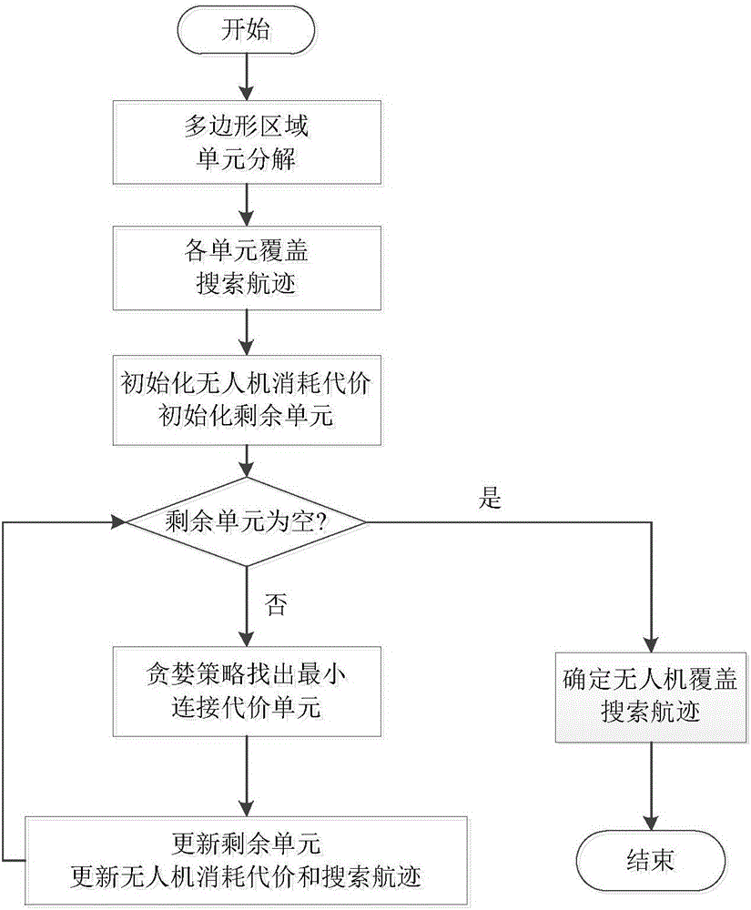
[0057] The specific implementation steps are as follows:

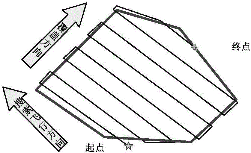
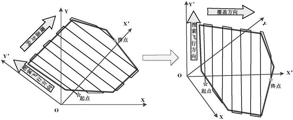
[0058] Step 1, determine the coverage direction. First, calculate the distan...


PUM


Abstract

The invention relates to a rotor unmanned aerial vehicle coverage search flight path planning method for a polygonal region having a no-fly zone, wherein the method comprises the steps: step 1, determining a coverage direction, wherein the direction from a polygon width-corresponding top point to edge is a coverage direction for realizing shortest-path polygon region coverage searching; step 2, transforming a coordinate, taking an X axis of a new coordinate system (OX'Y') as a coverage direction, and making an origin point of the new coordinate system (OX'Y') the same as an origin point of an original coordinate system; step 3, according to the transformed to-be-covered polygon region and obstacle, carrying out Boustrophedon searching unit decomposition; step 4, determining an alternative optical grating line search flight path set of each searching unit; step 5, determining the sequence and the flight path of each searching unit of the unmanned aerial vehicle based on a greedy strategy; and step 6, carrying out coordinate inverse transformation, transforming flight path points into flight path points in the original coordinate system through coordinate inverse transformation, and thus obtaining an original task searching flight path. The method ensures optimal property of understanding while reducing the time consuming of calculation.

Description

technical field [0001] The present invention relates to the field of unmanned aerial vehicle track planning, in particular to a method for planning the coverage search track of a rotor unmanned aerial vehicle in a polygonal area with a no-fly zone. Background technique [0002] Due to its small size, strong mobility, low price, flexible take-off, damage without casualties, and simple air support, UAVs are playing an increasingly important role in modern military and civilian fields, and are widely used in battlefield reconnaissance , In-depth attack, terrain surveying and mapping, address exploration, disaster search and rescue, pesticide spraying and other fields. Among them, the rotor UAV has attracted widespread attention due to its characteristics of autonomous hovering, flexible direction control, and no turning angle constraints. UAV mission planning system is the central control hub for UAVs to perform missions, and track planning technology, as a part of mission pla...

Claims


Application Information

Patent Timeline
IPC IPC(8): G01C21/20
CPCG01C21/20
Inventor 龙腾刘莉温永禄王祝
Owner BEIJING INSTITUTE OF TECHNOLOGYGY
Why Eureka
Try Eureka