

GNSS/INS/laser ranging combined positioning-based hand-held receiver and measurement method
A laser ranging and combined positioning technology, applied in the field of surveying and mapping, can solve the problems of difficult to obtain, unable to work normally, and difficult to reach the coordinates of the target point for GNSS handhelds.
- Summary
- Abstract
- Description
- Claims
- Application Information
AI Technical Summary
Problems solved by technology
Method used
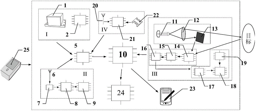
Image

Examples
Embodiment 1
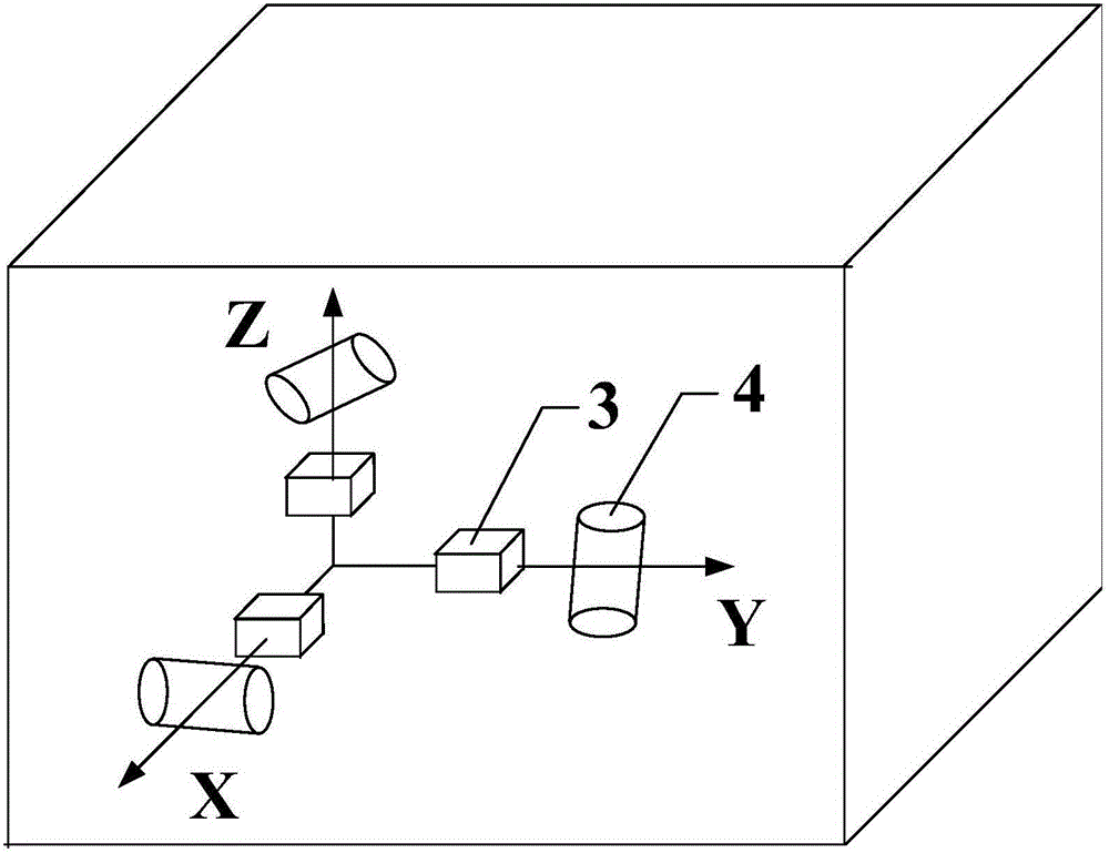
[0063] Firstly, the definitions of each coordinate system designed in the present invention are clarified. The coordinate systems applied in the measurement include: carrier fixed coordinate system, navigation coordinate system, station center coordinate system, earth coordinate system, space Cartesian coordinate system,
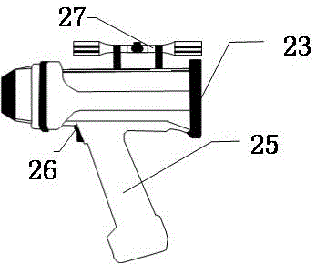
[0064] 1) The fixed coordinate system of the handheld is based on the center of mass of the handheld as the origin, y b The axis is consistent with the laser emission axis of the handset, x b Axis Laser emission axis is vertical, take the right hand as positive, z b The axis and the first two directions satisfy the right-hand spiral theorem;
[0065] 2) The navigation coordinate system is the coordinate system used when the inertial navigation module solves the coordinates. The origin is the center of mass of the handheld, and x n The direction is east, y n Axis is north direction, z n The axis is the vertical direction;
[0066] 3) The definition of t...
PUM
 Abstract
Description
Claims
Application Information