Geographic information freehand sketching system based on longitude and latitude

A technology of latitude and longitude and information hands, applied in the direction of electrical digital data processing, special data processing applications, instruments, etc., can solve problems such as not widely used, not involving geographical information, etc., and achieve the effect of wide controllability

Active Publication Date: 2016-12-28
DACHUANG INFORMATION ON THE USE OF SUZHOU CO LTD
View PDF6 Cites 23 Cited by
  • Summary
  • Abstract
  • Description
  • Claims
  • Application Information

AI Technical Summary

Problems solved by technology

The existing hand-painting system has powerful functions, but its application is not wide. It is more ...

Method used


Image

  • Geographic information freehand sketching system based on longitude and latitude
  • Geographic information freehand sketching system based on longitude and latitude
  • Geographic information freehand sketching system based on longitude and latitude

Examples


Embodiment Construction

[0042] The following embodiments are further provided in conjunction with the accompanying drawings and the contents of the present invention:

[0043] The present invention has good adaptability to global control. In the hand-drawing system of the present invention, anyone who holds a GPS device can display and view it in the hand-drawing system. The technology of the present invention will be described below in conjunction with the accompanying drawings of the present invention. The program is described in detail.

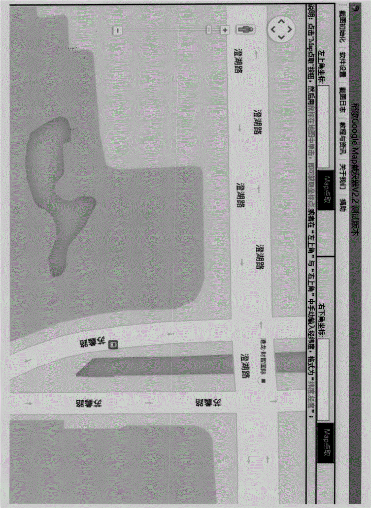
[0044] 1. If figure 1 , before drawing the map, you need to import the base map as a reference system. The base map is intercepted from a third-party software. It is required to know the latitude and longitude of the upper left corner and the lower right corner of the intercepted base map.

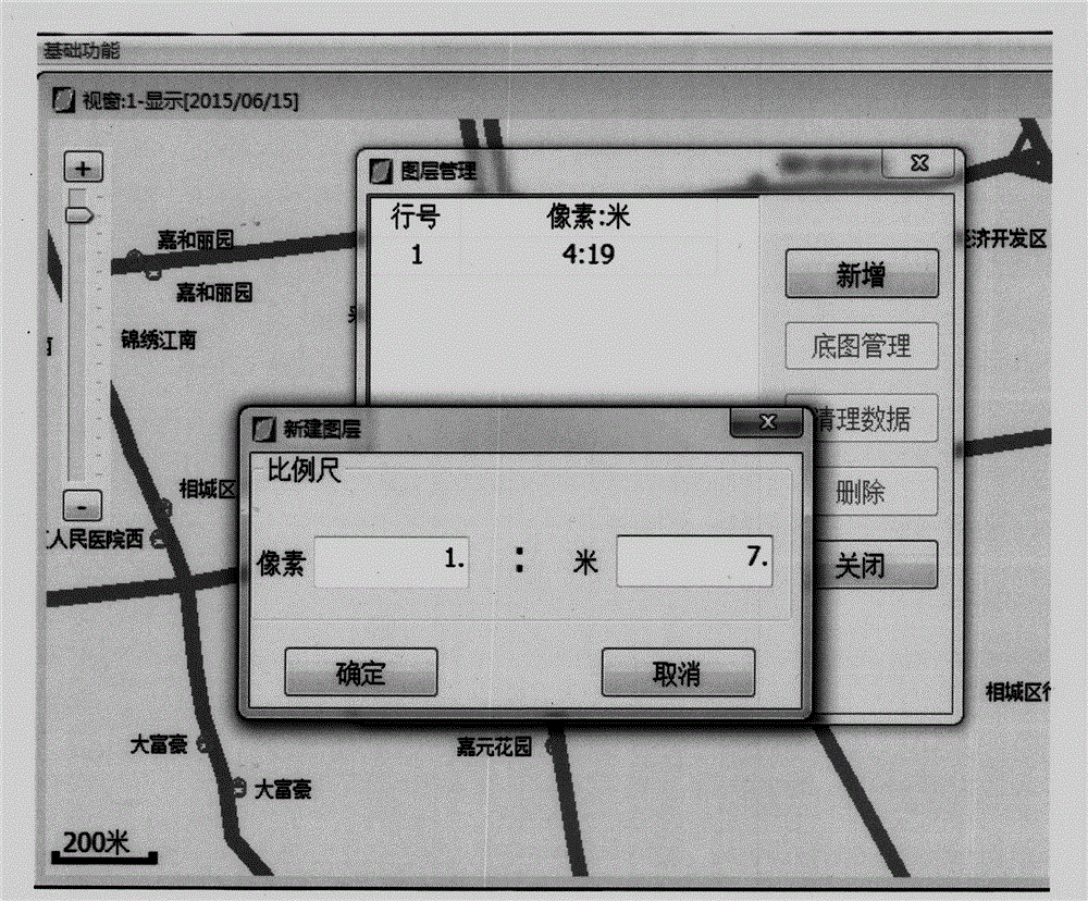
[0045] 2. If figure 2 , before drawing elements, you need to define the drawing layer and create a drawing board, and one of the most important attributes of the layer is ...


PUM


Abstract

The invention discloses a geographic information freehand sketching system based on longitude and latitude. The geographic information freehand sketching system is a system combing longitude and latitude information with freehand sketching information. The system is composed of map layers, a base map, various elements in a map including roads, stations and lines, and longitude and latitude information. Firstly, one or more map layers and measuring scales of the map layers are defined by a user, a drawing reference system (base map) is imported, and the reference system base map needs to acquire the longitude and latitude of two endpoints; then the user defines various elements in the base map, and longitude and latitude, name and beginning and ending time serve as the basic attributes of the elements; the defined elements are drawn into the map layers through mouse clicking and dragging. A map drawn with the method has extremely high expandability, randomness and controllability; furthermore, the elements in the map all have time attribute and longitude and latitude attribute. Longitude and latitude information is acquired through corresponding geographic information acquiring equipment and uploaded to a corresponding server, so that the position information of the map elements can be inquired in real time and displayed on a PC or a mobile device.

Description

technical field [0001] The invention relates to a system and software for manually drawing geographical information, in particular to a system and software for manually drawing geographical information based on longitude and latitude information. Background technique [0002] Maps and map systems play an indispensable role in people's lives today, and people's demand for maps is increasing day by day during travel. Today's dominant map systems such as Baidu Maps and Google Maps also occupy a dominant position in the market. Not only on computers, but with the development of mobile devices, mobile phones have also begun to implant map systems. In these maps or navigation systems, GPS positioning technology also plays a vital role. The use of GPS positioning satellites to perform real-time positioning and navigation around the world is called the Global Satellite Positioning System, or GPS for short. [0003] All third-party maps on the market are built for specific needs, an...

Claims


Application Information

Patent Timeline
IPC IPC(8): G06F17/30
CPCG06F16/3328
Inventor 程雷干王许敏章吉成袁震
Owner DACHUANG INFORMATION ON THE USE OF SUZHOU CO LTD
Why Eureka
Try Eureka