

Urban area and indoor high-precision visual positioning system and method
A visual positioning, high-precision technology, applied in data processing applications, instruments, calculations, etc., can solve the problems that positioning technology is difficult to meet the requirements of user accuracy, reliability, continuity, expensive hardware costs, etc., to achieve stable and sustainable positioning ability, achieve continuous positioning, low cost effect
- Summary
- Abstract
- Description
- Claims
- Application Information
AI Technical Summary
Problems solved by technology
Method used
Image

Examples
Embodiment Construction
[0064] The technical solution of the present invention will be further specifically described below through the embodiments and accompanying drawings.
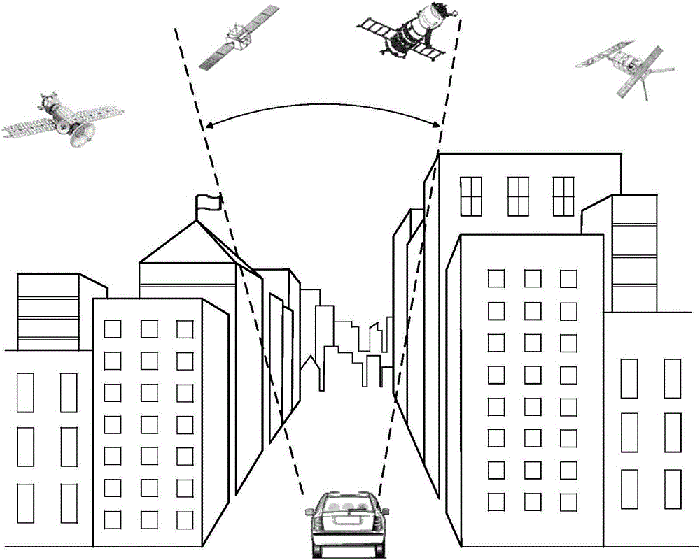
[0065] Firstly, the reception of user positioning signals based on radio frequency signals in urban environment is described. figure 1 is a schematic diagram depicting GNSS satellite signal reception in an urban environment.
[0066] Such as figure 1 As shown, the user (car) is driving in an urban canyon full of tall buildings, and the GNSS antenna continues to receive signals from navigation satellites (including but not limited to GPS, BeiDou, GLONASS, Galileo, WAAS, EGNOS, QZSS, GAGAN / IRNSS, etc.) and ( or) navigation satellite radio frequency signals from ground-based pseudolites. figure 1 Due to the obstruction of radio frequency signals by high-rise buildings, users cannot continuously track the navigation signals of multiple satellites within the visible range of the user, resulting in long waiting time, low accuracy,...
PUM
 Abstract
Description
Claims
Application Information