
Glacier grassland distribution range determining method based on tracing calculation

A technology of distribution range and determination method, applied in calculation, design optimization/simulation, image data processing, etc., can solve problems such as inability to discriminate pasture distribution

Inactive Publication Date: 2017-03-08
CHINA INST OF WATER RESOURCES & HYDROPOWER RES
View PDF2 Cites 0 Cited by
  • Summary
  • Abstract
  • Description
  • Claims
  • Application Information

AI Technical Summary

Problems solved by technology

At present, the distribution range of grassland is basically determined according to the distribution of land use or satellite remote sensing inversion method. This method can accurately determine the overall distribution range of grassland, but it cannot distinguish the distribution of grassland with different water supply types.

Method used


Image

  • Glacier grassland distribution range determining method based on tracing calculation
  • Glacier grassland distribution range determining method based on tracing calculation

Examples


Embodiment Construction

[0031] The principles and features of the present invention are described below in conjunction with the accompanying drawings, and the examples given are only used to explain the present invention, and are not intended to limit the scope of the present invention.

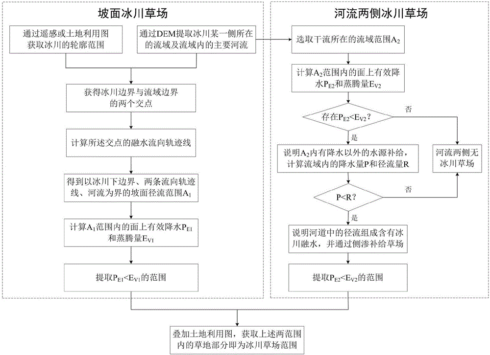
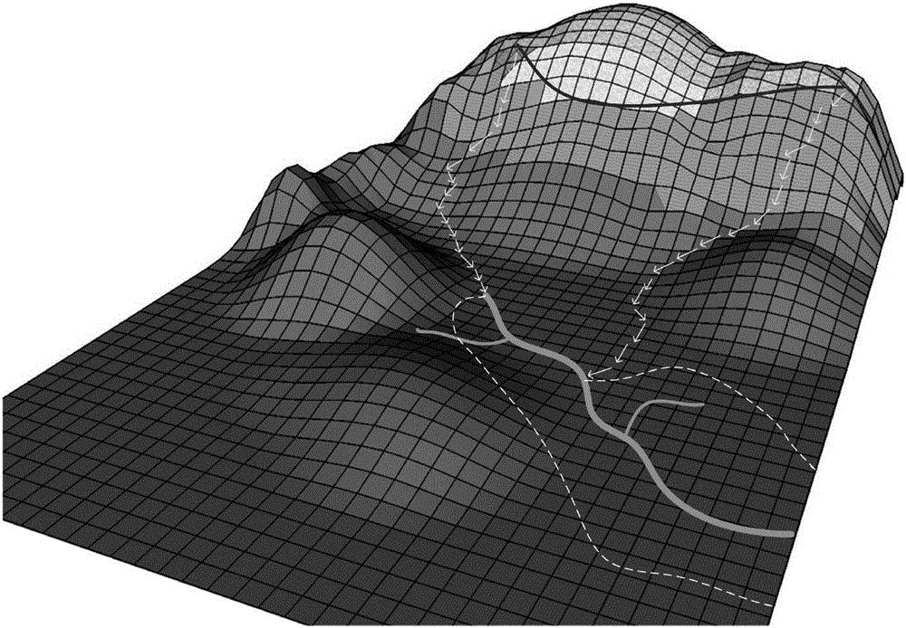
[0032] Such as figure 1 and figure 2 as shown, figure 1 Shows the flow chart of the method for determining the distribution range of glacier grasslands based on tracking calculations; glacier grasslands generally refer to grasslands mainly supplied by glacier meltwater, including the following two parts of the range of glacier grasslands: the first part is glacier meltwater on the slope The supply grassland is referred to as the slope glacier grassland for short; the second part is the grassland recharged by the side seepage or flooding of the river after the glacier melt water enters the river channel, and is referred to as the glacier grassland on both sides of the river for short. The technical problem to be s...


PUM


Abstract

The invention discloses a glacier grassland distribution range determining method based on tracing calculation. The method includes steps: (1), adopting a method for determining slope glacier grassland distribution range to acquire a slope glacier melt water supply rang, and adopting a method for determining distribution range of glacier grassland on two sides of a river to acquire a range of glacier melt water supply of the two sides of the river; (2), combining the slope glacier melt water supply range with the range of glacier melt water supply of the two sides of the river, and extracting a portion with grassland within the combined range according to a land utilization map, wherein the portion is a glacier grassland distribution range. Guided by theories of hydrogeomorphology, the glacier grassland distribution range can be acquired through tracing calculation of glacier melt water flowing direction and combining with land utilization condition; the method has certain reference value in studying problems like grassland distribution and grassland degeneration and can provide technical support to studies on water source supply type and water source analysis of alpine meadows.

Description

technical field [0001] The invention relates to the problem of water flow direction in the fields of hydrology and geomorphology, in particular to a method for determining the distribution range of glacier grassland based on tracking calculation. Background technique [0002] As an important part of the alpine ecosystem, grassland plays a vital role in maintaining the stability of the ecosystem. Grassland can maintain water and soil and prevent land desertification. As a resource, grassland can carry livestock and bring economic benefits. However, due to unreasonable human activities in recent years, especially overgrazing, the alpine grassland has degraded to varying degrees and needs to be repaired urgently . Studying the main sources of water in pastures is beneficial to assess the carrying capacity of pastures from the perspective of water cycle, so as to provide a theoretical basis for the scientific and rational use of pastures. [0003] At present, the research on g...

Claims


Application Information

Patent Timeline
Patent Type & Authority Applications(China)
IPC IPC(8): G06F17/50G06T17/05
CPCG06F30/20G06T17/05
Inventor 李蒙严登华史婉丽秦天玲叶茂王浩
Owner CHINA INST OF WATER RESOURCES & HYDROPOWER RES
Learn More