A Method for Determining the Distribution Range of Glacier Grassland Based on Tracing Calculation
A technology of distribution range and determination method, applied in calculation, design optimization/simulation, image data processing, etc., can solve problems such as inability to identify grassland distribution
- Summary
- Abstract
- Description
- Claims
- Application Information
AI Technical Summary
Problems solved by technology
Method used
Image
Examples
Embodiment Construction
[0031] The principles and features of the present invention are described below in conjunction with the accompanying drawings, and the examples given are only used to explain the present invention, and are not intended to limit the scope of the present invention.
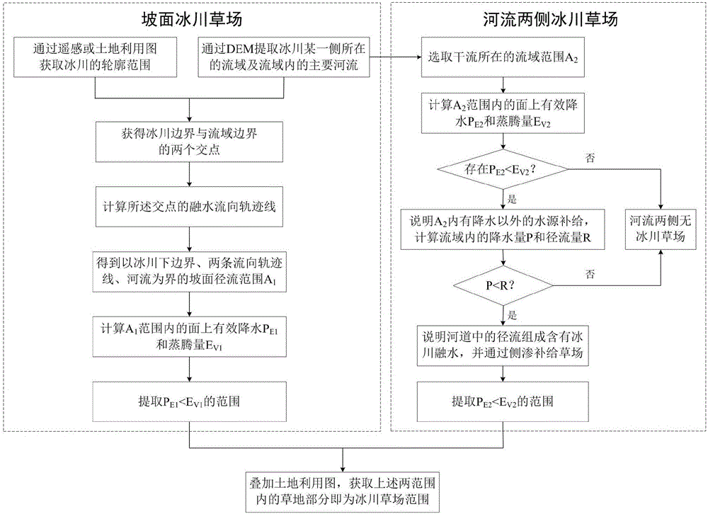
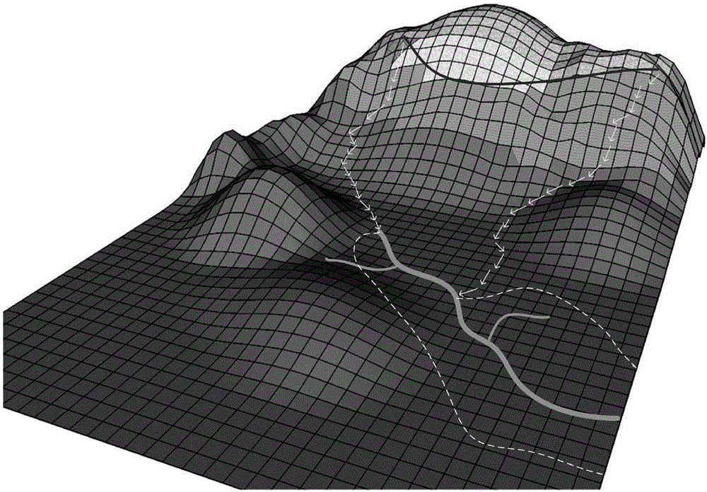
[0032] Such as figure 1 with figure 2 as shown, figure 1 Shows the flow chart of the method for determining the distribution range of glacier grasslands based on tracking calculations; glacier grasslands generally refer to grasslands mainly supplied by glacier meltwater, including the following two parts of the range of glacier grasslands: the first part is glacier meltwater on the slope The supply grassland is referred to as the slope glacier grassland for short; the second part is the grassland recharged by the side seepage or flooding of the river after the glacier melt water enters the river channel, and is referred to as the glacier grassland on both sides of the river for short. The technical problem to be ...
PUM
 Abstract
Description
Claims
Application Information
 - R&D
- Intellectual Property
- Life Sciences
- Materials
- Tech Scout
- Unparalleled Data Quality
- Higher Quality Content
- 60% Fewer Hallucinations
Browse by: Latest US Patents, China's latest patents, Technical Efficacy Thesaurus, Application Domain, Technology Topic, Popular Technical Reports.
© 2025 PatSnap. All rights reserved.Legal|Privacy policy|Modern Slavery Act Transparency Statement|Sitemap|About US| Contact US: help@patsnap.com


