

Indoor and outdoor navigation system and method
A navigation system and indoor navigation technology, applied in the field of navigation and positioning, can solve the problems of poor adaptability in unfamiliar environments and areas, and achieve the effects of improving navigation and positioning accuracy, low navigation and positioning costs, and strong environmental practicability
- Summary
- Abstract
- Description
- Claims
- Application Information
AI Technical Summary
Problems solved by technology
Method used
Image

Examples
Embodiment 1
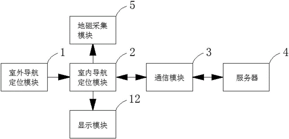
[0048] Such as figure 1 and figure 2 As shown, an indoor and outdoor navigation system includes an outdoor navigation and positioning module 1, an indoor navigation and positioning module 2, a communication module 3 and a server 4;
[0049] The outdoor navigation and positioning module 1 is used for satellite navigation and positioning. When receiving positioning signals equal to or more than a preset number of satellites, the satellite orbit and the clock correction number are obtained in real time through intermittent RTPPP, and the difference between epochs The self-calibration model processes satellite orbits and clock corrections to obtain navigation and positioning data; when less than a preset number of positioning signals are received, the outdoor positioning data is transmitted to the indoor navigation and positioning module 2;
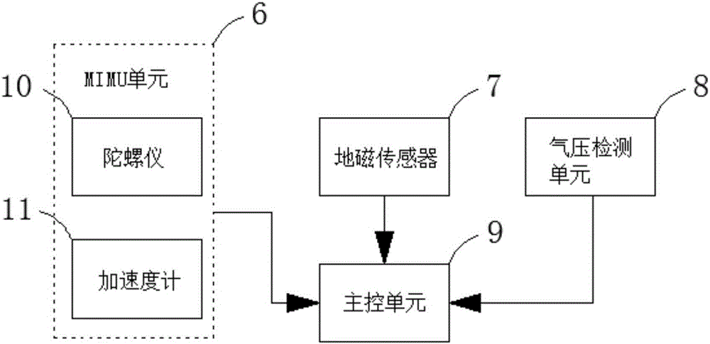
[0050] The indoor navigation and positioning module 2 is used to collect the rotation angle data, acceleration data, air pressure data and...
Embodiment 2
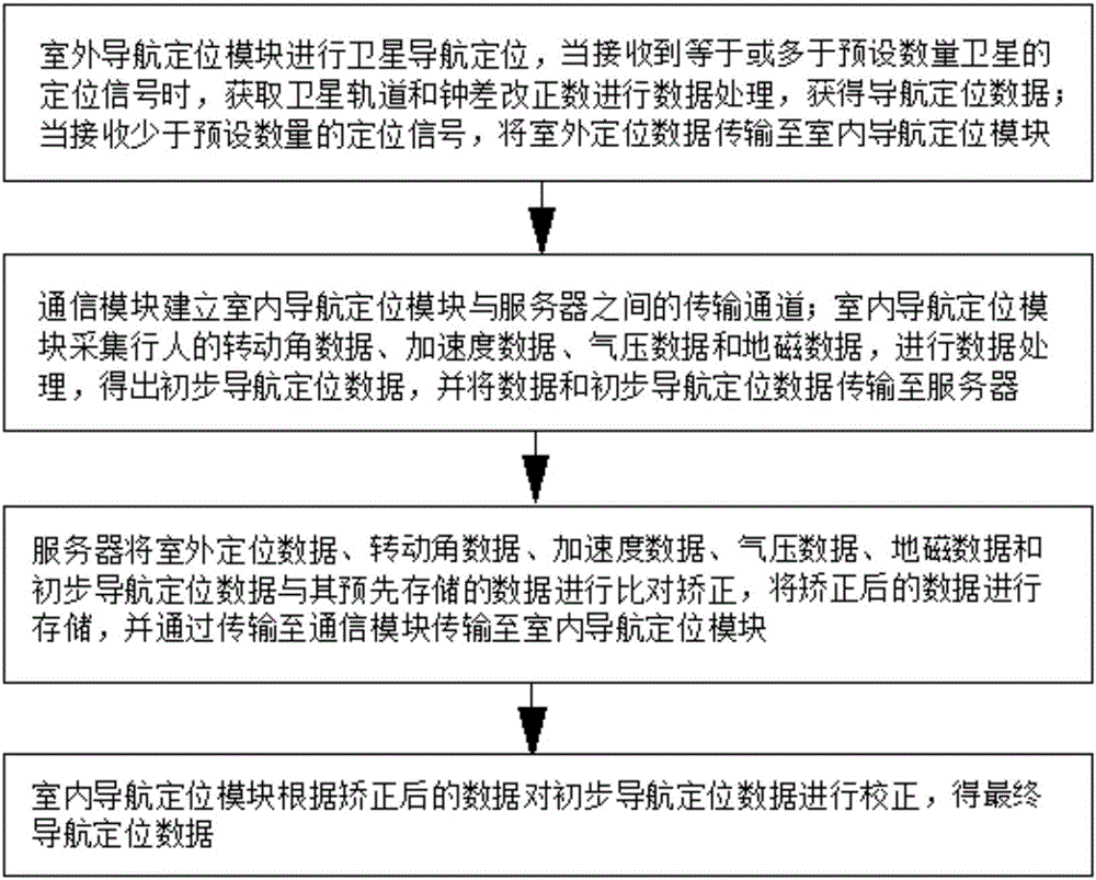
[0065] Such as image 3 As shown, an indoor and outdoor navigation method includes the following steps:
[0066] Step S1. The outdoor navigation and positioning module 1 performs satellite navigation and positioning. When receiving positioning signals equal to or more than the preset number of satellites, the satellite orbit and clock error correction number are obtained in real time through intermittent RTPPP, and self-calibration is performed through the difference between epochs The model processes satellite orbits and clock corrections to obtain navigation and positioning data; when less than a preset number of positioning signals are received, the outdoor positioning data is transmitted to the indoor navigation and positioning module 2;
[0067] Step S2. The communication module 3 establishes a transmission channel between the indoor navigation and positioning module 2 and the server 4; the indoor navigation and positioning module 2 collects the rotation angle data, accel...
PUM
 Abstract
Description
Claims
Application Information