Navigation method, device and terminal
A technology of a navigation terminal and a navigation method, applied in the field of navigation, can solve the problems of high power consumption and limit the battery life of the device, and achieve the effect of improving the battery life.
- Summary
- Abstract
- Description
- Claims
- Application Information
AI Technical Summary
Problems solved by technology
Method used
Image
Examples
Embodiment 1
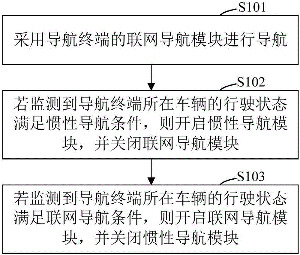
[0035] figure 1 It is a flow chart of a navigation method provided by Embodiment 1 of the present invention. This embodiment is applicable to low power consumption navigation. The method can be executed by a navigation device, which can be implemented by hardware and / or software. For example, it can be a control unit or a control program integrated in a navigation device or another terminal. Specifically include the following steps:
[0036] Step S101, using the networked navigation module of the navigation terminal to perform navigation.
[0037] The networked navigation module of the navigation terminal is used for navigation. The navigation terminal can be a mobile phone, a wearable device, a vehicle or a ship-borne device, wherein the networked navigation module includes GPS, GNSS, or Beidou and other navigation modules that need to be networked.
[0038] Step S102, if it is detected that the driving state of the vehicle where the navigation terminal is located satisfies...
Embodiment 2
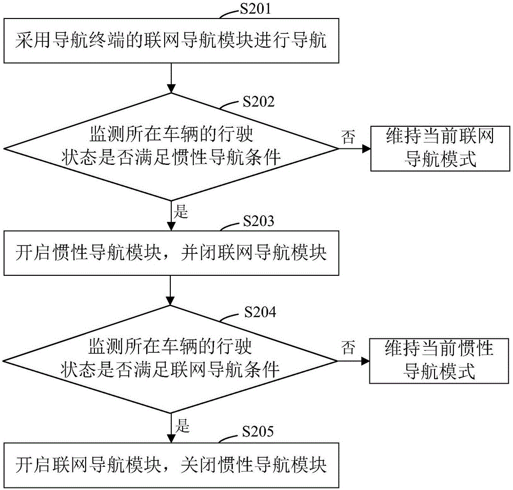
[0048] Please refer to figure 2 , figure 2 It is a flowchart of a navigation method provided by Embodiment 2 of the present invention. This embodiment is based on the solutions of the above embodiments and is optimized and improved. In particular, it provides a step of monitoring whether the driving state of the vehicle where the navigation terminal is located satisfies the conditions for networked navigation or inertial navigation. Such as figure 2 As shown, the method includes:
[0049] Step S201, using the networked navigation module of the navigation terminal to perform navigation.
[0050]Step S202, monitor whether the driving state of the vehicle where the navigation terminal is located satisfies the inertial navigation condition, if yes, execute step S203, if not, keep the current networked navigation module enabled, and maintain the current networked navigation mode unchanged.
[0051] Specifically, monitoring whether the driving state of the vehicle where the n...
Embodiment 3
[0059] Please refer to image 3 , image 3 It is a structural schematic diagram of a navigation device provided by the third embodiment of the present invention. Such as image 3 As shown, the navigation device includes:
[0060] The navigation execution module 101 is used for navigating by using the networked navigation module of the navigation terminal;
[0061] The inertial navigation switching module 102 is used to open the inertial navigation module and close the networked navigation module if the driving state of the vehicle where the navigation terminal is monitored meets the inertial navigation condition;
[0062] The networked navigation switching module 103 is configured to turn on the networked navigation module and close the inertial navigation module if it is detected that the driving state of the vehicle where the navigation terminal is located satisfies the conditions for networked navigation.
[0063] On the basis of the above technical solution, further, t...
PUM
 Abstract
Description
Claims
Application Information
 - R&D
- Intellectual Property
- Life Sciences
- Materials
- Tech Scout
- Unparalleled Data Quality
- Higher Quality Content
- 60% Fewer Hallucinations
Browse by: Latest US Patents, China's latest patents, Technical Efficacy Thesaurus, Application Domain, Technology Topic, Popular Technical Reports.
© 2025 PatSnap. All rights reserved.Legal|Privacy policy|Modern Slavery Act Transparency Statement|Sitemap|About US| Contact US: help@patsnap.com


