Unmanned aerial vehicle vision navigation landing system based on multi-scale marker

A technology of visual navigation and navigation system, which is applied in the field of unmanned aerial vehicle (UAV) and computer vision for short , the effect of improving the accuracy

Inactive Publication Date: 2017-05-31
HANGZHOU LINGMU TECH CO LTD
View PDF5 Cites 24 Cited by
  • Summary
  • Abstract
  • Description
  • Claims
  • Application Information

AI Technical Summary

Problems solved by technology

[0011] In order to overcome the deficiencies of the existing unmanned aerial vehicle visual navigation and landing system, such as low scale change adaptability, poor attitude calculation ability, and insufficient scalability, the present invention provides a high scale change adaptability, good attitude calculation ability, and scalability A better UAV visual navigation and landing system based on multi-scale markers

Method used


Image

  • Unmanned aerial vehicle vision navigation landing system based on multi-scale marker
  • Unmanned aerial vehicle vision navigation landing system based on multi-scale marker
  • Unmanned aerial vehicle vision navigation landing system based on multi-scale marker

Examples


Embodiment Construction

[0033] The present invention will be further described below in conjunction with the accompanying drawings.

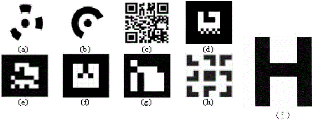
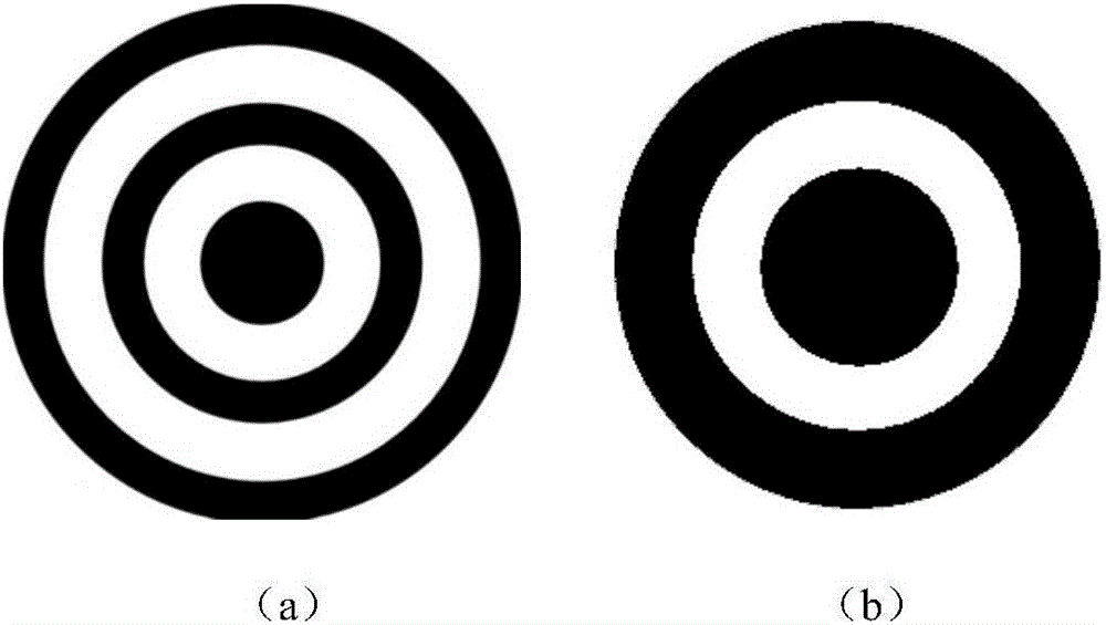
[0034] refer to Figure 1 to Figure 7 , a UAV visual navigation and landing system based on multi-scale markers,

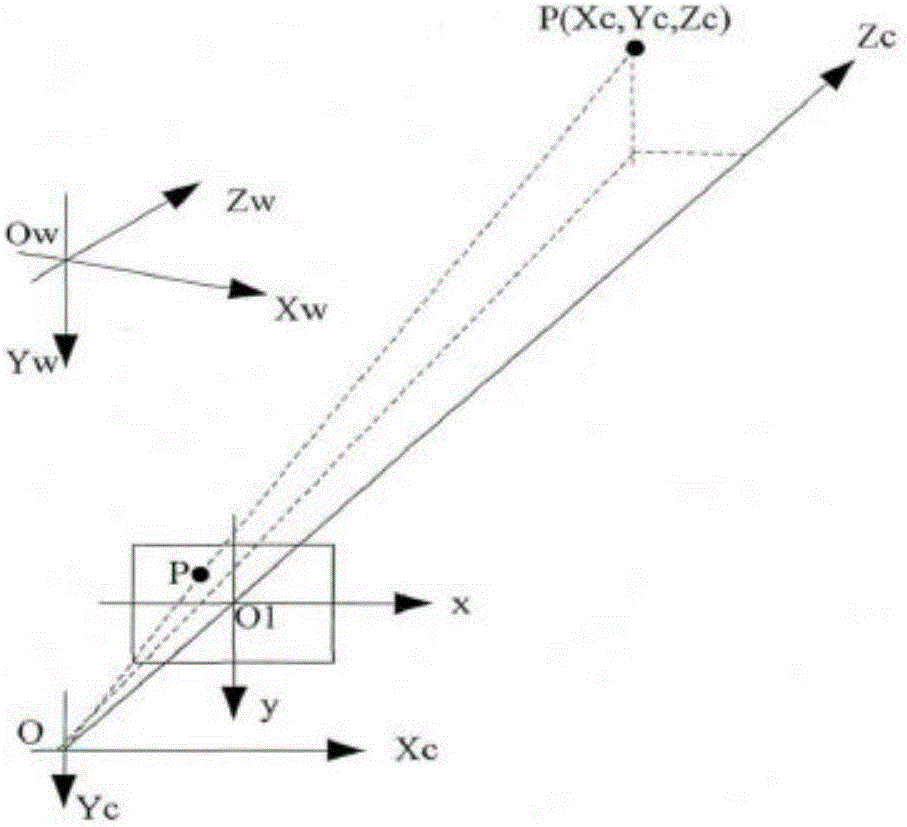
[0035] Define the coordinate system, arrange the markers in the area to be landed, establish the geometric relationship between the ground markers and the images collected by the drone, and define the following coordinate systems.

[0036] World coordinate system (w: O w -W x W y W z ), the camera coordinate system (C:O c -C x C y C z), UAV coordinate system (B:O b -B x B y B z ), image coordinate system (I: uv)

[0037] Since the system assumes that the camera is installed vertically at the center of gravity of the drone, and the direction is vertically downward, the relationship between the camera coordinate system and the drone coordinate system is fixed, and the coordinate systems can be transformed through rotation and translation;

[00...


PUM


Abstract

An unmanned aerial vehicle vision navigation landing system based on a multi-scale marker comprises the multi-scale marker, an identification and attitude resolution algorithm and a navigation system. The multi-scale marker uses an image center as a world coordinate system origin (0,0,0). The side length of the origin is one pixel. The origin extends in four directions around the pixel. In every outward extension, the side length of a black matrix becomes two times of the original side length. The multi-scale marker is automatically generated according to the pixel dimension and the integral dimension of the marker. Supposing the world coordinate system is at the central point of the marker, the z-axis coordinate of the point on the marker is zero and the central coordinate of each matrix is known; a rotational translation matrix of a camera relative to the marker is calculated. The navigation system comprises a coordinate system calibration module, an image acquisition module and an operational processing module. The operational processing module is used for target identification, attitude resolution, navigation control and communication with an unmanned aerial vehicle flight controller. The unmanned aerial vehicle vision navigation landing system has advantages of high dimension change adaptability, high attitude resolution capability and relatively high expandability.

Description

technical field [0001] The invention relates to the fields of unmanned aerial vehicle (Unmanned Aerial Vehicle) for short unmanned aerial vehicle (UAV) and computer vision (Computer vision), in particular to an unmanned aerial vehicle visual navigation and landing system. Background technique [0002] UAV autonomous navigation and landing refers to the process in which the UAV uses the flight control system and its own sensors to locate and navigate and finally controls the UAV to land. Autonomous landing is an important foundation and key technology for autonomous flight. According to the different requirements of the mission, there are usually higher requirements for navigation and control accuracy, environmental robustness and reliability. [0003] Traditional navigation technologies for autonomous UAV landing include: Inertial Navigation System (INS), GPS Navigation System and INS / GPS Integrated Navigation System. The inertial navigation system uses inertial components...

Claims


Application Information

Patent Timeline
Patent Type & Authority Applications(China)
IPC IPC(8): G05D1/10
CPCG05D1/101
Inventor 谢榛步青贺亮应高选金玲曹涛
Owner HANGZHOU LINGMU TECH CO LTD
Why Eureka
Try Eureka