Remote sensing extraction method of agricultural disaster information based on vegetation index time-space statistical characteristics

A technique of vegetation index and spatial statistics, applied in calculation, data processing applications, instruments, etc., can solve the problems that disaster monitoring and evaluation cannot be used, monitoring methods are not universal, etc., to achieve large-scale range, solve errors, improve The effect of precision

Active Publication Date: 2017-05-31
NORTHEAST INST OF GEOGRAPHY & AGRIECOLOGY C A S
View PDF5 Cites 28 Cited by
  • Summary
  • Abstract
  • Description
  • Claims
  • Application Information

AI Technical Summary

Problems solved by technology

[0005] The purpose of the present invention is to solve the problem that the existing remote sensing monitoring of agricultural disasters cannot be used to monitor and evaluate disasters in larg

Method used


Image

  • Remote sensing extraction method of agricultural disaster information based on vegetation index time-space statistical characteristics
  • Remote sensing extraction method of agricultural disaster information based on vegetation index time-space statistical characteristics
  • Remote sensing extraction method of agricultural disaster information based on vegetation index time-space statistical characteristics

Examples


specific Embodiment approach 1

[0027] Specific implementation mode one: the following combination Figure 1 to Figure 6 Describe this embodiment, the remote sensing extraction method of agricultural disaster information based on vegetation index spatio-temporal statistical characteristics described in this embodiment, it comprises the following steps:

[0028]Step 1: Collect the MODIS reflectance product MOD09Q1 data and MYD09Q data in the crop growth period of the monitored area; collect the vegetation index product MOD13Q1 data in the base year of the monitored area; collect the HJ- 1A / 1B_CCD image data and GF-1 / WFV image data;

[0029] Step 2: Transform and project the MOD09Q1 data and MYD09Q data, calculate and obtain the normalized difference vegetation index MOD09Q1-NDVI and MYD09Q1-NDVI respectively, and combine the two to obtain the MOD_MYD-NDVI time series of the crop growth period in the monitored area;

[0030] The MOD13Q1 data is re-projected, and the 23-period normalized difference vegetation ...

specific Embodiment

[0051] Step 1: Download the MODIS reflectance products MOD09Q1 and MYD09Q1 required for a research area, transproject the MOD09Q1 and MYD09Q1 data of the crop growing season, and use the spatial analysis function to calculate NDVI. The two are used together through splicing to eliminate the influence of clouds. The normalized difference vegetation index NDVI time series of the study area from the beginning of May to the end of October 2013 was obtained.

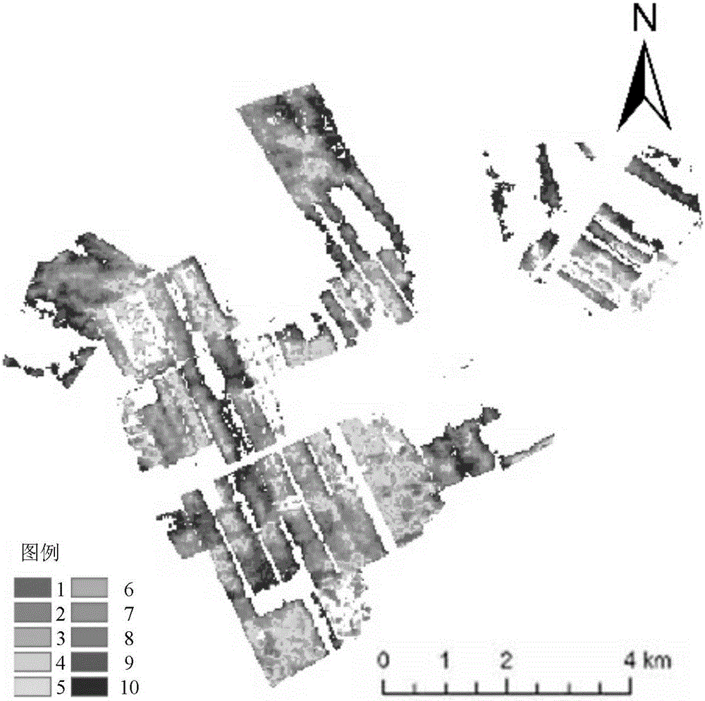
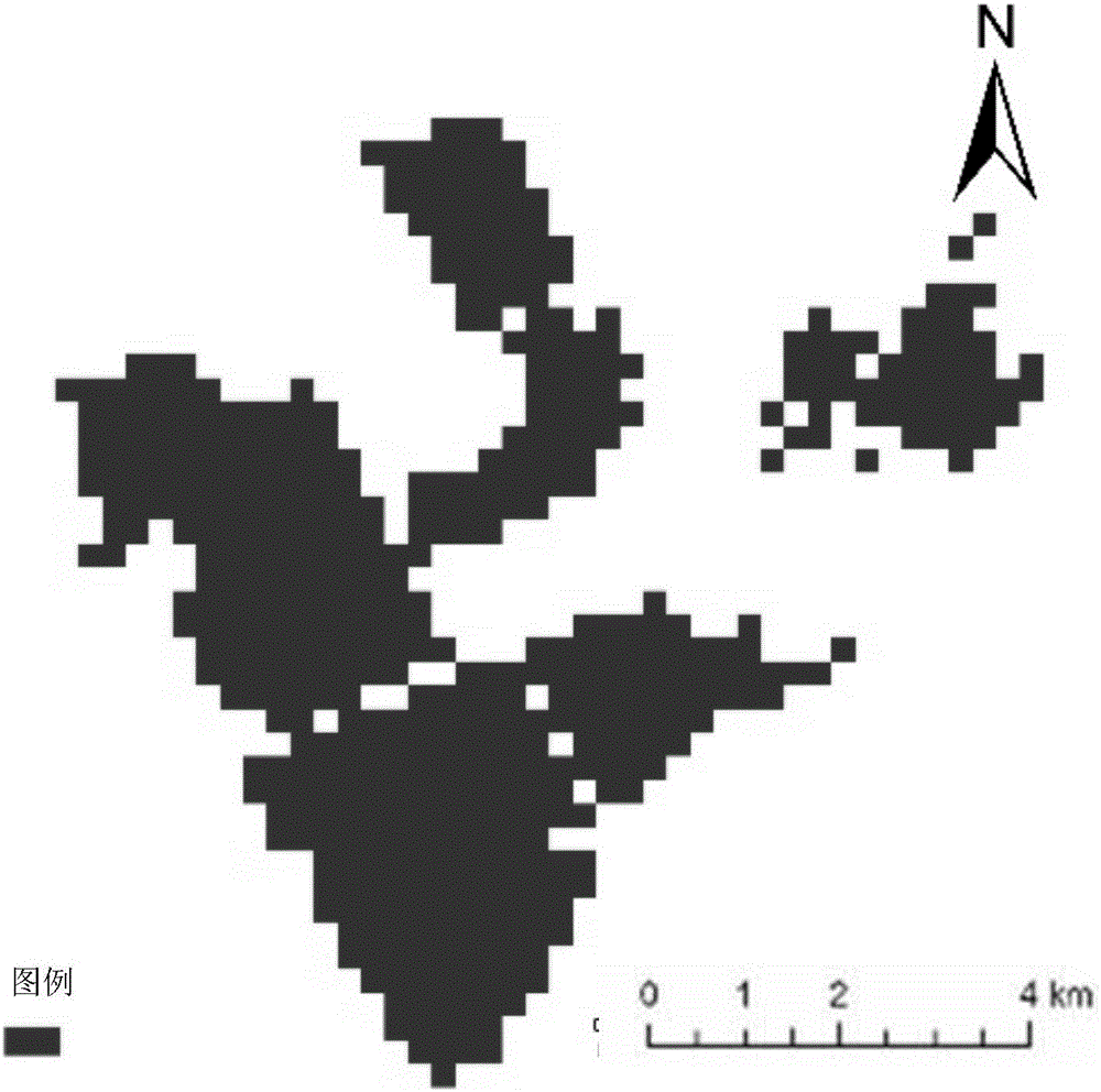
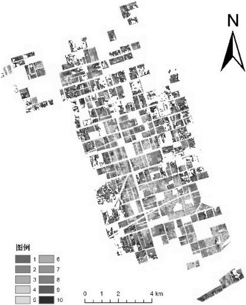
[0052] Step 2: Download the HJ-1A / 1B_CCD or GF-1 / WFV cloud-free images of known typical disaster areas in the study area in 2013, perform preprocessing such as radiometric calibration, atmospheric correction, orthophoto correction, and automatic matching, and extract NDVI. Hierarchical processing, reserve the disaster area, and get the final high-resolution disaster monitoring results.

[0053] Step 3: Use phenological data for information extraction, and perform principal component analysis and standardization processing on ...


PUM


Abstract

The invention provides a remote sensing extraction method of agricultural disaster information based on vegetation index time-space statistical characteristics and belongs to the technical field of agricultural disaster information acquisition, aiming at solving the problems that existing agricultural disaster remote sensing monitoring cannot be used for monitoring and evaluating a large-scale region or a long time sequence in the region and a monitoring method has no universality. On the basis of considering that vegetation indexes of different phonological regions, crops and growth phases have difference, an NDVI (Normalized Difference Vegetation Index) of each pixel in the phonological regions with known diseases and an average value NDVIm of the NDVI and a standard difference STD of the same crops are extracted; a relation between the parameters is analyzed by utilizing the statistical characteristics according to NDVI gradation histogram characteristics before and after the disasters and a disaster monitoring model is established; the agricultural disasters are extracted. According to the method provided by the invention, interference factors caused by the growth regions, different crops and growth phases are considered and the precision of a monitoring result is improved. The remote sensing extraction method provided by the invention is used for monitoring the agricultural disasters.

Description

technical field [0001] The invention relates to a remote sensing extraction method of agricultural disaster information based on the time-space statistical characteristics of vegetation index, and belongs to the technical field of agricultural disaster information acquisition. Background technique [0002] At present, in most researches on remote sensing monitoring of agricultural disasters, there are many studies on small-scale areas or a certain period of time, and a certain type of disasters, and there are few studies on large-scale area or long-term disaster monitoring and evaluation, which cannot be comprehensive and comprehensive. Macroscopically grasp and analyze the spatiotemporal distribution of agricultural disasters; due to the differences in the vegetation index of different crop types, growing regions, and growth stages, the vegetation index obtained by using single-temporal images can only reflect the crops in the region and at that time. Due to the relative ad...

Claims


Application Information

Patent Timeline
IPC IPC(8): G06Q50/02
CPCG06Q50/02
Inventor 刘焕军殷继先张新乐闫岩于微孟令华
Owner NORTHEAST INST OF GEOGRAPHY & AGRIECOLOGY C A S
Why Eureka
Try Eureka